Category:Maps of medieval Europe
Jump to navigation
Jump to search
Subcategories
This category has the following 17 subcategories, out of 17 total.
*
B
I
L
U
Media in category "Maps of medieval Europe"
The following 22 files are in this category, out of 22 total.
-
1000 CE, Europe.svg 512 × 438; 1.76 MB
-
1030 CE, Europe-IT.svg 512 × 438; 1.78 MB
-
1030 CE, Europe.svg 512 × 438; 1.75 MB
-
1071 CE, Europe.svg 512 × 438; 1.78 MB
-
1092 CE, Europe.svg 512 × 438; 1.86 MB
-
1100 CE, Europe.svg 512 × 438; 1.82 MB
-
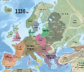
1130 CE, Europe.svg 512 × 438; 1.77 MB
-
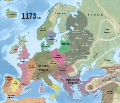
1173 CE, Europe.svg 512 × 438; 1.77 MB
-
1212 CE, Europe.svg 512 × 438; 1.73 MB
-
1230 CE, Europe-es.svg 2,757 × 2,329; 3.31 MB
-
1230 CE, Europe.svg 512 × 438; 1.76 MB
-
1444 Map.jpg 6,637 × 4,983; 4.6 MB
-
254 of 'An Introduction to the study of the Middle Ages, 375-814' (11250425016).jpg 1,297 × 1,993; 506 KB
-
Beowulf Tribes.svg 392 × 271; 55 KB
-
EvropaiSredizemnomorieto9.pdf 1,633 × 1,233; 1.78 MB
-
Frontière entre le Domaine royal et le comté de Champagne et localisation de Nemours.png 1,484 × 1,568; 463 KB
-
Grodzisko Waćmierek.jpg 960 × 540; 35 KB
-
Pskov Republic 1444.jpg 983 × 790; 138 KB
-
Reihengraberzivilisation.png 475 × 434; 26 KB
-
Spruner-Menke Handatlas 1880 Karte 07.jpg 10,353 × 8,753; 25.49 MB
-
Tabula geographica Europae ad statum, quo sub finem Anni 1400 post Christ. nat. fuit.jpg 7,871 × 6,111; 13.16 MB


