
Category:Maps of Europe in the 18th century
English: This category is about the subject of Europe 1701-1800 CE: History maps showing all or a substantial part of the territory of Europe as it was in the 18th century.
Contemporary old maps belong into: Category:18th-century maps of Europe and its subcategories.
Contemporary old maps belong into: Category:18th-century maps of Europe and its subcategories.
Maps of the history of Europe: (BCE) 9th century · 8th century · 5th century · 4th century · 3rd century · 2nd century · 1st century · (CE) 1st century · 2nd century · 3rd century · 4th century · 5th century · 6th century · 7th century · 8th century · 9th century · 10th century · 11th century · 12th century · 13th century · 14th century · 15th century · 16th century · 17th century · 18th century · 19th century · 20th century · 21st century ·
Subcategories
This category has the following 22 subcategories, out of 22 total.
Media in category "Maps of Europe in the 18th century"
The following 140 files are in this category, out of 140 total.
-
 007 Ukrainian Cossack Hetmanate and Russian Empire 1751-ar.jpg 1,012 × 1,256; 465 KB
-
 007 Ukrainian Cossack Hetmanate and Russian Empire 1751.jpg 767 × 952; 414 KB
-
 421 of 'England under Stuart Rule, etc' (11245018734).jpg 1,904 × 1,267; 612 KB
-
 C. 1713-1721 Europe (treaty adjustments).jpg 1,419 × 1,099; 1.48 MB
-
 419 of 'Britain and her Rivals in the eighteenth century, 1713-1789' (11233442156).jpg 2,523 × 2,308; 872 KB
-
 Map of Europe (1714).png 998 × 801; 353 KB
-
 Poland-Lithuania 1714.svg 450 × 456; 880 KB
-
 Frieden von Nystad, Stockholm und Fredericksborg.svg 1,127 × 933; 684 KB
-

-
 C. 1735-1763 Europe (treaty adjustments).jpg 1,704 × 1,369; 1,019 KB
-
 C. 1740 Europe and Western Asia.jpg 4,024 × 3,041; 5.89 MB
-
 Europe 1740.jpg 2,292 × 1,867; 785 KB
-
 Europe in 1740.jpg 797 × 552; 753 KB
-
 Historical atlas of modern Europe 1903 (135895389).jpg 9,165 × 7,123; 65.99 MB
-
 Modern history; Europe (1904) (14742800856).jpg 2,912 × 1,988; 1.57 MB
-

-
 Spruner-Menke Handatlas 1880 Karte 10.jpg 3,644 × 2,994; 1.34 MB
-

-

-
 C. 1740 Europe.jpg 1,901 × 1,364; 3.43 MB
-
 1750 literacy Europe.png 1,036 × 810; 243 KB
-
 Europe en 1750.pdf 1,752 × 1,239; 464 KB
-
 Spilsbury jigsaw - John Spilsbury, 1766 - BL.jpg 1,434 × 1,342; 996 KB
-
-
 Administrative division of the Polish-Lithuanian Commonwealth in 1789.PNG 2,981 × 3,103; 1.56 MB
-
 Polish-Lithuanian Commonwealth 1789-1792.PNG 1,989 × 1,554; 733 KB
-
 Polish-Lithuanian Commonwealth1773-1789.png 1,992 × 1,554; 848 KB
-
 PolishRuswar 1792.JPG 2,000 × 1,568; 415 KB
-
 PolRuswar 1792.JPG 2,000 × 1,568; 335 KB
-

-
 Rpon1793wojew.png 1,524 × 1,372; 513 KB
-
 Rzeczpospolita Rozbiory 2.png 1,902 × 1,568; 296 KB
-
 Разделы-Польши2.png 2,000 × 1,568; 104 KB
-
 Hapsburg Monarchy 1797.svg 450 × 456; 1.02 MB
-
 Caucasus map 1799.png 3,919 × 3,253; 5.85 MB
-
 1Westfalen1800.png 2,962 × 2,353; 1.78 MB
-
 459 of '(Histoire de la Belgique.)' (11108497415).jpg 2,560 × 1,541; 814 KB
-
 Alliances in Europe 1725-1730-es.svg 1,391 × 978; 1.12 MB
-
 Alliances in Europe 1725-1730.png 3,872 × 2,761; 1.19 MB
-
 Alliances in Europe 1740.png 3,872 × 2,761; 1.37 MB
-
 Alliances in Europe 1748-1766.png 3,872 × 2,761; 1.38 MB
-
 AtHistEur1750.jpg 1,306 × 1,434; 397 KB
-
 Bilboko itsasadarra 1731ean.jpg 1,600 × 1,380; 567 KB
-
 BradfordMap CrossDetail HAGAM.jpg 2,212 × 3,913; 8.54 MB
-
 BradfordMap CrossLocation HAGAM.jpg 4,288 × 2,848; 7.31 MB
-
 BradfordMap HAGAM.jpg 4,058 × 2,848; 6.57 MB
-
 Brandenburg-Preussen-1701-1806 ohne Westen.png 1,020 × 831; 80 KB
-
 Brandenburg-preussen-1701-1806.png 1,020 × 831; 245 KB
-
 Burggrafschaft Friedberg.png 1,387 × 660; 269 KB
-
 Carte historique du Luxembourg.jpg 9,440 × 10,826; 90.34 MB
-
 Central europe 1786.jpg 2,319 × 1,871; 829 KB
-
 Dobrava 1744.jpg 567 × 393; 137 KB
-
 Esseratsweiler um 1700.jpg 1,024 × 768; 147 KB
-
 Europa 17 u. 18 Jh.jpg 5,536 × 4,336; 10.3 MB
-
 Europa 1701-es.svg 1,357 × 1,357; 1.03 MB
-
 Europa 1701.svg 1,357 × 1,357; 688 KB
-
 Europa 1721-es.svg 1,357 × 1,357; 1.01 MB
-
 Europa 1721.svg 1,357 × 1,357; 680 KB
-
 Europa em 1792.jpg 2,025 × 1,458; 1.65 MB
-
 Europa1717.jpg 2,155 × 1,503; 1.3 MB
-
 Europako hiri nagusien populazioa (XVI-XVIII).png 675 × 885; 419 KB
-
 Europe 1714.png 1,550 × 1,118; 1.01 MB
-
 Europe 1740 blank.png 3,872 × 2,761; 975 KB
-
 Europe 1740 lt.png 5,163 × 3,682; 1.7 MB
-
 Europe 1748-1766 it.jpg 3,872 × 2,761; 2.28 MB
-
 Europe 1783-1792 blank.png 3,872 × 2,761; 966 KB
-
 Europe 1783-1792 lt.png 5,163 × 3,682; 1.68 MB
-
 Europe c. 1700.png 1,550 × 1,118; 1.02 MB
-
 Europe, 1700—1714 (cropped, Italy).png 393 × 453; 159 KB
-
 Europe, 1700—1714 hu.png 1,590 × 1,086; 1.18 MB
-
 Europe, 1700—1714.png 1,590 × 1,086; 1.07 MB
-
 Europe, 1714.png 1,590 × 1,086; 986 KB
-
 Frieden von Nystad, Stockholm und Fredericksborg-es.svg 1,127 × 933; 1.01 MB
-
 Frieden von Nystad, Stockholm und Fredericksborg-hu.svg 1,127 × 933; 703 KB
-
 Galicja i Nowa Galicja - cyrkuły 1805.png 696 × 661; 55 KB
-
 Giurisdizioni bresciane in epoca veneta (Luca Giarelli).png 1,367 × 2,000; 273 KB
-
 Guerra Primeira Coligação - primeiras acções 1792.jpg 708 × 583; 162 KB
-
 Habsburg Monarchy 1714.svg 450 × 456; 915 KB
-
 Helmholt - Western Europe early 18th century.jpg 2,998 × 2,482; 2.69 MB
-
 Historical map of the Saarland 1793.gif 995 × 540; 38 KB
-
 History of Russia, 1682-1762.jpg 1,330 × 1,650; 597 KB
-
 History of Russia, XVIII c.jpg 2,552 × 3,432; 1.97 MB
-
 Italia 1796-ca.svg 3,500 × 4,200; 1.25 MB
-
 Italia 1796-es.svg 3,500 × 4,200; 1.13 MB
-
 Italy 1796 de.svg 896 × 1,060; 1.66 MB
-
 Italy 1796 it.svg 3,662 × 4,309; 573 KB
-
 Italy 1796 ko.svg 3,662 × 4,309; 594 KB
-
 Italy 1796-hu.svg 3,500 × 4,200; 986 KB
-
 Italy 1796.svg 3,500 × 4,200; 1.16 MB
-
 Kaart Expeditie Schelde 1793.jpg 752 × 536; 121 KB
-
 Karte der zum Kloster Heiligkreuztal gehörigen Waldungen 1700.jpg 2,683 × 1,982; 1,004 KB
-
 Karte Gemeine-Herrschaften.png 2,000 × 1,268; 245 KB
-
 Karte Helvetik 1-fr.svg 2,478 × 1,549; 584 KB
-
 Karte Helvetik 1.png 2,500 × 1,561; 1.19 MB
-
 Karte Helvetik 2.png 3,000 × 2,186; 1.21 MB
-
 Karte Helvetik 3-EN.png 2,500 × 1,570; 743 KB
-
 Karte Helvetik 3-FR.png 2,500 × 1,570; 738 KB
-
 Karte Helvetik 3-fr.svg 2,478 × 1,549; 585 KB
-
 Karte Helvetik 3.png 2,500 × 1,577; 845 KB
-
 Karte Helvetik 3b.png 2,500 × 1,623; 369 KB
-
 Karte Reise eines Buergers.png 826 × 628; 689 KB
-
 Karte Zugewandte Orte.png 1,200 × 761; 211 KB
-
 Kingdom of Prussia 1714.svg 450 × 456; 893 KB
-
 Królestwo Galicji.png 490 × 480; 101 KB
-
 Kurzemes un Zemgales Hercogiste 1740.png 2,387 × 2,100; 606 KB
-
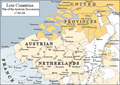 Low Countries 1740.png 813 × 575; 225 KB
-
 Map around Vesuvius 1770 plate6 from William Hamilton.jpg 3,000 × 3,201; 989 KB
-
 Map Austria and the spartitions of Poland 1928-1940 - Touring Club Italiano CART-TRC-60.jpg 6,290 × 6,846; 4.53 MB
-
 Map Austria in the napoleonic age 1928-1940 - Touring Club Italiano CART-TRC-61.jpg 5,056 × 6,579; 3.63 MB
-
 Map europe 1700 to 1715 changes.gif 333 × 333; 66 KB
-
 Map of the Battle of Fontenoy 1745.png 569 × 741; 533 KB
-
 Map-italy-old.jpg 551 × 554; 45 KB
-
 March to the Danube May June 1704.png 1,040 × 944; 504 KB
-
 Norditalien 1796.png 3,785 × 3,023; 1.47 MB
-
 Old Confederacy 18th centur.png 2,500 × 1,585; 560 KB
-
 Peace of Basel and Campo-Formio.png 998 × 1,637; 2.8 MB
-
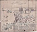
 Plan of Leipzig 18 century.jpg 4,492 × 4,613; 7.81 MB
-
 Polen-Litauen BV044859943.jpg 3,768 × 4,500; 2.79 MB
-
 PolishRuswar1792.PNG 2,000 × 1,568; 921 KB
-
 PolskaXVIIwieku.gif 355 × 353; 9 KB
-
 Principati1786.jpg 6,272 × 4,704; 5.05 MB
-
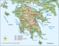 Regno di Morea de.svg 1,785 × 1,398; 1.12 MB
-
 Regno di Morea.svg 1,785 × 1,398; 1.73 MB
-
 Regno di MoreaV1Make.svg 6,479 × 5,113; 2.05 MB
-
 Repubblica bresciana suddivisione cantoni.png 1,200 × 1,800; 76 KB
-
 Republic of Ragusa.svg 512 × 519; 1.09 MB
-
 RP 1701.JPG 1,996 × 1,568; 560 KB
-
 Russian map of 18th century war in Moldova.jpg 1,098 × 1,478; 218 KB
-
 Rzeszów mapa 1762 p6.jpg 3,188 × 2,036; 2.17 MB
-
 Sección-mapa-1745-Rosellón.png 629 × 269; 379 KB
-
 Struktur Eidgenossenschaft.png 2,500 × 1,585; 576 KB
-
 The story of the map of Europe, its making and its changing (1916) (14778369165).jpg 2,016 × 2,820; 665 KB
-
 Verenigde Nederlandse Staten 1790.jpg 1,215 × 1,230; 310 KB
-
 War of the Spanish Succession alliances (1703).png 2,729 × 2,761; 605 KB
-
 Western Europe 1700.jpg 1,677 × 1,311; 412 KB
-
 Wielki Gościniec Litewski.png 1,347 × 1,218; 392 KB
-
 WKL wojewodztwa 1771.png 991 × 854; 119 KB
-
 Professor G. Droysens Allgemeiner historischer Handatlas 1886 (134037838).jpg 6,552 × 10,351; 74.28 MB
-
 The Collegiate Atlas 1876 (73060505).jpg 6,752 × 5,233; 5.17 MB
-
 Суворовские каналы.png 260 × 433; 66 KB


.jpg)
.jpg)
.jpg)
.png)


)%27_(11154436706).jpg)
.jpg)


.jpg)
_(14742800856).jpg)
.jpg)

_(14594431308).jpg)
_(14595905807).jpg)


_(1905)_(14784504272).jpg)


%27_(11108497415).jpg)


.png)


.png)


.png)


_(14778369165).jpg)

.png)


.jpg)
.jpg)
