Category:Spanish-language SVG maps of Peru
Jump to navigation
Jump to search
Subcategories
This category has only the following subcategory.
Media in category "Spanish-language SVG maps of Peru"
The following 10 files are in this category, out of 10 total.
-
Costa-y-sierra-huamachuco-a-ayacucho.svg 1,499 × 4,339; 261 KB
-
Dominio Marítimo del Perú.svg 1,168 × 1,513; 187 KB
-
Ecuador-Peru-Frontera.svg 885 × 587; 571 KB
-
Mapa de la frontera Colombia-Perú.svg 719 × 550; 280 KB
-
Mapa de la frontera marítima Chile-Perú.svg 894 × 683; 165 KB
-
Mapa de la frontera marítima Ecuador-Perú.svg 932 × 609; 144 KB
-
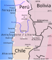
Ocupacion de Antofagasta.es.svg 428 × 487; 53 KB
-
Peru, administrative divisions - es - colored (+zoom).svg 820 × 1,000; 1.39 MB
-
Peru, administrative divisions - es - monochrome (+zoom).svg 820 × 1,000; 1.4 MB
-
Reserva Nacional de Paracas topographic map-es.svg 387 × 475; 4.45 MB


