Category:Public transport maps of Switzerland
Jump to navigation
Jump to search
Subcategories
This category has the following 14 subcategories, out of 14 total.
B
C
F
G
L
S
W
Z
Media in category "Public transport maps of Switzerland"
The following 27 files are in this category, out of 27 total.
-
 Eisenbahnstrecken Schweiz (Grenzen).png 5,087 × 3,126; 115 KB
-
 Fahrplanfelder Schweiz (Grenzen).png 5,087 × 3,126; 172 KB
-
 Glarner Sprinter Map.Full.png 294 × 291; 51 KB
-
 Glarner Sprinter Map.Glarus.png 469 × 599; 117 KB
-
 Glattalbahn vbg.png 4,274 × 4,424; 6.6 MB
-
 GleisplanBremgarten-Dietikon2019.png 6,096 × 4,179; 416 KB
-
 GleisplanBTI2019.png 4,463 × 5,902; 450 KB
-
 IC-Netz SBB 1982.svg 636 × 392; 159 KB
-
 IC-Netz SBB 2002.svg 636 × 392; 198 KB
-
 IC-Netz SBB 2017-2020.svg 636 × 392; 219 KB
-
 IC-Netz STEP 2035 2019-01.svg 636 × 392; 303 KB
-
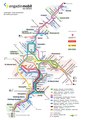
 Karte der S-Bahn Chur.svg 467 × 405; 183 KB
-
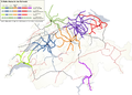
 Karte der Verkehrsverbünde und Tarifverbünde in der Schweiz.png 777 × 599; 147 KB
-
 Karte der Verkehrsverbünde und Tarifverbünde in Deutschland, Österreich und der Schweiz.png 2,956 × 2,404; 1.75 MB
-
 Lagekarte Chemin de Fer Clarens–Chailly–Blonay .png 831 × 1,336; 2.43 MB
-
 Limmattalbahn Map.png 5,348 × 2,901; 3.46 MB
-
 Liniennetz S-Bahn Bern.svg 1,354 × 987; 589 KB
-
 LinienplanEB.pdf 1,752 × 2,479; 922 KB
-
 Projektierte-Eisenbahn-und-Telegrafenlinien-Schweiz-1852.jpg 3,205 × 2,315; 3.06 MB
-
 Rheintallinie (SBB 880).png 964 × 1,184; 2.39 MB
-
 S-Bahn St. Gallen Netzplan 2015.jpg 3,257 × 4,000; 2.29 MB
-
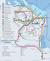
 S-Bahn St. Gallen Netzplan 2022.jpg 2,266 × 2,785; 1.21 MB
-
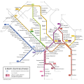 S-Bahn Zentralschweiz 12-2013.svg 980 × 974; 82 KB
-
 S-Bahn-Netze Schweiz.png 1,600 × 1,148; 401 KB
-
 STI-Thun.jpg 1,164 × 1,439; 163 KB
-
 Trolleybus Thun–Beatenbucht.png 2,271 × 2,044; 462 KB
-
 TrolleybusLeitungsplanLuzern2019.png 4,748 × 4,063; 891 KB
.png)
.png)


.png)


