Category:Rail transport maps of Switzerland
Jump to navigation
Jump to search
Subcategories
This category has the following 14 subcategories, out of 14 total.
L
- Maps of Léman Express (18 F)
M
S
- Maps of S-Bahn Zürich (6 F)
T
- Tram maps of Basel (32 F)
- Tram maps of Bern (6 F)
- Tram maps of Biel/Bienne (2 F)
Media in category "Rail transport maps of Switzerland"
The following 200 files are in this category, out of 327 total.
(previous page) (next page)-
2014-GareCornavin-Hall1.jpg 2,592 × 1,944; 1.24 MB
-
286 of 'The International Geography. ... Edited by H. R. Mill' (11166037545).jpg 782 × 1,323; 230 KB
-
Adolf Guyer-Zeller Projekt 1871.png 2,747 × 3,507; 2.47 MB
-
Adolf Guyer-Zeller Projekt 1895.png 2,747 × 3,507; 4.16 MB
-
Affiche ancienne Gotthardbahn Laghi di Como Lugano Maggiore.jpg 1,600 × 2,774; 996 KB
-
Affiche Société Genevoise des chemins de fer à voie étroite.jpg 528 × 660; 114 KB
-
Albula Bernina.png 1,359 × 922; 466 KB
-
Albula line between Naz and Bergün (south is above), OSM map 2022.png 1,023 × 3,863; 1.25 MB
-
Albula line between Naz and Bergün, OSM map 2022.png 1,023 × 3,871; 1 MB
-
Albulabahn Karte.png 4,839 × 3,931; 5.32 MB
-
Alptransit project overview engl.jpg 1,000 × 682; 239 KB
-
Ancienne et nouvelle gare de Châtel-Saint-Denis.png 1,199 × 797; 473 KB
-
AOMC-tablette-2019.jpg 2,062 × 1,398; 866 KB
-
Appenzeller Bahnen - Streckennetz.png 1,496 × 1,046; 217 KB
-
Arosabahn Steigungsdiagramm.png 792 × 612; 12 KB
-
ArosabahnHE.png 737 × 542; 13 KB
-
Association des chemins de fer de la Suisse Occidentale.png 2,399 × 2,617; 1.02 MB
-
ASt Sitterviadukt Lageplan.jpg 1,109 × 538; 102 KB
-
ASt Station Appenzell Lageplan.jpg 1,371 × 513; 156 KB
-
ASt Station Gais Lageplan.jpg 1,163 × 655; 176 KB
-
Bahn-ZH-Innenstadt.svg 483 × 409; 18 KB
-
Bahnhof Arth-Goldau Karte.png 3,604 × 2,108; 12.57 MB
-
Bahnhof Buchs SG Karte.png 2,799 × 4,046; 15.56 MB
-
Bahnhof Chur Karte.png 3,400 × 2,467; 12.49 MB
-
Bahnhof Gossau SG Karte.png 2,189 × 1,200; 3.96 MB
-
Bahnhof Herisau Karte 2019.png 2,189 × 1,358; 4.24 MB
-
Bahnhof Landquart Karte.png 2,986 × 4,801; 18.22 MB
-
Bahnhof Nesslau Neu St. Johann Karte.png 1,527 × 1,902; 2.77 MB
-
Bahnhof Rapperswil Karte.png 3,930 × 1,800; 8.97 MB
-
Bahnhof Romanshorn Karte.png 2,632 × 3,768; 10.21 MB
-
Bahnhof Rorschach Karte.png 6,000 × 1,800; 12.68 MB
-
Bahnhof Sargans Karte.png 3,892 × 2,621; 10.73 MB
-
Bahnhof St. Gallen Karte.png 4,871 × 3,600; 29.13 MB
-
Bahnhof Vallorbe - Karte 1934.jpg 2,108 × 1,010; 1.59 MB
-
Bahnhof Wattwil Karte 1908.png 1,397 × 2,022; 4.79 MB
-
Bahnhof Wattwil Karte 1911.png 1,397 × 2,022; 4.98 MB
-
Bahnhof Weesen 1910.png 1,807 × 1,135; 5.09 MB
-
Bahnhof Weesen 2010.png 1,440 × 911; 2.26 MB
-
Bahnhof Wil Karte.png 3,812 × 2,140; 11.2 MB
-
Bahnhof Ziegelbrücke Karte.png 3,742 × 2,670; 15.53 MB
-
Bahnhof Zug 1896.png 2,880 × 3,990; 18.28 MB
-
Bahnhof Zug 1990.png 2,880 × 3,990; 8.16 MB
-
Bahnhof Zug 2018.png 2,880 × 3,990; 4.52 MB
-
Bahnhof Zweisimmen, map OSM 2022.png 249 × 778; 168 KB
-
Bahnhof Zweisimmen, OSM map 2022 (S).png 213 × 760; 207 KB
-
Bahnhof Zweisimmen, OSM map 2022 (W).png 761 × 204; 193 KB
-
Bahnstrecke Effretikon–Hinwil.png 3,101 × 3,535; 3.85 MB
-
Bahnstrecke Eglisau–Neuhausen.png 828 × 1,024; 394 KB
-
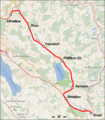
Bahnstrecke Etzwilen–Singen.png 1,473 × 4,297; 2.6 MB
-
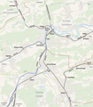
Bahnstrecken Olten.png 2,077 × 2,379; 1.65 MB
-
Bam carte.png 551 × 599; 42 KB
-
Bandeau CHTrain part2.png 1,000 × 707; 292 KB
-
Baubahn-Nord.JPG 2,827 × 1,027; 643 KB
-
Baubahn-Schlossweid.JPG 1,077 × 1,624; 1.27 MB
-
Karte der S-Bahn Bern.svg 1,033 × 844; 3.05 MB
-
Bern-Schwarzenburg-Bahn, Streckenverlauf.svg 720 × 1,133; 41.36 MB
-
Bernina diagram.svg 990 × 765; 27 KB
-
Bernina.png 842 × 595; 10 KB
-
BerninaHe.png 795 × 506; 21 KB
-
Blsmap.png 506 × 720; 44 KB
-
Bremgarten-Dietikon-Bahn.png 2,249 × 1,325; 2.49 MB
-
BTB Streckenprofil.jpg 845 × 1,087; 145 KB
-
Bülach-Baden-Bahn.png 2,677 × 1,366; 2.27 MB
-
Bülach-Regensberg-Bahn.png 2,927 × 5,900; 6.94 MB
-
Carte Chemin de fer Nyon-Crassier-Divonne svg.svg 1,146 × 621; 2.32 MB
-
Carte Chemin de fer Nyon-Crassier-Divonne.png 2,802 × 1,519; 1.55 MB
-
Carte de la Suisse @ Hall @ Gare de Genève-Cornavin @ Genève (50898656222).jpg 6,240 × 4,160; 4.31 MB
-
Carte ferro B-FC.png 1,472 × 1,166; 307 KB
-
Ceneri Basistunnel.png 835 × 604; 671 KB
-
CEV Bahnstrecken 01.png 640 × 480; 25 KB
-
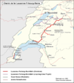
Chemin de fer Lausanne–Fribourg–Berne.png 2,399 × 2,698; 1.07 MB
-
Chur Arosa Bahn.png 2,027 × 1,202; 768 KB
-
D-A-Wettbewerber-EVU.png 1,814 × 2,105; 1.22 MB
-
Deviation Diagram Albula.svg 990 × 765; 10 KB
-
Diagram Albula.png 792 × 612; 14 KB
-
Diagram AlbulaHE.png 754 × 515; 23 KB
-
Doppelschleife der Nordrampe der Lötschbergbahn.png 816 × 398; 60 KB
-
Eisenbahnstrecken Schweiz.png 5,087 × 3,126; 795 KB
-
Emmenbrücke Bahnhof Nord OpenStreetMap August 2022.png 613 × 574; 218 KB
-
Eppenberg Tunnel Alignment.jpg 1,552 × 987; 490 KB
-
Fahrplanfelder Schweiz.png 5,087 × 3,126; 811 KB
-
Faszination Gotthardbahn.png 2,702 × 6,264; 12.6 MB
-
FO Bahnnetz.png 1,246 × 768; 168 KB
-
FW Wil - Schweizerhof 1959.png 1,400 × 820; 2.75 MB
-
FW Wil - Schweizerhof 1965.png 1,400 × 820; 2.87 MB
-
Gare d'Aigle.png 2,184 × 1,357; 5.88 MB
-
Gare de Bex.png 1,525 × 1,988; 3.51 MB
-
Gare de Morges.png 2,187 × 1,356; 4.8 MB
-
Gare de Nyon.png 1,526 × 1,625; 4.47 MB
-
Gares du Léman Express, locations of geocoded photos on OSM map, Sept 2022.png 1,920 × 1,080; 1.65 MB
-
GlacierExpressMap.jpg 302 × 227; 39 KB
-
GlacierExpressMap.svg 1,337 × 918; 237 KB
-
Glarner Sprinter Map.Full.png 294 × 291; 51 KB
-
Glarner Sprinter Map.Glarus.png 469 × 599; 117 KB
-
Glattalbahn vbg.png 4,274 × 4,424; 6.6 MB
-
Glattalbahn-3.png 1,408 × 1,264; 1.58 MB
-
Gleisnetz im Kanton St. Gallen.svg 1,784 × 1,881; 109 KB
-
GleisplanBTI2019.png 4,463 × 5,902; 450 KB
-
GleisplanPilatus2021.png 6,002 × 6,192; 575 KB
-
GleisplanWaldenburg-Liestal2019.png 1,952 × 6,526; 282 KB
-
Goldenpass Bahnstrecken 01.png 960 × 720; 38 KB
-
Goldenpass Bahnstrecken 02.png 960 × 720; 37 KB
-
Gotthard-Basistunnel Trasse.png 1,200 × 710; 876 KB
-
Gotthardbahn Bergstrecke.png 1,880 × 1,576; 3.06 MB
-
Gotthardbahn map.png 2,702 × 6,264; 16.07 MB
-
Gotthardbahn Nordrampe.png 1,072 × 748; 883 KB
-
Gotthardbahn ohne Basistunnel.png 2,702 × 6,264; 12.64 MB
-
Gotthardtunnel-b2.png 296 × 640; 334 KB
-
GrandesLignesCFF.png 2,486 × 1,603; 5.07 MB
-
Güterverkehrskorridore 1 und 2.PNG 1,140 × 1,536; 659 KB
-
Hirschengrabentunnel b.png 822 × 1,057; 1.28 MB
-
Hirschengrabentunnel.svg 483 × 409; 17 KB
-
IC-Netz SBB 1982.svg 636 × 392; 159 KB
-
IC-Netz SBB 2002.svg 636 × 392; 198 KB
-
IC-Netz SBB 2017-2020.svg 636 × 392; 219 KB
-
IC-Netz STEP 2035 2019-01.svg 636 × 392; 303 KB
-
Intercity Bahnhöfe Schweiz, locations of geocoded photos on OSM map, Sept 2022.png 1,920 × 1,080; 2.35 MB
-
International trains Paris-Zurich 2015.svg 1,122 × 899; 35 KB
-
International trains Paris-Zurich.svg 1,122 × 899; 17 KB
-
InterRegio Bahnhöfe Schweiz, locations of geocoded photos on OSM map, Sept 2022.png 1,920 × 1,080; 2.39 MB
-
Jungfraubahn Plan 1903.jpg 1,166 × 1,884; 717 KB
-
JungFrauBahnen.png 350 × 417; 51 KB
-
JungFrauBahnen.svg 371 × 486; 355 KB
-
Jura-Gotthard-Bahn.png 687 × 755; 297 KB
-
Jura-Simplon - Karte.jpg 2,134 × 2,081; 3.87 MB
-
Jura-Simplon - Touristenkarte.jpg 2,366 × 2,692; 3.7 MB
-
KARTE albulabahn.png 1,024 × 758; 459 KB
-
KARTE albulabahn1.png 370 × 214; 53 KB
-
Karte Bahnstrecke Nyon crassier.png 2,802 × 1,519; 1.03 MB
-
Karte Bahnstrecke Nyon Crassier.svg 1,146 × 621; 2.32 MB
-
Karte Bahnstrecke Wädenswil–Einsiedeln.png 1,562 × 1,686; 2.34 MB
-
KARTE Bernina1.png 271 × 249; 50 KB
-
Karte Berninabahn.png 807 × 726; 244 KB
-
Karte Bhf Filisur.svg 827 × 556; 630 KB
-
Karte der Birsigthalbahn und ihrer Umgebung. flle IV, Basel - btv1b102236701.jpg 6,302 × 4,581; 5.2 MB
-
Karte der Eisenbahn von Strassburg nach Basel - btv1b102238289.jpg 2,643 × 4,087; 1.96 MB
-
Karte der S-Bahn Chur.svg 467 × 405; 183 KB
-
Karte Furka-Oberalp-Bahn.png 1,246 × 768; 155 KB
-
Karte Gotthardbahn.png 807 × 726; 623 KB
-
Karte Hist Entwicklung der Eisenbahn Schweiz.jpg 2,805 × 1,911; 843 KB
-
Karte Lugano-Cadro-Dino-Bahn.png 1,489 × 2,561; 7.48 MB
-
Karte RhB Stammnetz.png 1,020 × 754; 537 KB
-
KARTE rhb-he.png 1,024 × 758; 519 KB
-
KARTE rhb.png 1,020 × 754; 513 KB
-
KARTE rhbVernina.png 337 × 163; 41 KB
-
Karte Schweizerische Nationalbahn.png 3,701 × 1,779; 1.32 MB
-
Karte TG Hochformat.jpg 3,101 × 4,356; 785 KB
-
Karte Vitznau-Rigi-Bahn.svg 1,209 × 1,450; 617 KB
-
Karte Wetzikon-Meilen-Bahn.svg 1,333 × 838; 465 KB
-
Karte ZH Flughafenlinie.png 1,992 × 1,088; 1.37 MB
-
Karte Zürich Flughafenlinie.png 2,000 × 1,099; 1.03 MB
-
KarteEffretikonPfäffikonHinwiel.jpg 434 × 617; 151 KB
-
Keilbahnhof in der Schweiz, locations of geocoded photos on OSM map, Sept 2022.png 1,920 × 1,080; 2.32 MB
-
Knotensystem Schweiz mit Bahn2000 2.Etappe 2030.png 1,359 × 922; 527 KB
-
Knotensystem Schweiz mit Bahn2000 2004.png 1,359 × 922; 519 KB
-
Knotensystem Schweiz mit GBT und CBT 2019.png 1,699 × 1,153; 790 KB
-
Knotensystem Schweiz mit HGV 2015.png 1,359 × 922; 541 KB
-
Knotensystem Schweiz mit HGV und Löwenstrasse 2013.png 1,699 × 1,153; 820 KB
-
Knotensystem Schweiz mit LBT 2007.png 1,699 × 1,153; 823 KB
-
Koch Opitz 1905 Schweiz 13679042.webp 10,391 × 6,727; 16.72 MB
-
Koch Opitz 1905 Schweiz Detail Gotthard 13679042.webp 1,848 × 5,138; 2.52 MB
-
Koch Opitz 1905 Schweiz0 13679037.webp 7,259 × 4,481; 1.18 MB
-
Koch Opitz 1905 Schweiz1 13679038.webp 5,514 × 3,765; 2.77 MB
-
Koch Opitz 1905 Schweiz2 13679039.webp 5,389 × 3,738; 4.5 MB
-
Koch Opitz 1905 Schweiz3 13679040.webp 5,417 × 3,782; 4.51 MB
-
Koch Opitz 1905 Schweiz4 13679041.webp 5,427 × 3,706; 4.22 MB
-
Käferbergtunnel.jpg 872 × 642; 204 KB
-
Lagekarte der Bahnstrecke Chur–Arosa.svg 3,000 × 2,087; 600 KB
-
LaiDadOvaSpinOfenbergbahn.png 1,100 × 725; 2.4 MB
-
Landquart Davos.png 792 × 612; 17 KB
-
Landquart-Davos-map.png 650 × 514; 257 KB
-
Limmattalbahn Map.png 5,348 × 2,901; 3.46 MB
-
Linienplan trireno 2019 A4h.pdf 1,239 × 1,752; 73 KB
-
Linksufrige Zürichseebahn.png 1,782 × 1,542; 3.09 MB
-
LokalbahnNetzentwicklungMOB.png 4,247 × 3,435; 407 KB
-
LongitudinalProfileGotthardtbahnAndTunnelSwitzerland.jpg 1,732 × 1,138; 242 KB
-
Lotschberg base tunnel rail map german.jpg 5,500 × 1,462; 2.3 MB
-
FLP-Strecke.png 450 × 300; 5 KB
-
Luzern asv2022-10 Gotthardgebäude img09.jpg 4,251 × 5,668; 10.12 MB
-
Lyria Network 2008.png 1,003 × 898; 159 KB
-
Lyria Network.PNG 862 × 772; 33 KB
-
Map Brig-Visp-Zermatt-Bahn.png 1,000 × 1,583; 170 KB
-
Map Gotthard-Basistunnel.png 2,535 × 3,268; 7.64 MB
-
Map S-Bahn St. Gallen (schematic).png 2,041 × 2,534; 846 KB
-
Map S-Bahn Zentralschweiz 2021 PNG.png 2,300 × 2,675; 683 KB
-
Map S-Bahn Zentralschweiz 2021.svg 690 × 803; 309 KB
-
Mappa ferrovia Bellinzona-Locarno.png 1,181 × 768; 638 KB
-
Mappa ferrovia Luino-Bellinzona.png 1,099 × 768; 882 KB
-
Mappa ferrovia Monte Generoso.png 856 × 1,024; 138 KB
-
Mappa ferrovie retiche.svg 570 × 494; 34 KB
-
Mappa treni da MI a Zurigo.jpg 956 × 316; 64 KB
-
MapRhaetischeBahn.svg 887 × 672; 216 KB
-
Maptokisc.jpg 255 × 300; 14 KB
-
Mappa ferrovia Mendrisio-Varese.png 1,024 × 719; 865 KB


