Category:Public transport maps of the United Kingdom
Jump to navigation
Jump to search
This category is for public transport maps only.
If you're looking for railway maps, please refer to Category:Rail transport maps of the United Kingdom.
Subcategories
This category has the following 24 subcategories, out of 24 total.
Media in category "Public transport maps of the United Kingdom"
The following 13 files are in this category, out of 13 total.
-
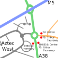
Aztec West Transport.svg 500 × 500; 20 KB
-
Electical control rooms GB mainlines 041124.jpg 2,481 × 3,509; 2.32 MB
-
Isle of Wight public transport map September 2009.png 1,101 × 806; 550 KB
-
Isle of Wight public transport map September 2010.png 1,226 × 912; 434 KB
-
Kinver Light Railway.jpg 600 × 600; 88 KB
-
Map of Urban rail in the UK.svg 1,064 × 1,942; 81 KB
-
Northstowe and Guided busway map.png 1,397 × 1,297; 688 KB
-
OSM 2023 Bermuda PublicTrans.png 1,472 × 1,088; 592 KB
-
SERT routes.png 979 × 483; 201 KB
-
West Yorkshire Mass Transit diagram.svg 512 × 352; 2.62 MB
-
XN Core.png 1,920 × 1,080; 256 KB
-
XNnetwork.jpg 4,096 × 2,304; 308 KB
-
ÖPNV-Systeme auf den Britischen Inseln.png 1,845 × 2,715; 512 KB


