Category:Public transport maps of Austria
Jump to navigation
Jump to search
Subcategories
This category has the following 13 subcategories, out of 13 total.
C
- Maps of S-Bahn Carinthia (12 F)
G
- Tram maps of Gmunden (9 F)
I
K
L
S
T
- Maps of S-Bahn Tirol (8 F)
V
Media in category "Public transport maps of Austria"
The following 20 files are in this category, out of 20 total.
-
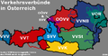 Oesterreich Verkehrsverbuende.png 764 × 392; 78 KB
-
 Bahnnetz in Kärnten nach Inbetriebnahme der Koralmbahn.png 4,170 × 2,953; 1.05 MB
-
 GKB Netzplan 1960.jpg 5,870 × 6,549; 4.94 MB
-
 Karte der S-Bahn Vorarlberg.svg 693 × 881; 485 KB
-
 Karte der Verkehrsverbünde und Tarifverbünde in Deutschland, Österreich und der Schweiz.png 2,956 × 2,404; 1.75 MB
-
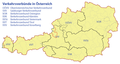 Karte der Verkehrsverbünde und Tarifverbünde in Österreich.png 1,282 × 680; 194 KB
-
 Liniennetzplan Villach.png 9,218 × 6,780; 13.91 MB
-
 Lokal-undStraßenbahnNetzentwicklungBaden.png 3,719 × 4,340; 402 KB
-
 Lokal-undStraßenbahnNetzentwicklungMödling.png 2,444 × 3,600; 284 KB
-
 Lokalbahn-undOBusNetzentwicklungMurtal.png 7,027 × 3,477; 512 KB
-
 LokalbahnGleisplanBaden2020.png 3,272 × 6,716; 570 KB
-
 NetzentwicklungFlorianerbahn.png 2,468 × 2,299; 165 KB
-
 Netzplan der Stadtwerke Leoben.png 2,232 × 1,604; 195 KB
-
 Netzpläne Autobuslinien Weststeiermark, Oststeiermark Sommer 1934.jpg 10,558 × 8,407; 58.32 MB
-
 S-Bahn Oberösterreich - Netzplan.png 976 × 615; 99 KB
-
 S-Bahn Oberösterreich - Netzplan.svg 975 × 615; 705 KB
-
 S3 Kärnten im Vollausbau 2025.png 2,000 × 1,167; 153 KB
-
 StraßenbahnNetzentwicklungStPölten.png 1,223 × 2,876; 172 KB
-
 StraßenbahnNetzentwicklungYbbs.png 974 × 1,090; 78 KB
-


.jpg)