Category:Maps of the Congress of the Philippines
Jump to navigation
Jump to search
Subcategories
This category has only the following subcategory.
Media in category "Maps of the Congress of the Philippines"
The following 11 files are in this category, out of 11 total.
-
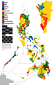
 14th Congress of the Philippines.png 2,000 × 3,120; 274 KB
-
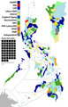
 16th Congress of the Philippines party standing.png 2,000 × 3,120; 285 KB
-
 2007PhilippineHouseElections.PNG 2,000 × 3,120; 320 KB
-
 Circonscriptions sénatoriales des Philippines.png 1,005 × 1,160; 210 KB
-
 PH Congressional districts 14th Congress.png 1,400 × 1,616; 319 KB
-
 Philippine congressional districts population.png 2,050 × 3,120; 215 KB
-
 Philippine legislative districts starting 2010.png 2,000 × 3,120; 284 KB
-
 Philippine legislative districts starting 2016.png 2,050 × 3,122; 161 KB
-
 Philippine legislative districts starting 2019.png 2,050 × 3,122; 160 KB
-
 Philippine legislative districts.png 2,000 × 3,120; 276 KB
-
 Senatorial Districts of the Philippines.png 1,005 × 1,160; 267 KB


