Category:Old maps of Tonga
Jump to navigation
Jump to search
Countries of Oceania: Australia · Fiji · Federated States of Micronesia · Kiribati · Marshall Islands · Nauru · New Zealand · Palau · Papua New Guinea · Samoa · Solomon Islands · Tonga · Tuvalu · Vanuatu
Other areas: Clipperton Island · Cook Islands · French Polynesia · Guam · Hawaii · New Caledonia · Niue · Northern Mariana Islands · Pitcairn Islands · Wallis and Futuna – Partly: British overseas territories · Indonesia · French Southern and Antarctic Lands
Other areas: Clipperton Island · Cook Islands · French Polynesia · Guam · Hawaii · New Caledonia · Niue · Northern Mariana Islands · Pitcairn Islands · Wallis and Futuna – Partly: British overseas territories · Indonesia · French Southern and Antarctic Lands
Use the appropriate category for maps showing all or a large part of Tonga. See subcategories for smaller areas:
| If the map shows | Category to use |
|---|---|
| Tonga on a recently created map | Category:Maps of Tonga or its subcategories |
| Tonga on a map created more than 70 years ago | Category:Old maps of Tonga or its subcategories |
| the history of Tonga on a recently created map | Category:Maps of the history of Tonga or its subcategories |
| the history of Tonga on a map created more than 70 years ago | Category:Old maps of the history of Tonga or its subcategories |
Media in category "Old maps of Tonga"
The following 28 files are in this category, out of 28 total.
-
 1777 Cook Map of the Friendly Islands or Tonga - Geographicus - FriendlyIsles-cook-1777.jpg 3,000 × 1,970; 1.54 MB
-

-

-
 Admiralty Chart No 2363 Tongatabu, Published 1890.jpg 12,275 × 7,188; 12.56 MB
-
 Admiralty Chart No 2421 Tonga or Friendly Is, Published 1866.jpg 11,106 × 16,356; 42.65 MB
-
 Admiralty Chart No 3098 Vavau Group, Published 1900.jpg 11,226 × 16,415; 24.37 MB
-
 Admiralty Chart No 3099 Haapai Group Northern Portion, Published 1900.jpg 16,448 × 11,196; 32.24 MB
-
 An account of the natives of the Tonga Islands - A map of the Tonga Islands.png 4,867 × 2,436; 3.38 MB
-
 Carte des Isles Des Amis.jpg 4,795 × 3,484; 3.41 MB
-
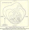 Fonuafoon tonga 1928.jpg 633 × 658; 98 KB
-
 Fonuafoou tonga 1889.jpg 640 × 683; 103 KB
-
 Futuna & Alofi, Niuafo'ou, Niuatoputapu & Tafahi on 1646 map.png 1,354 × 1,737; 2.64 MB
-
 Hessel Gerritsz 1622 map of the Pacific - closeup 'Illas de Salomon'.png 1,203 × 605; 1.63 MB
-
 HK311.jpg 5,332 × 3,332; 3.9 MB
-
 Isle de Cocos (18950175714).jpg 5,472 × 3,704; 2.98 MB
-
 Meyer‘s Zeitungsatlas 091 – Mittelamerika.jpg 7,267 × 6,238; 13.82 MB
-
 Niuafoʻou cropped from Plans in the South Pacific Ocean 1951 US nautical chart.jpg 2,883 × 3,642; 4.39 MB
-
 Niuatoputapu tafahi tonga.jpg 644 × 1,127; 131 KB
-
 P150 - N° 551. Groupes des Fidji et des Samoa. - Liv4-Ch06.png 1,438 × 1,652; 668 KB
-
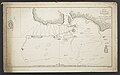
 Plan du Havre de Tongataboo, 1777 (19384895488).jpg 6,280 × 3,896; 3.36 MB
-
 Plans in the South Pacific Ocean 1951 US nautical chart.jpg 6,154 × 8,909; 21.39 MB
-
 Samuel Wallis map of Boscawen and Keppel islands (Tafahi and Niuatoputapu).jpg 2,339 × 2,464; 2.51 MB
-
 The Social and Political Systems of Central Polynesia - Tongatabu.png 5,141 × 3,503; 106 KB
-
 Tonga group.jpg 641 × 702; 90 KB
-
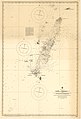
 Tonga. LOC 91685746.jpg 2,345 × 2,954; 522 KB
-
 Tonga. LOC 91685746.tif 2,345 × 2,954; 19.82 MB
-
 Tongatabu Island.jpg 469 × 369; 59 KB
-
 Wallis, Futuna, Niuas islands on a 1797 French map.jpg 960 × 626; 230 KB

.jpg)
%27_(11003672445).jpg)


.jpg)


.jpg)

.jpg)


