
Category:Old maps of New Zealand
Countries of Oceania: Australia · Fiji · Federated States of Micronesia · Kiribati · Marshall Islands · Nauru · New Zealand · Palau · Papua New Guinea · Samoa · Solomon Islands · Tonga · Tuvalu · Vanuatu
Other areas: Clipperton Island · Cook Islands · French Polynesia · Guam · Hawaii · New Caledonia · Niue · Northern Mariana Islands · Pitcairn Islands · Wallis and Futuna – Partly: British overseas territories · Indonesia · French Southern and Antarctic Lands
Other areas: Clipperton Island · Cook Islands · French Polynesia · Guam · Hawaii · New Caledonia · Niue · Northern Mariana Islands · Pitcairn Islands · Wallis and Futuna – Partly: British overseas territories · Indonesia · French Southern and Antarctic Lands
Use the appropriate category for maps showing all or a large part of New Zealand. See subcategories for smaller areas:
| If the map shows | Category to use |
|---|---|
| New Zealand on a recently created map | Category:Maps of New Zealand or its subcategories |
| New Zealand on a map created more than 70 years ago | Category:Old maps of New Zealand or its subcategories |
| the history of New Zealand on a recently created map | Category:Maps of the history of New Zealand or its subcategories |
| the history of New Zealand on a map created more than 70 years ago | Category:Old maps of the history of New Zealand or its subcategories |
Subcategories
This category has the following 9 subcategories, out of 9 total.
Media in category "Old maps of New Zealand"
The following 200 files are in this category, out of 221 total.
(previous page) (next page)-
 'The Kip Brothers' by George Roux 06.jpg 417 × 700; 94 KB
-

-
 Riviere Tamise et Baye Mercure a la Nle. Zeland (18951793103).jpg 7,272 × 4,408; 4.54 MB
-
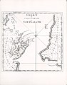
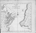
 (1842) MAP OF THE COLONY NEW ZEALAND.jpg 1,994 × 2,559; 3.32 MB
-
 1925 Air Routes of New Zealand.jpg 1,219 × 1,756; 764 KB
-
 1938 Index to Admiralty charts of New Zealand nla.obj-574968413.jpg 11,176 × 8,212; 12.86 MB
-
 209 of 'Pitman's Commercial Geography of the World' (11248720244).jpg 1,312 × 1,942; 488 KB
-
-
 28 of 'The War in New Zealand ... With ... maps, etc' (11074237813).jpg 2,738 × 2,094; 696 KB
-
 29 of 'New Zealand; or Zealandia, the Britain of the South' (11053076416).jpg 3,951 × 5,049; 3.36 MB
-
 A chart of Nelson Haven, Tasman's Gulf, New Zealand MapColl-834.1aj.jpg 1,080 × 1,522; 115 KB
-
 A manual of forestry (1906) (14783893123).jpg 1,518 × 2,096; 299 KB
-
 Admiralty Chart Catalogue 1967 Page 080 Index N.jpg 8,576 × 6,866; 7.37 MB
-

-
 Admiralty Chart No 1090 Plans on the north coast of North Island, New Zealand, Published 1942.jpg 11,240 × 16,430; 69.76 MB
-
 Admiralty Chart No 1212 New Zealand, Published 1856.jpg 7,984 × 11,984; 12.24 MB
-

-
 Admiralty Chart No 1575 Akaroa Harbour (16380266047), Surveyed 1849-1850.jpg 3,413 × 4,540; 5.43 MB
-
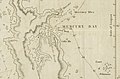
 Admiralty Chart No 2574 Mercury Bay, Published 1940.jpg 11,049 × 8,086; 21.56 MB
-

-
 Admiralty Chart No 788 South Pacific Ocean Western Sheet, Published 1877.jpg 16,530 × 11,322; 45.37 MB
-
 An atlas of commercial geography (1913) (14779122374).jpg 2,322 × 2,924; 1.31 MB
-

-
 Auckland Islands (Maungahuka) (20648924731).jpg 4,753 × 6,311; 2.77 MB
-
-
 Bay of Islands New Zealand (by Captain James Cook, 1773).jpg 1,412 × 1,452; 1.41 MB
-
 Black Map Christchurch 1850.jpg 2,895 × 2,645; 984 KB
-
 Black Map, Christchurch (12485843915).jpg 1,334 × 1,648; 1.39 MB
-
 Black Map, Christchurch.jpg 13,631 × 9,824; 43.47 MB
-

-

-
 Captain Cook's Voyages - Illustrations (19).jpg 900 × 1,152; 211 KB
-
 Carte de la Nle. Zelande (19386152309).jpg 3,666 × 4,753; 1.97 MB
-
 Carte du detroit de Cook dans le Nle. Zelande (19565848452).jpg 4,664 × 4,320; 2.91 MB
-
 Catalogue of Admiralty Charts 1914 Index Sheet 14 New Zealand.png 3,720 × 2,866; 5.03 MB
-
 Chapman's map of the Middle (South) Island, c.1860-1869 (16592596960).jpg 5,186 × 3,254; 10.6 MB
-
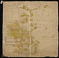
 Chapman's map of the Waikato, 1866.jpg 13,510 × 21,136; 16.97 MB
-
 Chart of Mercury Bay by Richard Pickersgill (1769).jpg 908 × 709; 121 KB
-
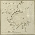 Chart of Tolaga Bay New Zealand (by Captain James Cook, 1773).jpg 1,416 × 1,412; 1.36 MB
-
 Church Street Rail Crossing, Onehunga, Auckland (16807288390).jpg 3,232 × 4,462; 4.96 MB
-
 Collier's 1921 New Zealand.jpg 1,905 × 2,561; 693 KB
-
 Cook chart of New Zealand.jpg 1,093 × 1,508; 301 KB
-
 Cook New Zealand South Cape.jpg 800 × 618; 127 KB
-
 Cook new zealand.jpg 861 × 1,024; 307 KB
-
 Cook Streight accountofvoyages 02hawk 0484.jpg 2,543 × 2,493; 662 KB
-
 Cook.south.island.jpg 909 × 1,050; 510 KB
-
 CookchartNorthIsland.jpg 6,128 × 7,436; 8.27 MB
-
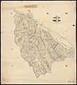
 Crown Grant Map - (Longwood Survey District) Blocks 1, 2, 3.jpg 22,220 × 13,477; 39.08 MB
-
 Crown Grant Map - Town of Woodend.jpg 15,552 × 12,269; 36.44 MB
-
 Detail from a map of Wanganui River Valley, Canterbury.jpg 4,946 × 3,397; 3.02 MB
-
 EB1911 New Zealand - geological map.jpg 864 × 1,250; 210 KB
-
 EB1911 New Zealand.jpg 1,879 × 2,590; 906 KB
-
 Erewhon.map.jpg 2,206 × 1,360; 321 KB
-
 Eyrewell and adjacent runs.jpg 1,347 × 1,038; 181 KB
-
 FMIB 35269 Relief Map of South Island, New Zealand.jpeg 642 × 778; 126 KB
-
 FMIB 35271 Relief Map of North Island, New Zealand.jpeg 624 × 856; 176 KB
-

-
 FMIB 50816 Sketch Map of the Antipodes Islands.jpeg 1,262 × 1,648; 173 KB
-
 FMIB 50818 Sketch Map of Campbell Island.jpeg 1,209 × 1,324; 166 KB
-
 FMIB 50819 Sketch Map of the Auckland Islands.jpeg 1,174 × 1,771; 299 KB
-
 Image of mining under Ohai area.jpg 13,360 × 10,032; 4.72 MB
-

-
 Islands of New Zealand, Joel Samuel Polack.jpg 244 × 350; 22 KB
-
 Map and Photo of Argo (11969040323).jpg 4,341 × 2,919; 7.13 MB
-
 Map of Beaumont Survey District (1922).jpg 5,754 × 8,186; 3.1 MB
-
 Map of Benger Survey District (1922).jpg 8,452 × 8,140; 6.01 MB
-
 Map of Blackstone Survey District (1955).jpg 7,466 × 8,227; 4.22 MB
-
-
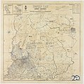
 Map of Catlins Survey District (1893).jpg 6,701 × 6,433; 3.38 MB
-
 Map of Crookston Survey District (1932).jpg 7,389 × 7,250; 4.72 MB
-
 Map of Domet Survey District (unknown date).jpg 6,027 × 7,973; 2.51 MB
-
 Map of Dunback Survey District (1894).jpg 6,342 × 7,956; 3.21 MB
-
 Map of Fraser and Cairnhill Survey Districts (1939).jpg 9,198 × 7,687; 5.34 MB
-
 Map of Gimmerburn Survey District and Part of Poolburn Survey District (1902).jpg 7,517 × 8,724; 4.61 MB
-
 Map of Glenomaru Survey District (1933).jpg 6,139 × 6,762; 4.23 MB
-
 Map of Hillend Survey District (1884).jpg 8,101 × 8,015; 5.4 MB
-
 Map of Kakanui Survey District (1911).jpg 7,119 × 6,928; 2.94 MB
-
 Map of Kurow Survey District (1906).jpg 7,016 × 8,163; 3.93 MB
-
 Map of Kyeburn Survey District (1902).jpg 8,083 × 7,852; 3.5 MB
-
 Map of Lammerlaw Survey District (1922).jpg 6,700 × 8,011; 4.05 MB
-
 Map of Lauder Survey District (1915).jpg 8,087 × 7,979; 4.79 MB
-
 Map of Leaning Rock Survey District (1936).jpg 7,079 × 7,347; 3.61 MB
-
 Map of Lower Hawea Survey District (1956).jpg 7,571 × 7,650; 3.61 MB
-
 Map of Maerewhenua Survey District (1908).jpg 7,708 × 8,398; 5.85 MB
-
 Map of Maniototo Survey District (1902).jpg 7,691 × 8,416; 5.22 MB
-
 Map of Naseby and Idaburn Survey Districts (1902).jpg 7,851 × 8,531; 4.62 MB
-
 Map of Nenthorn Survey District (1923).jpg 7,259 × 7,860; 4.02 MB
-
 Map of New Zealand from 1798, Canterbury Museum, 2016-01-27.jpg 2,688 × 4,112; 7.32 MB
-
 Map of New Zealand.jpg 2,935 × 3,458; 1.97 MB
-
 Map of Rimu Survey District (1906).jpg 8,011 × 7,780; 4.59 MB
-
 Map of Rock and Pillar Survey District (1894).jpg 8,404 × 8,082; 5.39 MB
-
 Map of Silverpeak Survey District (1956).jpg 5,782 × 8,645; 2.63 MB
-
 Map of Strath Taieri Survey District (1939).jpg 7,531 × 7,351; 3.69 MB
-
 Map of Survey Districts Clutha and South Molyneux (1955).jpg 8,375 × 8,798; 5.65 MB
-
 Map of Survey Districts of Waitahuna East and Waitahuna West (1886).jpg 8,175 × 8,170; 6.49 MB
-
 Map of Sutton Survey District (unknown date).jpg 7,463 × 7,762; 3.96 MB
-
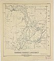 Map of Tarras Survey District (1952).jpg 7,693 × 8,692; 4.53 MB
-
 Map of Teviot Survey District (1899,1924).jpg 10,063 × 8,304; 6.75 MB
-
 Map of the North Island, with iwi boundaries and Māori population, 1863 (29009895625).jpg 3,041 × 4,000; 9.04 MB
-
 Map of the North Island, with iwi boundaries and Māori population, 1881 (29010155165).jpg 3,404 × 5,000; 12.88 MB
-
 Map of the Port Hills-Akaroa Summit Road.jpg 617 × 768; 66 KB
-
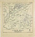 Map of Tiger Hill Survey District (1935).jpg 7,794 × 8,384; 5.49 MB
-
 Map of Tuapeka East Survey District (1946).jpg 7,722 × 7,771; 4.87 MB
-
 Map of Tuapeka West Survey District (Plan) (1952).jpg 6,590 × 7,384; 3.49 MB
-
 Map of Waihemo Survey District (1924).jpg 7,461 × 8,031; 3.74 MB
-
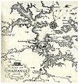 Map of Waitangi and its Environments, 1940 (16909495681).jpg 2,058 × 2,188; 3.85 MB
-
 Map of Woodland Survey District (1933).jpg 7,368 × 5,968; 3.46 MB
-
 Maps 1760 extralarge.jpg 1,488 × 2,000; 661 KB
-
 Marlborough Land District No.110, 1889 (27659786305).jpg 3,421 × 2,608; 2.09 MB
-
 Mercury Bay New Zealand (by Captain James Cook, 1773).jpg 1,441 × 951; 946 KB
-
 Meyers b12 s0083b.jpg 1,432 × 2,248; 946 KB
-
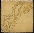
 Māori map of the Middle (South) Island and Stewart Island, c.1841 (19532914794).jpg 3,038 × 4,609; 808 KB
-
 National Women’s Hospital Opening (1964) (24596591229).jpg 1,792 × 2,691; 744 KB
-
 New Hebrides Map 1860 (19764556578).jpg 2,180 × 5,447; 2.11 MB
-
 New zealand 1832.jpg 780 × 1,371; 95 KB
-
 New Zealand 1854.jpg 4,783 × 6,446; 2.25 MB
-
 New Zealand administrative divisions. LOC 2006628167.jpg 2,525 × 3,235; 653 KB
-
 New Zealand administrative divisions. LOC 2006628167.tif 2,525 × 3,235; 23.37 MB
-
-
 New Zealand Company plan of Port Nicholson, 1840 (15991853901).jpg 6,731 × 8,950; 12.69 MB
-
 New Zealand Company plan of the Town of Wellington, Port Nicholson, 1840 (15975386086).jpg 9,434 × 6,819; 21.01 MB
-
 New zealand counties 1913.jpg 2,024 × 2,894; 1.04 MB
-
 New Zealand on the Map.jpg 640 × 474; 376 KB
-
 New Zealand plants and their story (1919) (14777461165).jpg 1,704 × 2,674; 473 KB
-
 New Zealand. LOC 2006628166.jpg 2,502 × 3,239; 718 KB
-
 New Zealand. LOC 2006628166.tif 2,502 × 3,239; 23.19 MB
-
 New Zealand. LOC 2006628337.jpg 2,524 × 3,250; 822 KB
-
 New Zealand. LOC 2006628337.tif 2,524 × 3,250; 23.47 MB
-
 Old maps of New Zealand, South Island 01.jpg 1,159 × 1,406; 2.27 MB
-
 Old maps of New Zealand, South Island 02.jpg 1,159 × 1,406; 2.33 MB
-
 Old maps of New Zealand, South Island 03.jpg 1,145 × 1,557; 2.34 MB
-
 P041 - N° 530. Ile Septentrionale de la Nouvelle-Zélande. - Liv4-Ch05.png 1,446 × 1,975; 422 KB
-
-

-
 Photograph of J S Polack’s 1838 map of New Zealand (25918375021).jpg 1,657 × 2,444; 689 KB
-
 Pinkerton Map 1818 - Recolour v1.6.tif 5,317 × 3,973; 60.46 MB
-
-

-
 Plan of the Town of Wellington, 1840 (11968849753).jpg 6,432 × 4,643; 2.66 MB
-
 Polus Antarcticus Terra Australis Incognita (15188866396).jpg 4,961 × 4,268; 2.89 MB
-
 Position of Maori Tribes About 1800 (16044619492).jpg 4,310 × 6,292; 6.12 MB
-

-
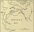 Poverty Bay, Nueva Zelanda, octubre de 1769. Según W.L. Williams, (1888).jpg 1,246 × 1,138; 761 KB
-
 Province of Westland (9560948380).jpg 4,477 × 17,507; 3.51 MB
-
 Riccarton Estate (27110588173).jpg 6,143 × 3,240; 4.67 MB
-
 River Thames and Mercury Bay New Zealand (by Captain James Cook, 1773).jpg 2,976 × 2,896; 5.55 MB
-
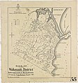
 Roads in the Tranaki District. ATLIB 292354.png 5,425 × 6,909; 26.73 MB
-
 Roger Creek, 1953.jpg 775 × 972; 151 KB
-
 Search map for missing aviators George Hood & John Moncrieff.jpg 6,989 × 10,231; 14.88 MB
-
 Sketch map of the Paparata Valley, Surrey Redoubt and Paparoa (16766506593).jpg 3,849 × 3,037; 9.31 MB
-
 Survey Office - Aorere District (updated).jpg 1,080 × 1,299; 85 KB
-
 Survey Office - Aorere District.jpg 1,080 × 1,247; 64 KB
-
 Survey Office - Arnaud Survey District.jpg 1,080 × 2,060; 70 KB
-
 Survey Office - City of Nelson - Crown Grant Record Map - Sheet No 2.jpg 1,080 × 1,388; 146 KB
-
 Survey Office - City of Nelson - Crown Grant Record Map - Sheet No. 3.jpg 1,080 × 1,369; 118 KB
-
 Survey Office - City of Nelson - Crown Grant Record Map - Sheet No. 4.jpg 1,080 × 1,597; 138 KB
-
 Survey Office - City of Nelson, Crown - Grant Record Map - Sheet No 1.jpg 1,080 × 1,389; 115 KB
-
 Survey Office - Collingwood (2 Sheets).jpg 1,080 × 1,081; 90 KB
-
 Survey Office - Collingwood.jpg 1,080 × 1,033; 79 KB
-
 Survey Office - Grey Circuit - Tasman Bay & Golden Bay.jpg 1,080 × 1,288; 87 KB
-
 Survey Office - Molesworth-Tarndale-Rainbow Run Shewn.jpg 1,080 × 974; 132 KB
-
 Survey Office - Motueka - Moutere.jpg 1,080 × 1,088; 109 KB
-
 Survey Office - Motueka River-Stanley Brook.jpg 1,080 × 1,099; 110 KB
-
 Survey Office - Moutere Inlet.jpg 1,080 × 1,094; 86 KB
-
 Survey Office - Mt Arthur-Wangapeka-Motueka-Wai-iti (2).jpg 1,080 × 1,093; 88 KB
-
 Survey Office - Mt Arthur-Wangapeka-Motueka-Wai-iti.jpg 1,080 × 1,067; 64 KB
-
 Survey Office - Native & Public Reserve in the town of Nelson.jpg 1,080 × 1,045; 120 KB
-
 Survey Office - Nelson & Fox Hill Railway.jpg 1,077 × 92; 8 KB
-
 Survey Office - Pakawau - Aorere - Waitapu.jpg 1,080 × 1,043; 92 KB
-
 Survey Office - Pakawau - Onetaua.jpg 1,079 × 1,046; 56 KB
-
 Survey Office - Plan of Charleston.jpg 1,080 × 1,763; 94 KB
-
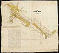
 Survey Office - Plan of Lake Run, Part 1 & 3.jpg 1,079 × 376; 21 KB
-

-
-
 Survey Office - Plan of Maruia & Grey River.jpg 1,080 × 603; 30 KB
-
 Survey Office - Plan of Part of the Grey Coal Field, north of the Buller.jpg 1,080 × 832; 41 KB
-
-
 Survey Office - Plan of the Accommodation & Rural sections, Blind Bay & Waitohi.jpg 1,080 × 1,221; 114 KB
-
 Survey Office - Plan of the Lake Run.jpg 1,080 × 971; 79 KB
-
 Survey Office - Plan of the Valley of the Moutere.jpg 1,080 × 440; 41 KB
-
 Survey Office - Province of Nelson & Marlborough.jpg 1,080 × 1,057; 89 KB
-
 Survey Office - Provisional Survey of the Howard Block.jpg 1,080 × 1,198; 95 KB
-
 Survey Office - River Inangahua.jpg 1,080 × 442; 29 KB
-

-
 Survey Office - Tadmore (Motupiko Valley from Tadmor).jpg 1,080 × 338; 18 KB
-
 Survey Office - Takaka - Kai-teri-teri - Motueka (2).jpg 1,080 × 1,061; 99 KB
-
 Survey Office - Takaka - Kai-teri-teri - Motueka.jpg 1,080 × 1,246; 84 KB
-
 Survey Office - Takaka River (2).jpg 1,080 × 1,296; 89 KB
-
 Survey Office - Takaka River (3).jpg 1,080 × 1,091; 102 KB
-
 Survey Office - Takaka River.jpg 1,080 × 1,069; 74 KB
-
 Survey Office - Totara-nui (2).jpg 1,080 × 1,059; 67 KB
-
 Survey Office - Totara-nui.jpg 1,080 × 1,082; 69 KB
-
 Survey Office - Town of Hampden River Matakitaki, River Buller.jpg 1,080 × 359; 25 KB
-
 Survey Office - Wai-iti-Waimea-Gordon Rintoul (2).jpg 1,080 × 1,063; 113 KB
-
 Survey Office - Wai-iti-Waimea-Gordon Rintoul.jpg 1,080 × 1,078; 66 KB
-
 Survey Office - Waimea (1).jpg 1,080 × 1,097; 96 KB
-
 Survey Office - Waimea (2).jpg 1,080 × 1,078; 116 KB
-
 Survey Office - Waimea (3).jpg 1,080 × 1,017; 85 KB
-
 Survey Office - Waimea - Maungatapu.jpg 1,080 × 1,075; 82 KB
-
 Survey Office - Waimea Plain.jpg 1,080 × 791; 62 KB

.jpg)
.jpg)
_MAP_OF_THE_COLONY_NEW_ZEALAND.jpg)


.jpg)
%27_(11165413216).jpg)
.jpg)
.jpg)

_(14783893123).jpg)

_(16030576661),_Surveyed_1849.jpg)


,_Surveyed_1849-1850.jpg)


_(14779122374).jpg)
_(14584057117).jpg)
_(20648924731).jpg)

.jpg)

.jpg)

_(19780047814).jpg)

.jpg)
.jpg)
.jpg)

_Island,_c.1860-1869_(16592596960).jpg)

.jpg)
.jpg)
.jpg)


_Blocks_1,_2,_3.jpg)


.jpg)

.jpg)
.jpg)
.jpg)
.jpg)
.jpg)
.jpg)
.jpg)
.jpg)
.jpg)
.jpg)
.jpg)
.jpg)
.jpg)
.jpg)
.jpg)
.jpg)
.jpg)
.jpg)
.jpg)
.jpg)
.jpg)
.jpg)
.jpg)
.jpg)


.jpg)
.jpg)
.jpg)
.jpg)
.jpg)
.jpg)
.jpg)
.jpg)
.jpg)
.jpg)
.jpg)

.jpg)
.jpg)
_(1952).jpg)
.jpg)
.jpg)
.jpg)

.jpg)
.jpg)

_Island_and_Stewart_Island,_c.1841_(19532914794).jpg)
_(24596591229).jpg)


_1911-1912._(21014706744).jpg)
.jpg)
.jpg)


_(14777461165).jpg)


.jpg)

.jpg)
.jpg)
.jpg)
.jpg)
.jpg)
.jpg)
.jpg)


.jpg)
.jpg)


.jpg)


.jpg)


.jpg)
.jpg)


.jpg)


.jpg)

.jpg)
.jpg)

.jpg)

.jpg)

.jpg)
.jpg)
.jpg)


.jpg)
_by_MacDonald_Gil._Original_from_Museum_of_New_Zealand._Digitally_enhanced_by_rawpixel._(50623609486).jpg)
.jpg)
.jpg)