Category:Old maps of Karnataka
Jump to navigation
Jump to search
States of India: Andhra Pradesh · Arunachal Pradesh · Assam · Bihar · Goa · Gujarat · Jharkhand · Karnataka · Kerala · Madhya Pradesh · Maharashtra · Manipur · Meghalaya · Odisha · Sikkim · Tamil Nadu · Telangana · Tripura · Uttar Pradesh · Uttarakhand · West Bengal
Union territories: Andaman and Nicobar Islands · Dadra and Nagar Haveli and Daman and Diu · Delhi · Jammu and Kashmir · Ladakh · Lakshadweep · Puducherry
Former states of India: Jammu and Kashmir ·
Former union territories: Daman and Diu ·
Union territories: Andaman and Nicobar Islands · Dadra and Nagar Haveli and Daman and Diu · Delhi · Jammu and Kashmir · Ladakh · Lakshadweep · Puducherry
Former states of India: Jammu and Kashmir ·
Former union territories: Daman and Diu ·
Subcategories
This category has the following 4 subcategories, out of 4 total.
- Old maps of Bangalore (24 F)
- Old maps of Mysore (12 F)
P
Media in category "Old maps of Karnataka"
The following 47 files are in this category, out of 47 total.
-
 103 of 'A Handbook for the use of Visitors to Seringapatam' (11250540086).jpg 6,344 × 4,571; 4.52 MB
-
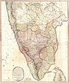 1793 Faden Wall Map of India - Geographicus - India-faden-1793.jpg 6,000 × 7,229; 9.83 MB
-
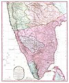
 1800 Faden Rennell Wall Map of India - Geographicus - India-faden-1795.jpg 6,000 × 7,353; 10.85 MB
-
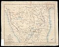
 1800 Map of Peninsular India-1795.jpg 5,936 × 7,137; 50.39 MB
-
-
 1801 - 20 - 29(A) 1806 Districts interchanged between EE India Co and Rajah of Mysore.jpg 9,283 × 7,557; 3.51 MB
-
 1801 - 20 - 30(A) Territories of Mysore.jpg 12,743 × 9,486; 6.74 MB
-
 1801 - 20 - 61 Fort and Petta of Muddukayray.jpg 7,751 × 6,425; 2.81 MB
-
 F.3' Citadel of Bejapoor. Plan..jpg 976 × 621; 135 KB
-

-
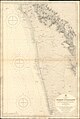
 Admiralty Chart No 827 Vengurla to Cape Comorin, Published 1877, New Edition 1914.jpg 10,881 × 16,191; 50.36 MB
-
 Admiralty Chart No 827 Vengurla to Cape Comorin, Published 1877.jpg 10,542 × 16,083; 51.21 MB
-
 Hampi Ruins of Vijaynagar India Map 1911.jpg 1,346 × 1,796; 225 KB
-
 Hampi Ruins Map.jpg 3,129 × 2,550; 2.28 MB
-
 58 A 09 Mysore State (1910).jpg 6,066 × 6,948; 4.31 MB
-
 60The South Indian Railway.jpg 1,689 × 1,897; 985 KB
-
 A map of India, showing Malabar, Madura and Cormeddel Wellcome L0038175.jpg 3,888 × 3,120; 3.34 MB
-
 Admiralty Chart No 745 Netrani to Mangalore, Published 1902.jpg 10,921 × 16,273; 62.35 MB
-
 Admiralty Chart No 746 Mulki to Mount Dilli, Published 1858.jpg 10,920 × 16,251; 60.78 MB
-
 Admiralty Chart No 782 Bombay to Carwar Head, Published 1791.jpg 7,206 × 8,758; 9.37 MB
-
 Bangalore district 1854.jpg 5,016 × 6,416; 11.77 MB
-
 Bellary 1854 Pharoah.jpg 7,600 × 6,528; 29.58 MB
-
 Bellary 1854.jpg 2,336 × 1,716; 3.85 MB
-
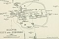 Bijapur City and Suburb Places of Interest 1896 map.jpg 2,304 × 1,530; 318 KB
-
 Bijapur district 1896.jpg 1,716 × 2,636; 894 KB
-
 Bijapur Murray.jpg 2,464 × 1,616; 2.3 MB
-
 Chitradurga 1854.jpg 5,168 × 6,320; 16.56 MB
-
 Chitradurga map.png 4,285 × 3,380; 3.05 MB
-
 EstadoInd.jpg 329 × 575; 53 KB
-
 Hampi Murray.jpg 1,446 × 1,943; 1.42 MB
-
 JamkhandiKart.jpg 357 × 524; 201 KB
-
 Madikeri map.jpg 2,684 × 1,956; 5.91 MB
-
 Malabar district.jpg 689 × 565; 107 KB
-
 Mercara 1854.jpg 8,885 × 6,545; 31.27 MB
-
 Mysore 1854.jpg 5,192 × 6,501; 17.5 MB
-
 Mysore in 1704 Joppen.jpg 880 × 1,280; 246 KB
-
 N Canara 1854.jpg 5,312 × 6,336; 15.31 MB
-
 North Kanara 1896.jpg 1,661 × 2,678; 713 KB
-
 North Kanara mission map.jpg 2,430 × 1,954; 4.53 MB
-
 Overland trade routes through the Deccan.jpg 696 × 523; 75 KB
-
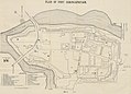
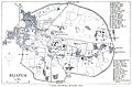
 Plan of Seringapatam and its environs.jpg 1,896 × 1,410; 326 KB
-
 Plan of Seringapatam.jpg 2,688 × 2,058; 2.72 MB
-
 Plan of the Chitradurg Fort.JPG 976 × 663; 110 KB
-
 S Canara 1854.jpg 5,152 × 6,288; 11.33 MB
-
 Shimoga 1854.jpg 5,296 × 6,448; 23.29 MB
-
 South Kanara.jpg 507 × 562; 96 KB
-
 Wikipedia OldMysore.jpg 1,200 × 840; 267 KB
.jpg)


_1806_Districts_interchanged_between_EE_India_Co_and_Rajah_of_Mysore.jpg)
_Territories_of_Mysore.jpg)


.jpg)


