Category:Old maps of South India
Jump to navigation
Jump to search
States of India: Andhra Pradesh · Arunachal Pradesh · Assam · Bihar · Goa · Gujarat · Jharkhand · Karnataka · Kerala · Madhya Pradesh · Maharashtra · Manipur · Meghalaya · Odisha · Sikkim · Tamil Nadu · Telangana · Tripura · Uttar Pradesh · Uttarakhand · West Bengal
Union territories: Andaman and Nicobar Islands · Dadra and Nagar Haveli and Daman and Diu · Delhi · Jammu and Kashmir · Ladakh · Lakshadweep · Puducherry
Former states of India: Jammu and Kashmir ·
Former union territories: Daman and Diu ·
Union territories: Andaman and Nicobar Islands · Dadra and Nagar Haveli and Daman and Diu · Delhi · Jammu and Kashmir · Ladakh · Lakshadweep · Puducherry
Former states of India: Jammu and Kashmir ·
Former union territories: Daman and Diu ·
Subcategories
This category has the following 10 subcategories, out of 10 total.
Media in category "Old maps of South India"
The following 51 files are in this category, out of 51 total.
-
1652 Sanson Map of India - Geographicus - India-sanson-1652.jpg 2,500 × 1,966; 1.45 MB
-
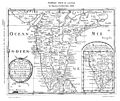
South India Map 1652.jpg 1,836 × 1,540; 1.24 MB
-
Southindia1721.jpg 576 × 768; 101 KB
-
Plan de Mahe avec les attaques de Bayanor souverain du lieu.jpg 1,687 × 669; 605 KB
-
1733 Homann Heirs Map of India - Geographicus - India-homannheirs-1733.jpg 4,000 × 4,527; 5.41 MB
-
1780 Raynal and Bonne Map of Southern India - Geographicus - Indes-bonne-1780.jpg 2,500 × 1,739; 1.08 MB
-
1793 Faden Wall Map of India - Geographicus - India-faden-1793.jpg 6,000 × 7,229; 9.83 MB
-
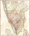
1800 Faden Rennell Wall Map of India - Geographicus - India-faden-1795.jpg 6,000 × 7,353; 10.85 MB
-
1800 Map of Peninsular India-1795.jpg 5,936 × 7,137; 50.39 MB
-
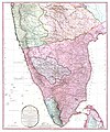
1804 German Edition of the Rennel Map of India - Geographicus - IndiaGerman-rennell-1804.jpg 3,500 × 4,275; 4.86 MB
-
1808 Smith Map of India - Geographicus - India-smith-1808.jpg 2,683 × 3,500; 3.56 MB
-
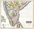
1814 Thomson Map of India - Geographicus - IndiaSouth-t-1814.jpg 3,300 × 2,799; 2.37 MB
-
Travancore 1871.JPG 380 × 649; 51 KB
-
Geology Gazetteer map 1897.jpg 1,980 × 2,145; 4.52 MB
-
The Harmsworth atlas and Gazetter 1908 (135850297).jpg 12,558 × 9,576; 119.48 MB
-
Southern India and Ceylon, 1967.jpg 1,989 × 2,915; 2.47 MB
-
24 of 'Native Life in Travancore' (11162355843).jpg 3,536 × 5,140; 3.49 MB
-
60The South Indian Railway.jpg 1,689 × 1,897; 985 KB
-
Buchanan Journey map.jpg 5,928 × 4,880; 24.93 MB
-
EB1911India - map (southern part).jpg 3,725 × 2,634; 3.8 MB
-
GhatRivers.png 1,815 × 2,931; 3.77 MB
-
Hyder's Dominions in 1780.jpg 320 × 458; 26 KB
-
Madras map 1913.jpg 464 × 560; 39 KB
-
Madras Prov 1859.gif 524 × 640; 247 KB
-
Madras Prov South 1909 Mysore.jpg 613 × 580; 230 KB
-
Madras Prov South 1909.jpg 1,000 × 1,246; 430 KB
-
Map of South Kerala 1498 AD by Dutch.png 537 × 808; 891 KB
-
Map of Thekkumkur in 1790.jpg 2,320 × 1,576; 711 KB
-
Map1880s.jpg 1,071 × 1,600; 135 KB
-
Mysore in 1704 Joppen.jpg 880 × 1,280; 246 KB
-
Peutinger India.png 463 × 247; 42 KB
-
Plate 34. Sect. XIII- Madras, Mysore and Goa maps from Constable 1893 Hand Atlas.jpg 1,736 × 1,376; 830 KB
-
Pope1880MadrasPres2.jpg 910 × 1,200; 205 KB
-
S India1893.jpg 745 × 613; 91 KB
-
South India map 1782.jpg 1,656 × 2,104; 1.53 MB
-
South India Map 1794.jpg 3,400 × 4,608; 2.59 MB
-
South India map.jpg 2,954 × 3,557; 8.59 MB
-
Southern Division Map 1843.jpg 2,883 × 2,640; 5.58 MB
-
Southern India 1808.jpg 3,084 × 2,749; 8.03 MB
-
SouthIndia1794.jpeg 814 × 416; 110 KB
-
TabulaPeutingerianaMuziris.jpg 457 × 373; 71 KB
-
Tranquebar 1600.jpg 549 × 252; 35 KB
-
Wikipedia OldMysore.jpg 1,200 × 840; 267 KB

