Category:Old maps of Goa
Jump to navigation
Jump to search
States of India: Andhra Pradesh · Arunachal Pradesh · Assam · Bihar · Goa · Gujarat · Jharkhand · Karnataka · Kerala · Madhya Pradesh · Maharashtra · Manipur · Meghalaya · Odisha · Sikkim · Tamil Nadu · Telangana · Tripura · Uttar Pradesh · Uttarakhand · West Bengal
Union territories: Andaman and Nicobar Islands · Dadra and Nagar Haveli and Daman and Diu · Delhi · Jammu and Kashmir · Ladakh · Lakshadweep · Puducherry
Former states of India: Jammu and Kashmir ·
Former union territories: Daman and Diu ·
Union territories: Andaman and Nicobar Islands · Dadra and Nagar Haveli and Daman and Diu · Delhi · Jammu and Kashmir · Ladakh · Lakshadweep · Puducherry
Former states of India: Jammu and Kashmir ·
Former union territories: Daman and Diu ·
Subcategories
This category has the following 2 subcategories, out of 2 total.
L
- Maps of Goa by Linschoten (17 F)
M
Media in category "Old maps of Goa"
The following 35 files are in this category, out of 35 total.
-
Portuguese Goa 1620 - Manuel Godinho de Herédia.png 1,337 × 1,014; 2.92 MB
-
Croatian India - Location of São Braz in Goa.jpg 886 × 728; 236 KB
-
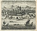
*A view from a Portuguese atlas, 1630*.jpg 886 × 728; 130 KB
-
BlokkadevlootGoa.jpg 5,000 × 3,476; 7.22 MB
-
AMH-6769-KB View of Goa.jpg 2,400 × 2,047; 797 KB
-
Map of Goa, 1683.jpg 725 × 1,078; 165 KB
-
Map of Goa, 1719.jpg 850 × 1,021; 177 KB
-
*A map of Goa in its coastal setting, by Bellin.jpg 651 × 900; 69 KB
-
Bellin's map of the port itself.jpg 725 × 900; 91 KB
-
Mapa Topografico das Ilhas e Provincias de Goa.jpg 1,333 × 971; 446 KB
-
Mapa topográfico de Goa.jpg 3,138 × 2,362; 2.77 MB
-
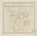
Admiralty Chart No 793 Goa Harbour, with a View, Published 1775.jpg 5,552 × 5,358; 6.32 MB
-
Admiralty Chart No 782 Bombay to Carwar Head, Published 1791.jpg 7,206 × 8,758; 9.37 MB
-
Divar (Ilha de Piedade), India Portuguesa.png 1,169 × 574; 1.8 MB
-
Admiralty Chart No 827 Vengurla to Cape Comorin, Published 1877, New Edition 1914.jpg 10,881 × 16,191; 50.36 MB
-
Admiralty Chart No 827 Vengurla to Cape Comorin, Published 1877.jpg 10,542 × 16,083; 51.21 MB
-
FONSECA(1878) p024 MAP OF GOA.jpg 3,782 × 5,763; 8.19 MB
-
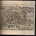
FONSECA(1878) p136 PLAN OF THE CITY OF GOA.jpg 3,231 × 3,005; 4.52 MB
-
Anjediva isle map.jpg 366 × 210; 22 KB
-
Goa1924.jpg 918 × 596; 89 KB
-
Admiralty Chart No 740 West Coast of India, Published 1858, New Edition 1914.jpg 10,460 × 15,958; 39.74 MB
-
Portuguese India 1923.jpg 2,112 × 2,816; 1.67 MB
-
Overland trade routes through the Deccan.jpg 696 × 523; 75 KB
-
Interiora Orientis 1687 (1005262).jpg 3,932 × 3,908; 4.85 MB


