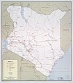
Category:Old maps of Kenya
Jump to navigation
Jump to search
Countries of Africa: Algeria · Angola · Benin · Botswana · Burkina Faso · Burundi · Cameroon · Cape Verde · Central African Republic · Chad · Comoros · Democratic Republic of the Congo · Republic of the Congo · Djibouti · Egypt‡ · Equatorial Guinea · Eritrea · Eswatini · Ethiopia · Gabon · The Gambia · Ghana · Guinea · Guinea-Bissau · Ivory Coast · Kenya · Lesotho · Liberia · Libya · Madagascar · Malawi · Mali · Mauritania · Mauritius · Morocco · Mozambique · Namibia · Niger · Nigeria · Rwanda · São Tomé and Príncipe · Senegal · Seychelles · Sierra Leone · Somalia · South Africa · South Sudan · Sudan · Tanzania · Togo · Tunisia · Uganda · Zambia · Zimbabwe
Limited recognition: Puntland · Somaliland – Other areas: Canary Islands · Ceuta · Madeira · Mayotte · Melilla · Réunion · Western Sahara
‡: partly located in Africa
Limited recognition: Puntland · Somaliland – Other areas: Canary Islands · Ceuta · Madeira · Mayotte · Melilla · Réunion · Western Sahara
‡: partly located in Africa
Use the appropriate category for maps showing all or a large part of Kenya. See subcategories for smaller areas:
| If the map shows | Category to use |
|---|---|
| Kenya on a recently created map | Category:Maps of Kenya or its subcategories |
| Kenya on a map created more than 70 years ago | Category:Old maps of Kenya or its subcategories |
| the history of Kenya on a recently created map | Category:Maps of the history of Kenya or its subcategories |
| the history of Kenya on a map created more than 70 years ago | Category:Old maps of the history of Kenya or its subcategories |
Subcategories
This category has the following 8 subcategories, out of 8 total.
Media in category "Old maps of Kenya"
The following 39 files are in this category, out of 39 total.
-
Admiralty Chart No 669 Cape Delgado to Port Mombasa, Published 1916.jpg 11,059 × 16,144; 12.47 MB
-
Africa (1878) (14589871897).jpg 2,968 × 1,436; 1.09 MB
-
Fort Jesus-Map-XVIIs.jpg 1,196 × 743; 117 KB
-
Fort Jesus-Map-XVIIs1.jpg 837 × 612; 116 KB
-
Kenya, administrative divisions. LOC 92681989.jpg 3,122 × 3,997; 1.4 MB
-
Kenya, administrative divisions. LOC 92681989.tif 3,122 × 3,997; 35.7 MB
-
Kenya, administrative divisions. LOC 94686096.jpg 2,927 × 3,424; 1.48 MB
-
Kenya, administrative divisions. LOC 94686096.tif 2,927 × 3,424; 28.67 MB
-
Kenya-Somalia boundary. LOC 2002622514.jpg 3,158 × 4,143; 1.32 MB
-
Kenya-Somalia boundary. LOC 2002622514.tif 3,158 × 4,143; 37.43 MB
-
Kenya-Uganda boundary. 8-69. LOC 75695706.tif 3,125 × 4,133; 36.95 MB
-
Kenya. 1-74. LOC 75690376.jpg 7,354 × 8,078; 7.74 MB
-
Kenya. 1-74. LOC 75690376.tif 7,354 × 8,078; 169.96 MB
-
Kenya. 12-69. LOC 73696378.jpg 6,980 × 7,978; 8.28 MB
-
Kenya. 12-69. LOC 73696378.tif 6,980 × 7,978; 159.32 MB
-
Kenya. 12-69. LOC gm70003174.jpg 11,926 × 7,989; 13.98 MB
-
Kenya. LOC 75690375.jpg 7,157 × 8,100; 10.44 MB
-
Kenya. LOC 75690375.tif 7,157 × 8,100; 165.86 MB
-
Kenya. LOC 86690360.jpg 3,355 × 4,332; 2.3 MB
-
Kenya. LOC 86690360.tif 3,355 × 4,332; 41.58 MB
-
Kenya. LOC 87692318.jpg 3,352 × 4,320; 1.82 MB
-
Kenya. LOC 87692318.tif 3,352 × 4,320; 41.43 MB
-
Kenya. LOC 88692656.jpg 2,501 × 3,017; 596 KB
-
Kenya. LOC 88692656.tif 2,501 × 3,017; 21.59 MB
-
Kenya. LOC 88692657.jpg 2,384 × 2,971; 750 KB
-
Kenya. LOC 88692657.tif 2,384 × 2,971; 20.26 MB
-
Kenya. LOC 97687595.jpg 3,164 × 4,150; 1.81 MB
-
Kenya. LOC 97687595.tif 3,164 × 4,150; 37.57 MB
-
Map of the lower Tana territory. German protectorate.jpg 2,400 × 2,200; 1.03 MB
-
Melinda chart 1873.jpg 2,874 × 3,121; 1.71 MB
-
Melinda coast 1873.jpg 2,768 × 2,740; 1.64 MB
-
Melinda in Melinda chart 1873.jpg 2,283 × 2,090; 993 KB
-
Meyers b14 s0300a.jpg 800 × 1,280; 376 KB
-
Port Melinda reef 1867.jpg 2,396 × 3,473; 1.68 MB
-
Slug map.jpg 1,024 × 934; 158 KB
-
Vasco da Gama Pillar Melinda chart 1873.jpg 1,968 × 1,490; 680 KB
-
Westlands Constituency 1969-2012(Kenya).jpg 1,587 × 1,377; 558 KB


