Category:Maps of the Roman Empire
Jump to navigation
Jump to search
Wikimedia category | |||||
| Upload media | |||||
| Instance of | |||||
|---|---|---|---|---|---|
| Category combines topics | |||||
| Category contains | |||||
| Roman Empire | |||||
period of ancient Rome following the Republic     | |||||
| Instance of |
| ||||
| Part of | |||||
| Named after | |||||
| Capital | |||||
| Basic form of government |
| ||||
| Legislative body |
| ||||
| Official language | |||||
| Currency | |||||
| Has part(s) |
| ||||
| Founded by | |||||
| Start time |
| ||||
| End time |
| ||||
| Dissolved, abolished or demolished date |
| ||||
| Population |
| ||||
| Area |
| ||||
| Religion or worldview |
| ||||
| Follows | |||||
| Replaces | |||||
| Replaced by |
| ||||
| Different from | |||||
| Said to be the same as | Daqin, Roman imperial period | ||||
 | |||||
English: Maps of the Roman Empire.
- Maps are also available as part of the
 Wikimedia Atlas of the World project in the Atlas of the Roman Empire.
Subcategories
This category has the following 22 subcategories, out of 22 total.
*
A
B
C
L
M
- Maps of Mithraism (2 F)
O
R
S
- SVG maps of the Roman Empire (113 F)
T
- Maps of the Tetrarchy (25 F)
W
- Maps of the Western Roman Empire (118 F)
Media in category "Maps of the Roman Empire"
The following 142 files are in this category, out of 142 total.
-

-
 500 fall-roman-empire-fr.svg 1,648 × 1,049; 1.83 MB
-

-

-

-

-
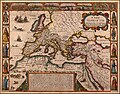 A New Map of The Roman Empire, 1651.jpg 6,230 × 4,867; 5.73 MB
-
 A Római Birodalom.jpg 1,024 × 966; 167 KB
-
 Alter Orient 0400AD-es.svg 2,102 × 1,510; 3.65 MB
-
 Ancient civilization; an introduction to modern history (1916) (14585035837).jpg 1,594 × 2,714; 1.22 MB
-

-
Ausdehnung des römischen Reiches.webm 25 s, 1,920 × 1,080; 21.5 MB
-
 Balkans AD125.png 495 × 261; 241 KB
-
 Bouillet - Atlas universel, Carte 22.png 3,425 × 2,674; 26.21 MB
-
 Bouillet - Atlas universel, Carte 23.png 3,425 × 2,704; 26.51 MB
-
 Campagne de Julien 362-363-hu.svg 2,210 × 1,343; 2.53 MB
-
 Campagne de Julien 362-363.svg 2,210 × 1,343; 2.53 MB
-
 Capitals Roman Empire.png 3,000 × 1,856; 402 KB
-
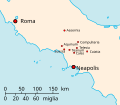
 Carte Rome & Véiès.png 514 × 664; 13 KB
-

-
 Cilicië, Cyprus, Syrië en de Fenicische kust in de oudheid.png 865 × 856; 978 KB
-
 Classical lands of the Mediterranean, 1949.jpg 4,879 × 3,322; 6.41 MB
-
 Claustra Alpium Iuliarum locator map.jpg 398 × 294; 12 KB
-
 Claustra Alpium Iuliarum.jpg 1,160 × 671; 163 KB
-
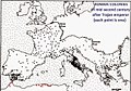
 Colonias romanas.jpg 399 × 279; 52 KB
-
 Culture Vincha peoples.jpg 510 × 343; 80 KB
-
 Diocese of Macedonia - AD 400.png 732 × 702; 572 KB
-
 Dioceses 300 & Praefectures 395 AD of the Roman Empire.png 2,052 × 2,830; 344 KB
-
 Diversité religieuse empire romain III-e s.jpg 2,291 × 1,559; 787 KB
-
 Drususfeldzuege 10-9-v-Chr.jpg 2,560 × 1,920; 1.35 MB
-
 Drususfeldzuege 12-11-v-Chr.jpg 2,560 × 1,920; 1.33 MB
-
 EB 1.1 antique map.jpg 2,500 × 1,547; 943 KB
-
 Emona in the Roman Province of Italy - Map 2.png 514 × 289; 436 KB
-
 Emona in the Roman Province of Italy.png 631 × 686; 1.24 MB
-
 Empire romain au II ème siècle.jpg 960 × 818; 91 KB
-
 Empire romain au IIème siècle.jpg 960 × 720; 70 KB
-
 EmpireDivision.png 2,020 × 1,436; 97 KB
-
 Eurasia in 2nd Century.png 1,096 × 689; 330 KB
-
 Europe en 01.pdf 1,752 × 1,239; 452 KB
-
 Fossaregiafossatumafricaemap.png 727 × 503; 79 KB
-
 Fossatum.png 727 × 503; 57 KB
-
 Frankish.Odyssey.3rd.century.jpg 4,637 × 3,125; 1,002 KB
-
 GallaeciainWesteastRome.PNG 583 × 391; 32 KB
-
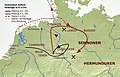
 Germania romana Hedemünden.jpg 951 × 992; 979 KB
-
 Germania romana Wilkenburg.jpg 951 × 992; 978 KB
-
 Germania romana.jpg 951 × 992; 411 KB
-
 Gothic raids in the 3rd century.jpg 5,120 × 3,938; 1.2 MB
-
 Gothic raids in the 3rd century.svg 2,325 × 1,727; 703 KB
-
 Guerre di Pirro in italia (versione in latino corretta).jpg 591 × 465; 194 KB
-
 Gunpowder Empire Map.JPG 1,761 × 1,262; 136 KB
-
 Iberic peninsula c. 156 BC.png 310 × 256; 55 KB
-
 Illyria SPQR.png 1,600 × 1,096; 47 KB
-
 Image-Diaspora synagogues in Antiquity.png 1,770 × 1,062; 631 KB
-
 Immensum-bellum-4-5-uZ.jpg 2,400 × 1,543; 2.03 MB
-
 Imperium Romanum mapa.png 1,000 × 650; 35 KB
-
 Imperium Romanum.png 280 × 200; 11 KB
-
 Indo-Roman trade.jpg 2,499 × 1,413; 967 KB
-
 Inici guerra servil.jpg 800 × 588; 116 KB
-
 Italia Annonaria ca 400 AD.png 690 × 518; 573 KB
-

-
 Localización de las siete iglesias del apocalipsis.jpg 767 × 542; 70 KB
-
 LocationRomanEmpire.png 1,084 × 705; 34 KB
-
 Map Length of Roman Rule Neo Latin Languages 2 edit by Liviojavi.png 2,605 × 2,252; 2.89 MB
-
 Map Length of Roman Rule Neo Latin Languages.jpg 2,605 × 2,252; 1.03 MB
-
 Map of part of Roman Empire in the fourth century (1705).jpg 7,430 × 5,631; 7.85 MB
-
 Map of the Christian world around the mediterranean in the 5th century AD.png 1,117 × 653; 206 KB
-
-
 Map of the Roman Empire in the time of Galen. Wellcome M0000910.jpg 1,583 × 1,070; 641 KB
-
 Map The Roman Empire under Trajan and Adrian- Touring Club Italiano CART-TRC-42.jpg 6,816 × 5,069; 4.02 MB
-
 Mapa Asiria Shamshi-Adad.png 3,771 × 2,552; 10.81 MB
-
 Mapa del Confín del Imperio Romano.gif 1,000 × 715; 53 KB
-
 Mapa guerra de Hispania (416-418).svg 1,165 × 939; 684 KB
-
 Mapa guerra suevo-vándala (419-420).svg 1,165 × 939; 443 KB
-
 Mapa Imperio Paleobabilónico 1750-1595 a.C.png 8,476 × 4,743; 44.32 MB
-
 Mapa Imperio Paleobabilónico Hammurabi (1792-1750 a.C.).png 8,476 × 4,743; 42.76 MB
-
 Mapa Próximo Oriente 1792 a.C.png 8,476 × 4,743; 45.01 MB
-

-
 Monetazione campana III secolo.svg 1,088 × 944; 448 KB
-
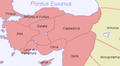
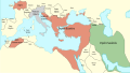
 Near East480ad.jpg 1,402 × 1,023; 226 KB
-
 Noricum Pict 2.JPG 461 × 372; 38 KB
-

-
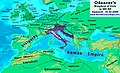 Odoacer 480ad.jpg 900 × 545; 701 KB
-
 Oppida map 1.jpg 1,097 × 743; 379 KB
-
 Planche 4 - Empire Romain - Liv2-ch10.png 4,360 × 3,384; 4.6 MB
-
 Portail rome antique fr.gif 800 × 800; 50 KB
-
 Quan entra cras.gif 491 × 492; 78 KB
-
 Roma Eyaletleri.png 850 × 537; 114 KB
-
 Roma İmparatorluğu.png 542 × 298; 17 KB
-
 Roman Algeria map.png 640 × 425; 22 KB
-
 Roman Empire (orthographic projection).svg 550 × 550; 555 KB
-
 Roman Empire 270.png 1,835 × 990; 352 KB
-
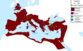
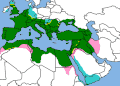
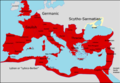
 Roman Empire at its greatest extent.png 1,280 × 713; 67 KB
-
 Roman Empire borders and influence.gif 1,000 × 715; 53 KB
-
 Roman Empire Contestedterritory.PNG 1,022 × 626; 34 KB
-
 Roman Empire full - Referenced.jpg 1,116 × 893; 303 KB
-
 Roman Empire Map-ar.png 1,600 × 1,096; 195 KB
-
 Roman Empire Map-ja.png 800 × 548; 94 KB
-
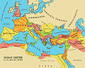
 Roman Empire Map.png 800 × 548; 44 KB
-
 Roman Empire map.svg 2,777 × 2,206; 8.85 MB
-
 Roman Empire map1011.png 765 × 558; 136 KB
-
 Roman Empire Territories.png 800 × 490; 84 KB
-
 Roman HanEmpires1CE.png 2,214 × 959; 39 KB
-
 Roman HanEmpiresAD1.png 2,214 × 959; 25 KB
-
 Roman harbors and fleets Augustus-Severus.png 2,052 × 1,414; 256 KB
-
 Roman history in brief (1903) (14776676201).jpg 2,496 × 2,874; 567 KB
-
 Roman legions destroyed 53 BC - 162 AD.png 1,804 × 1,328; 103 KB
-
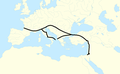
 Roman Mediterranean.jpg 2,187 × 1,542; 1.08 MB
-
 Roman provinces Galatia.png 624 × 499; 194 KB
-
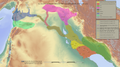
 Roman provinces hebrew.png 1,600 × 1,096; 934 KB
-
 Roman provincial languages .png 800 × 551; 201 KB
-
 Roman provincial languages 150CE-eu.svg 1,280 × 882; 399 KB
-
 Roman-Empire 477ad-es.svg 512 × 287; 36 KB
-
 Roman-Empire 477ad-hu.svg 512 × 287; 37 KB
-
 Roman-Empire 477ad-pt.svg 512 × 287; 28 KB
-
 RomanandHanEmpiresAD1.png 2,214 × 959; 76 KB
-
 Romancoloniae.jpg 647 × 452; 89 KB
-
 RomanEmpire large.jpg 532 × 324; 56 KB
-
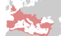 RomanEmpire.png 3,000 × 1,800; 254 KB
-
 RomanEmpireterritoryandtemporaryexpansions.gif 910 × 589; 34 KB
-
 Romanic popular shires.jpg 1,651 × 1,150; 784 KB
-
 RomanPowerAsiaMinor63BCE-es.svg 3,274 × 1,793; 907 KB
-
 Rome476.jpg 750 × 469; 79 KB
-
 Romia Imperio.png 1,600 × 1,096; 52 KB
-
 Rooman-valtakunta.png 800 × 548; 69 KB
-
 RoomanValtakuntaAntoninusPius.png 2,052 × 1,414; 134 KB
-
 Senatorial and Imperial provinces mid 2nd century.png 2,052 × 1,414; 155 KB
-
 Severus210AD.png 734 × 486; 24 KB
-
 Size of Empires.svg 996 × 1,515; 2.57 MB
-
 Sub-Saharan Roman expeditions.png 719 × 599; 180 KB
-
 The cities of the Roman world in the Imperial period.jpg 10,525 × 7,444; 5.88 MB
-
 The Roman Empire ca 400 AD (Danube provinces).png 1,603 × 765; 1.9 MB
-
 The Roman Empire ca 400 AD.png 4,339 × 2,689; 12.8 MB
-
 Tiberio 14 - 37dC jpg.jpg 1,704 × 1,181; 405 KB
-
 Toskanatrakt Salzburg Landkartensaal Römisches Reich.jpg 2,280 × 2,084; 6.26 MB
-
 Vardules Caristes Autrigones.png 2,104 × 1,554; 259 KB
-
 Via domitia map600x600 (1).png 600 × 600; 58 KB
-
 Via Regia und Via Imperii - hsb.png 1,286 × 938; 231 KB
-
 Waluburg map.png 1,881 × 1,680; 3.86 MB
-
 Śródziemne Imperium Rzymskie.png 448 × 330; 46 KB
-
 Галльські війни.png 1,280 × 1,514; 1.37 MB
-
 Ժողովուրդների Մեծ գաղթ.png 1,545 × 773; 233 KB
-
 الإمبراطورية البيزنطية في 1100.png 6,096 × 3,552; 274 KB
_pour_servir_%C3%A0_l%27histoire_de_la_marine_des_Romains._1884.jpg)

)%27_(11015394196).jpg)
_(14595672559).jpg)
_(14595711009).jpg)
_(14779981734).jpg)


_(14585035837).jpg)


.jpg)


.jpg)


.svg)
.svg)

.png)

_(14596770967).jpg)


.jpg)


.svg)


_(14776676201).jpg)


.png)


.png)


