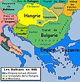
Category:Maps of the Byzantine Empire in the 10th century
Appearance
English: This category is about history maps on the subject. Contemporary, old maps belong into: Category:Old maps of the Byzantine Empire and its subcategories.
Maps of the Byzantine Empire: (BCE) (CE) 4th century · 5th century · 6th century · 7th century · 8th century · 9th century · 10th century · 11th century · 12th century · 13th century · 14th century · 15th century ·
Media in category "Maps of the Byzantine Empire in the 10th century"
The following 24 files are in this category, out of 24 total.
-
C. 911 Constantinople Patriarchate.jpg 1,949 × 1,190; 619 KB
-
C. 950 Eastern Roman Empire in Europe.jpg 3,000 × 4,000; 2.56 MB
-
C. 950 Eastern Roman Empire in Western Asia.jpg 3,000 × 4,000; 3.04 MB
-
87EarlyBagratid884-962-es.svg 2,938 × 1,873; 1.67 MB
-
87EarlyBagratid884-962-pt.svg 512 × 330; 69 KB
-
87EarlyBagratid884-962-ru.svg 2,938 × 1,873; 403 KB
-
87EarlyBagratid884-962.gif 700 × 457; 62 KB
-
Historical atlas of modern Europe 1903 (135895458).jpg 7,089 × 9,162; 57.47 MB
-
Historical atlas of modern Europe 1903 (135895460).jpg 7,099 × 9,170; 61.31 MB
-
AtlBalk965.jpg 318 × 327; 174 KB
-
Balkans 900.png 1,140 × 793; 237 KB
-
Balkans 925AD-es.svg 1,403 × 1,420; 1.12 MB
-
Balkans 960s.JPG 551 × 386; 30 KB
-
Bulgaria Samuil (997-1014) es fr.svg 728 × 594; 208 KB
-
Bulgaria Samuil (997-1014) es.svg 728 × 594; 185 KB
-
Bulgaria Samuil (997-1014) pt.svg 728 × 594; 185 KB
-
Bulgaria Samuil (997-1014) zh.svg 728 × 594; 183 KB
-
Byzantium's Balkan frontier in the 10-12th century.png 959 × 1,060; 1.04 MB
-
Byzantium975.jpg 572 × 368; 35 KB
-
Modern history; Europe (1904) (14762570541).jpg 3,104 × 1,800; 1.68 MB
-
Samuels Macedonian Kingdom.jpg 1,375 × 1,264; 1.83 MB
-
Spruner-Menke Handatlas 1880 Karte 79.jpg 3,537 × 2,963; 1.21 MB
-
النشاط البحري للمسلمين 750 - 960.jpg 1,311 × 965; 542 KB


