Category:Maps of regions of Croatia
Jump to navigation
Jump to search
Subcategories
This category has the following 6 subcategories, out of 6 total.
B
D
I
M
S
Media in category "Maps of regions of Croatia"
The following 64 files are in this category, out of 64 total.
-
Banovina location map.svg 159 × 115; 397 KB
-
Bay-of-Piran maritime-boundary-dispute.jpg 709 × 600; 160 KB
-
BorderDispute BayOfPiran blank.png 800 × 742; 601 KB
-
Central Croatia.svg 1,098 × 1,063; 475 KB
-
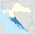
Central Croatian Adriatic.png 773 × 736; 183 KB
-
Croatia (Balkan and Central Europe).png 1,000 × 1,000; 324 KB
-
Croatia - overview.PNG 815 × 553; 47 KB
-
Croatia Iž area map.png 596 × 596; 35 KB
-
Croatia location map Baranja Drava.svg 146 × 96; 407 KB
-
Croatia location map Novska-Virovitica-Orahovica.svg 375 × 426; 422 KB
-
Croatia location map Osijek-Zupanja-Ilok.svg 408 × 296; 421 KB
-
Croatia location map Pula-Rijeka-Sibenik.svg 355 × 409; 324 KB
-
Croatia location map Split-Dalmatia co with inset.svg 850 × 638; 778 KB
-
Croatia Macroregions.svg 1,098 × 1,063; 798 KB
-
Croatia proper.svg 1,098 × 1,063; 773 KB
-
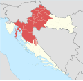
Croatia-central.png 1,288 × 1,231; 32 KB
-
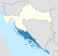
Croatia-Dalmatia.png 1,326 × 1,271; 78 KB
-
Croatia-Istria.png 1,288 × 1,231; 65 KB
-
Croatia-Lika.png 200 × 198; 35 KB
-
Croatia-Serbia Border Map.png 2,514 × 2,548; 1.25 MB
-
Croatia-Slavonia.png 1,288 × 1,231; 28 KB
-
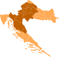
Croatia-Slavonija.png 200 × 198; 14 KB
-
Croatian Littoral.svg 512 × 496; 260 KB
-
Croislands ru.png 2,258 × 1,567; 415 KB
-
Dalmatia (Counties).svg 1,098 × 1,063; 791 KB
-
Dalmatia (Kingdom).svg 1,098 × 1,063; 799 KB
-
Dalmatia (Kotor).svg 1,098 × 1,063; 800 KB
-
Dalmatia (Various).svg 1,098 × 1,063; 800 KB
-
Dalmatia Croatia Slavonia Bosnia 1720 Matthaeus Seuteri.png 2,230 × 1,944; 150 KB
-
Dalmatia.svg 1,098 × 1,063; 757 KB
-
Dubrovnik region.jpg 4,948 × 4,792; 2.11 MB
-
Dugi Otok map.png 876 × 892; 183 KB
-
Eastern Croatia map.png 1,880 × 2,353; 1.14 MB
-
Gorski Kotar.svg 1,097 × 1,062; 293 KB
-
Grenzstreit-Bucht-von-Piran.jpg 800 × 742; 181 KB
-
Hrvatsko Podunavlje - Croatian Danube Region.png 670 × 765; 313 KB
-
Joint Council of Municipalities.jpg 786 × 570; 35 KB
-
Kvarner gulf map.png 401 × 584; 208 KB
-
Lika region map-sr.png 730 × 800; 34 KB
-
Lika region map.png 730 × 800; 35 KB
-
Map of Lika Northern Dalmatia and Western Bosnia.png 834 × 565; 521 KB
-
Mountainous Croatia.svg 1,098 × 1,063; 421 KB
-
North croatia.svg 1,097 × 1,062; 403 KB
-
Northern Croatian Littoral.svg 512 × 495; 267 KB
-
NUTS of Croatia (2013).png 1,288 × 1,231; 61 KB
-
Peljesac en Neum.png 483 × 237; 17 KB
-
Pelješac-561.jpg 256 × 256; 18 KB
-
Pozega Valley location map.svg 1,098 × 1,063; 402 KB
-
Slavonia topo map OSM.png 1,188 × 781; 635 KB
-
Slavonia.svg 1,098 × 1,063; 798 KB
-
Slovensko-hrvaška meja pri Metliki.svg 943 × 950; 85 KB
-
Spizza. NYPL1227037.tiff 4,553 × 3,379; 44.03 MB
-
Syrmia hu.png 1,226 × 750; 163 KB
-
Syrmia.png 1,082 × 662; 58 KB
-
Sremregionsr.png 1,082 × 662; 53 KB
-
Срем.png 1,082 × 662; 54 KB
-
Srem-region-mapa01.png 1,566 × 931; 61 KB
-
Srem-region-mapa02.png 1,566 × 931; 115 KB
-
Srem-region-mapa03.png 1,566 × 931; 64 KB
-
Srem-region-mapa04.png 1,566 × 931; 54 KB
-
Topographic Map of Zmajan-sr.svg 1,365 × 1,140; 580 KB
-
Western Croatia.png 1,066 × 1,096; 385 KB
-
ZVO on map of Croatia.png 1,633 × 997; 223 KB


