Category:Maps of regions of Belgium
Jump to navigation
Jump to search
Subcategories
This category has the following 4 subcategories, out of 4 total.
B
F
W
Media in category "Maps of regions of Belgium"
The following 28 files are in this category, out of 28 total.
-
Administrative regions of Belgium.svg 425 × 354; 188 KB
-
Agglomeratie Brussel.png 926 × 756; 83 KB
-
Belgia regioner og provinser.png 1,200 × 1,011; 186 KB
-
Belgia regioner og provinser.svg 921 × 744; 134 KB
-
Belgien Wahlkreise Senat.png 1,292 × 1,068; 99 KB
-
Belgien Wahlkreise.png 961 × 794; 90 KB
-
Belgio.svg 398 × 337; 26 KB
-
Belgique régionale.png 400 × 337; 47 KB
-
Belgische gewesten en gemeenschappen.png 712 × 600; 90 KB
-
Belgium Gewesten Empty.png 270 × 270; 4 KB
-
Belgium Gewesten Empty.svg 307 × 251; 68 KB
-
Belgium RegProv hu.svg 400 × 337; 231 KB
-
Belgium RegProv.bg.png 400 × 337; 17 KB
-
Belgium RegProv.png 400 × 337; 14 KB
-
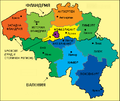
Belgium ukr.png 1,000 × 824; 161 KB
-
Belgium.geohive.png 620 × 531; 48 KB
-
Benelux államok.png 460 × 643; 28 KB
-
Brussels-Capital Region in Belgium and Europe.svg 680 × 520; 2.36 MB
-
Carte des provinces belges.svg 921 × 744; 24 KB
-
Flanders and Wallonia.png 1,004 × 826; 38 KB
-
Flemish Region in Belgium and Europe.svg 680 × 520; 2.36 MB
-
Gewestenkaart.png 270 × 270; 2 KB
-
Gewestenkaart.svg 307 × 251; 68 KB
-
Map of Belgium regions.png 399 × 335; 6 KB
-
Provinces de Belgique sans noms.svg 425 × 354; 35 KB
-
Regions of Belgium location.svg 1,136 × 945; 133 KB
-
Regions of Belgium.svg 307 × 251; 68 KB
-
Walloon Region in Belgium and Europe.svg 680 × 520; 2.36 MB


