Category:Maps of Dalmatia
Jump to navigation
Jump to search
Wikimedia category | |||||
| Upload media | |||||
| Instance of | |||||
|---|---|---|---|---|---|
| Category combines topics | |||||
| Dalmatia | |||||
Croatian region | |||||
| Instance of | |||||
| Location |
| ||||
| Population |
| ||||
| Area |
| ||||
| Different from | |||||
 | |||||
Subcategories
This category has the following 4 subcategories, out of 4 total.
M
O
Media in category "Maps of Dalmatia"
The following 56 files are in this category, out of 56 total.
-
Autriche-Hongrie 1914 littoral.png 3,507 × 2,480; 3.54 MB
-
BV043564124.tif 6,468 × 5,371; 79.01 MB
-
BV043564145.tif 6,477 × 4,476; 79.16 MB
-
BV043564299.tif 6,477 × 4,476; 58.53 MB
-
Central Croatian Adriatic.png 773 × 736; 183 KB
-
Colonies grecques Adriatique.png 550 × 605; 396 KB
-
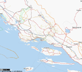
Croatia location map Sibenik.svg 184 × 148; 400 KB
-
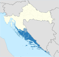
Croatia Panhandle.svg 8 × 6; 6 KB
-
Croatia-Dalmatia.png 1,326 × 1,271; 78 KB
-
D119- Carte des abords de la côte dalmate. - L1-Ch2.png 1,526 × 2,176; 644 KB
-
Dalmatia (Counties).svg 1,098 × 1,063; 791 KB
-
Dalmatia (Kingdom).svg 1,098 × 1,063; 799 KB
-
Dalmatia (Kotor).svg 1,098 × 1,063; 800 KB
-
Dalmatia (Various).svg 1,098 × 1,063; 800 KB
-
Dalmatia ethnic2001.png 1,096 × 982; 53 KB
-
Dalmatia location map.svg 1,097 × 1,062; 553 KB
-
Dalmatia map municipalities.png 2,201 × 2,151; 177 KB
-
Dalmatia-1953-Croats.png 2,434 × 2,055; 66 KB
-
Dalmatia-1953-Ethnic.png 2,434 × 2,055; 64 KB
-
Dalmatia-1953-Serbs.png 2,434 × 2,055; 64 KB
-
Dalmatia.png 1,537 × 1,200; 105 KB
-
Dalmatia.svg 1,098 × 1,063; 757 KB
-
Dalmatinska zagora.jpg 795 × 702; 181 KB
-
Dalmatinske krajine.svg 1,239 × 1,172; 574 KB
-
Dalmazia centrale it.png 672 × 588; 158 KB
-
Dalmazia settentrionale it.png 617 × 679; 319 KB
-
Dalmazia sud.png 734 × 410; 190 KB
-
Dalmazia toponomastica italiana.png 4,000 × 4,000; 2.74 MB
-
Dalmazia.jpg 2,000 × 1,455; 1.48 MB
-
Dalmazia.png 775 × 517; 65 KB
-
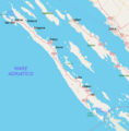
Dugi Otok map.png 876 × 892; 183 KB
-
Flag map of the Italian governate of Dalmatia (1941-1943).svg 2,265 × 1,894; 260 KB
-
Flag map of the Kingdom of Dalmatia.svg 704 × 601; 32 KB
-
Flag map of the Province of Zara.svg 822 × 845; 223 KB
-
Italia - di Matteo Greuter... - btv1b525056959 (05 of 24).jpg 10,294 × 7,734; 10.09 MB
-
Karta 00.png 330 × 330; 16 KB
-
Peljesac proposed bridge marked in red hr.svg 483 × 237; 41 KB
-
Peljesac proposed bridge marked in red sr.svg 483 × 237; 94 KB
-
Peljesac proposed bridge marked in red.svg 483 × 237; 93 KB
-
Pelješac bridge location map.svg 1,097 × 673; 810 KB
-
Serbs in Dalmatia.jpg 1,588 × 1,100; 149 KB
-
Southern Croatian Adriatic Solta.jpg 1,049 × 794; 462 KB
-
Southern Croatian Adriatic-SG.png 955 × 699; 162 KB
-
Southern Croatian Adriatic.png 1,049 × 876; 198 KB
-
Southern Croatian AdriaticBrac.jpg 1,049 × 794; 277 KB
-
Southern Croatian AdriaticLastovo.jpg 1,049 × 794; 278 KB
-
Southern Croatian AdriaticMljet.jpg 1,049 × 794; 280 KB
-
Spalato - 34-44.jpg 3,619 × 4,949; 4.96 MB
-
Spalatum - Salona.jpg 3,609 × 2,639; 7.87 MB
-
Tropolje Dalmatia Bosnia Adriatic Sea.png 1,734 × 1,574; 284 KB
-
Tropolje Fields Dalmatia Adriatic Sea.png 1,734 × 1,574; 360 KB
-
Vicinity-of-Prevlaka-in-Croatia-and-Montenegro hu.png 1,648 × 1,269; 626 KB
-
Vicinity-of-Prevlaka-in-Croatia-and-Montenegro.PNG 1,236 × 952; 80 KB
-
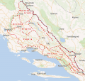
Vine-Region of Dingac, Postup and Grk1.jpg 483 × 237; 115 KB
-
Zagora - region in Dalmatian Hinterland, Croatia.svg 1,485 × 1,284; 933 KB
-
Далматинские острова.png 1,709 × 1,537; 168 KB
