Category:Maps of Istria
Jump to navigation
Jump to search
Slovenščina: Zemljevidi Istre.
Wikimedia category | |||||
| Upload media | |||||
| Instance of | |||||
|---|---|---|---|---|---|
| Category combines topics | |||||
| Istria | |||||
peninsula on the Adriatic Sea | |||||
| Instance of | |||||
| Location | Istria County, Croatia | ||||
| Located in or next to body of water | |||||
 | |||||
Subcategories
This category has the following 5 subcategories, out of 5 total.
Media in category "Maps of Istria"
The following 77 files are in this category, out of 77 total.
-
Albona Republic map.png 1,122 × 1,180; 89 KB
-
AvI Innerkrain oder der Adelsberger Kreis.jpg 12,022 × 10,236; 40.46 MB
-
Budava-pregled.png 623 × 1,151; 148 KB
-
CI-UI Slovenia e Croazia.png 4,438 × 3,132; 1.63 MB
-
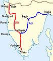
Collegamenti Istria.jpg 378 × 432; 38 KB
-
Croatia-Istria.png 1,288 × 1,231; 65 KB
-
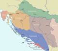
Dalmatia Croatia Slavonia Bosnia 1720 Matthaeus Seuteri.png 2,230 × 1,944; 150 KB
-
Economic map of Histria Romana (10435846834).jpg 2,888 × 3,575; 7.54 MB
-
Empire d'Autriche 1914 Istrie.png 3,507 × 2,480; 3.67 MB
-
Flag map of Istria (Peninsula).svg 612 × 884; 271 KB
-
Flag map of Istria County.svg 700 × 1,000; 61 KB
-
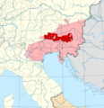
Great carantania.jpg 400 × 347; 34 KB
-
Innerkrain oder der Adelsberger Kreis 1795.jpg 9,996 × 7,813; 12.77 MB
-
Istarski ipsilon.jpg 378 × 432; 62 KB
-
Istra - blank.jpg 599 × 403; 222 KB
-
Istria Croatian Adriatic.png 596 × 559; 84 KB
-
Istria in Croatia.svg 1,098 × 1,063; 788 KB
-
Istria italiani 2001.png 581 × 556; 45 KB
-
Istria northeast.png 599 × 403; 208 KB
-
Istria-Croats-1961.gif 640 × 786; 78 KB
-
Istria-Croats-1971.gif 640 × 786; 79 KB
-
Istria-Croats-1981.gif 640 × 786; 84 KB
-
Istria-Croats-1991.gif 640 × 786; 95 KB
-
Istria-Croats-2001.gif 640 × 786; 92 KB
-
Istria-Ethnic-1961.gif 640 × 786; 91 KB
-
Istria-Ethnic-1971.gif 640 × 786; 92 KB
-
Istria-Ethnic-1981.gif 640 × 786; 83 KB
-
Istria-Ethnic-1991.gif 640 × 786; 90 KB
-
Istria-Ethnic-2001.gif 640 × 786; 88 KB
-
Istria-Istrians-1991.gif 640 × 786; 99 KB
-
Istria-Italians-1991.gif 640 × 786; 97 KB
-
Istria-mapBrijuni.jpg 599 × 403; 161 KB
-
Istria-Muslims-1991.gif 640 × 786; 81 KB
-
Istria-Serbs-1961.gif 640 × 786; 86 KB
-
Istria-Serbs-1971.gif 640 × 786; 85 KB
-
Istria-Serbs-1981.gif 640 × 786; 89 KB
-
Istria-Serbs-1991.gif 640 × 786; 89 KB
-
Istria-Slovenians-1961.gif 640 × 786; 89 KB
-
Istria-Slovenians-1971.gif 640 × 786; 90 KB
-
Istria-Slovenians-1981.gif 640 × 786; 89 KB
-
Istria-Slovenians-1991.gif 640 × 786; 90 KB
-
Istria-Yugoslavs-1981.gif 640 × 786; 100 KB
-
Istria.png 599 × 403; 193 KB
-
Istriacollegamenti.png 596 × 559; 86 KB
-
Istriait.jpg 4,840 × 3,256; 1.72 MB
-
Istrien-Atlas Andrees.png 586 × 450; 757 KB
-
Istriot Language distribution.png 2,000 × 3,278; 430 KB
-
Istro-Romanian villages.png 2,902 × 3,138; 166 KB
-
Italians in Istria 2001.png 335 × 407; 19 KB
-
Karte Istrien de.png 1,600 × 1,681; 3.25 MB
-
Karte Istrien en.png 1,600 × 1,681; 3.25 MB
-
Korutánske vojvodstvo.png 4,091 × 4,216; 3.92 MB
-
Limska draga - pregled.png 1,232 × 910; 317 KB
-
Litorale Austriaco su Opentopomap.jpg 4,960 × 7,015; 6.34 MB
-
Location of Mirna bridge, Croatia.jpg 378 × 432; 66 KB
-
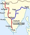
Location of the Limska draga Bridge, Croatia.jpg 378 × 432; 68 KB
-
Location of Učka tunnel, Croatia.jpg 378 × 432; 64 KB
-
Map Istrian Dialects Cakavian Brozovic.svg 610 × 750; 39 KB
-
Map of Dialects in Istria Yat.svg 610 × 750; 45 KB
-
Map of Labinština.png 592 × 565; 111 KB
-
Mappa R.D. 23 novembre 1936, n. 2177.png 1,024 × 1,315; 168 KB
-
Istria census 1910.PNG 780 × 961; 97 KB
-
Istrien Donaumonarchie.png 674 × 510; 7 KB
-
Istrien Gerichtsbezirke.png 748 × 995; 177 KB
-
Kuestenland 1914 1.JPG 254 × 362; 15 KB
-
Motovun~Karte.png 465 × 446; 59 KB
-
Noricum Pict 2.JPG 461 × 372; 38 KB
-
Istria map.svg 1,098 × 1,063; 794 KB
-
Italian province of Pola.JPG 764 × 904; 64 KB
-
Provincia di Pola (1923-1945).png 2,222 × 3,198; 760 KB
-
Regjons Istorichis FUR.jpg 2,044 × 1,417; 365 KB
-
Settlements in the Town of Labin.jpg 1,242 × 1,205; 183 KB
-
Učka Nature park - panoramio.jpg 2,000 × 1,419; 546 KB
-
VENEZIA GIULIA 1924 - 1943.JPG 341 × 599; 26 KB
-
VENEZIA GIULIA 1924.JPG 866 × 599; 32 KB
-
Veľká Karantánia.jpg 1,070 × 730; 544 KB
-
Vgiulia.PNG 826 × 1,169; 1.62 MB


