Category:Maps of regions of England
Jump to navigation
Jump to search
Subcategories
This category has the following 12 subcategories, out of 12 total.
Pages in category "Maps of regions of England"
This category contains only the following page.
Media in category "Maps of regions of England"
The following 117 files are in this category, out of 117 total.
-
BlankMap-EnglandRegions-He.png 2,140 × 2,645; 119 KB
-
BlankMap-EnglandRegions.png 2,140 × 2,645; 58 KB
-
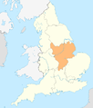
East England in England.png 814 × 953; 107 KB
-
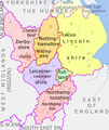
East Midlands counties 00.png 1,723 × 2,047; 295 KB
-
East Midlands in England.png 814 × 953; 107 KB
-
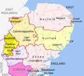
East of England Counties.png 1,593 × 1,440; 1.06 MB
-
ENG-East-bedford.png 360 × 400; 50 KB
-
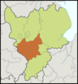
ENG-East-cambridge.png 360 × 400; 50 KB
-
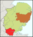
ENG-East-essex.png 360 × 400; 50 KB
-
ENG-East-hertford.png 360 × 400; 50 KB
-
ENG-East-norfolk.png 360 × 400; 50 KB
-
ENG-East-suffolk.png 360 × 400; 50 KB
-
ENG-em-derbys.png 350 × 380; 53 KB
-
ENG-em-leicester.png 350 × 380; 53 KB
-
ENG-em-lincolns.png 350 × 380; 53 KB
-
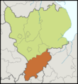
ENG-em-northamp.png 350 × 380; 53 KB
-
ENG-em-notting.png 350 × 380; 53 KB
-
ENG-em-rutland.png 350 × 380; 53 KB
-
ENG-ne-cdurham.png 270 × 330; 20 KB
-
ENG-ne-clevel.png 270 × 330; 20 KB
-
ENG-ne-northumber.png 270 × 330; 20 KB
-
ENG-ne-tynewear.png 270 × 330; 20 KB
-
ENG-nw-cheshire.png 270 × 500; 40 KB
-
ENG-nw-cumbria.png 270 × 500; 40 KB
-
ENG-nw-gmanch.png 270 × 500; 40 KB
-
ENG-nw-lancas.png 270 × 500; 40 KB
-
ENG-nw-mersey.png 270 × 500; 40 KB
-
ENG-regions.png 1,110 × 1,340; 290 KB
-
ENG-se-berks.png 480 × 400; 67 KB
-
ENG-se-buckingh.png 480 × 400; 67 KB
-
ENG-se-esuss.png 480 × 400; 67 KB
-
ENG-se-hamps.png 480 × 400; 67 KB
-
ENG-se-kent.png 480 × 400; 67 KB
-
ENG-se-oxford.png 480 × 400; 67 KB
-
ENG-se-surrey.png 480 × 400; 67 KB
-
ENG-se-wight.png 480 × 400; 67 KB
-
ENG-se-wsuss.png 480 × 400; 67 KB
-
ENG-southwest.png 700 × 500; 67 KB
-
ENG-sw-cornw.png 700 × 500; 54 KB
-
ENG-sw-devon.png 700 × 500; 54 KB
-
ENG-sw-dorset.png 700 × 500; 54 KB
-
ENG-sw-gloucest.png 700 × 500; 54 KB
-
ENG-sw-somerset.png 700 × 500; 55 KB
-
ENG-sw-wiltsh.png 700 × 500; 54 KB
-
ENG-wm-herefords.png 330 × 330; 39 KB
-
ENG-wm-shrops.png 330 × 330; 39 KB
-
ENG-wm-staffords.png 330 × 330; 39 KB
-
ENG-wm-warwicks.png 330 × 330; 40 KB
-
ENG-wm-wmidlc.png 330 × 330; 40 KB
-
ENG-wm-worcesters.png 330 × 330; 40 KB
-
ENG-yh-nelincs.png 375 × 300; 35 KB
-
ENG-yh-nyorks.png 375 × 300; 35 KB
-
ENG-yh-syorks.png 375 × 300; 35 KB
-
ENG-yh-wyorks.png 375 × 300; 35 KB
-
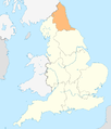
England locator map with North East England highlighted.svg 816 × 991; 469 KB
-
England Region - East England.svg 525 × 650; 83 KB
-
England Region - East Midlands.svg 525 × 650; 83 KB
-
England Region - London.svg 525 × 650; 83 KB
-
England Region - North East.svg 525 × 650; 83 KB
-
England Region - North West.svg 525 × 650; 83 KB
-
England Region - South East.svg 525 × 650; 83 KB
-
England Region - South West.svg 525 × 650; 83 KB
-
England Region - West Midlands.svg 525 × 650; 83 KB
-
England Region - Yorkshire and Humber.svg 525 × 650; 83 KB
-
England Regionen.png 200 × 247; 16 KB
-
England Regions - Blank.svg 525 × 650; 83 KB
-
England Regions - Labelled.svg 525 × 650; 89 KB
-
England Regions - Numbered.svg 525 × 650; 90 KB
-
England Regions within UK - fr.svg 690 × 982; 148 KB
-
England Regions within UK.svg 690 × 982; 187 KB
-
EnglandEastEngland.png 200 × 247; 15 KB
-
EnglandEastMidlands.png 200 × 247; 15 KB
-
EnglandGovernmentMidlands.png 2,165 × 2,670; 100 KB
-
EnglandLondon.png 200 × 247; 12 KB
-
EnglandNorthEast.png 200 × 247; 15 KB
-
EnglandNorthWest.png 200 × 247; 15 KB
-
EnglandRegions.png 200 × 247; 16 KB
-
EnglandSouthEast.png 200 × 247; 11 KB
-
EnglandSouthWest.png 200 × 247; 6 KB
-
EnglandSouthWestRegion2004.png 200 × 247; 12 KB
-
EnglandStandStatRegionsNumbered.png 200 × 247; 17 KB
-
EnglandWestMidlands.png 200 × 247; 15 KB
-
EnglandYorkshireHumber.png 200 × 247; 15 KB
-
English regions 2009 (named).svg 1,108 × 1,345; 379 KB
-
English regions 2009 (numbered).svg 1,108 × 1,345; 373 KB
-
English regions 2009.svg 1,108 × 1,345; 365 KB
-
English regions and counties by type 2009.svg 1,108 × 1,345; 483 KB
-
English regions and counties by type 2019.jpg 4,617 × 5,604; 827 KB
-
English regions and counties by type 2021.jpg 4,617 × 5,604; 1.46 MB
-
English regions and counties coloured by type map 2019.svg 1,108 × 1,345; 476 KB
-
English regions and counties coloured by type map 2020.svg 1,108 × 1,345; 476 KB
-
English regions and counties coloured by type map 2021.svg 1,039 × 1,261; 460 KB
-
English regions and counties coloured by type map 2023.svg 1,108 × 1,345; 482 KB
-
Greater London in England.png 814 × 953; 107 KB
-
Map of south-west England shown within England (Met Office region).png 2,400 × 2,736; 152 KB
-
Map of south-west England shown within England (Met Office region).svg 2,400 × 2,736; 70 KB
-
Midlands counties.png 1,032 × 920; 164 KB
-
North East England counties 2.2.png 842 × 1,100; 70 KB
-
North East England in England.png 814 × 953; 107 KB
-
North West England counties.png 1,341 × 2,685; 306 KB
-
North West England in England.png 814 × 953; 107 KB
-
NUTS 1 statistical regions of England map.svg 1,108 × 1,345; 373 KB
-
Regions of England - labelled.png 1,230 × 1,484; 387 KB
-
Regions of England.JPG 383 × 468; 19 KB
-
Regions of England.png 814 × 953; 107 KB
-
SEEngland.png 200 × 247; 15 KB
-
South East England counties.png 2,554 × 2,000; 428 KB
-
South East England in England.png 814 × 953; 130 KB
-
South West England by Anonymous101.svg 512 × 632; 9 KB
-
South West England counties.png 1,281 × 936; 258 KB
-
South West England in England.png 814 × 953; 107 KB
-
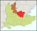
South-east of England.png 573 × 421; 227 KB
-
Tri region in south east corner of England.jpg 357 × 405; 35 KB
-
West Midlands counties.png 1,160 × 1,306; 166 KB
-
West Midlands in England.png 814 × 953; 107 KB
-
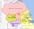
Yorkshire & The Humber counties.png 1,104 × 940; 169 KB
-
Yorkshire and the Humber in England.png 814 × 953; 107 KB


