Category:Maps of municipalities of the canton of St. Gallen
Jump to navigation
Jump to search
Cantons of Switzerland: Aargau (AG) · Appenzell Ausserrhoden (AR) · Appenzell Innerrhoden (AI) · Basel-Stadt (BS) · Basel-Landschaft (BL) · Bern (BE) · Fribourg (FR) · Geneva (GE) · Glarus (GL) · Jura (JU) · Luzern (LU) · Neuchâtel (NE) · Nidwalden (NW) · Obwalden (OW) · Schaffhausen (SH) · Schwyz (SZ) · Solothurn (SO) · Thurgau (TG) · Ticino (TI) · Uri (UR) · Valais (VS) · Vaud (VD) · Zug (ZG) · Zürich (ZH)
Subcategories
This category has the following 18 subcategories, out of 18 total.
2
O
R
S
T
W
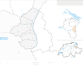
Media in category "Maps of municipalities of the canton of St. Gallen"
The following 16 files are in this category, out of 16 total.
-
 Karte Wahlkreis Rheintal 2007 blank.png 2,066 × 1,710; 636 KB
-
 Karte Wahlkreis Rheintal 2007.png 2,066 × 1,710; 821 KB
-
 Karte Wahlkreis Rorschach 2007 blank.png 2,066 × 1,359; 448 KB
-
 Karte Wahlkreis Rorschach 2007.png 2,066 × 1,359; 585 KB
-
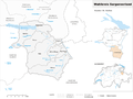
 Karte Wahlkreis Sarganserland 2007 blank.png 2,066 × 1,548; 543 KB
-
 Karte Wahlkreis Sarganserland 2007.png 2,066 × 1,548; 719 KB
-
 Karte Wahlkreis See-Gaster 2013 blank.png 2,066 × 1,263; 444 KB
-
 Karte Wahlkreis See-Gaster 2013.png 2,066 × 1,263; 580 KB
-
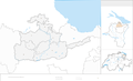 Karte Wahlkreis St. Gallen 2007 blank.png 2,066 × 1,250; 370 KB
-
 Karte Wahlkreis St. Gallen 2007.png 1,476 × 893; 321 KB
-
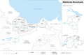
 Karte Wahlkreis Toggenburg 2023 blank.png 2,066 × 1,494; 463 KB
-
 Karte Wahlkreis Toggenburg 2023.png 2,066 × 1,494; 596 KB
-
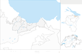
 Karte Wahlkreis Werdenberg 2007 blank.png 2,066 × 1,632; 528 KB
-
 Karte Wahlkreis Werdenberg 2007.png 2,066 × 1,632; 714 KB
-
 Karte Wahlkreis Wil 2013 blank.png 2,066 × 1,343; 490 KB
-
 Karte Wahlkreis Wil 2013.png 2,066 × 1,343; 621 KB


