Category:Maps of municipalities in the district of Wil
Jump to navigation
Jump to search
Subcategories
This category has the following 2 subcategories, out of 2 total.
Media in category "Maps of municipalities in the district of Wil"
The following 11 files are in this category, out of 11 total.
-
 Karte Gemeinden des Wahlkreis Wil 2013.png 1,476 × 1,186; 438 KB
-
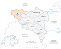
 Karte Gemeinde Degersheim 2013.png 1,476 × 1,186; 439 KB
-
 Karte Gemeinde Flawil 2013.png 1,476 × 1,186; 439 KB
-
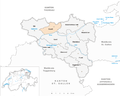
 Karte Gemeinde Jonschwil 2013.png 1,476 × 1,186; 440 KB
-
 Karte Gemeinde Niederbüren 2013.png 1,476 × 1,186; 440 KB
-
 Karte Gemeinde Niederhelfenschwil 2013.png 1,476 × 1,186; 440 KB
-
 Karte Gemeinde Oberbüren 2013.png 1,476 × 1,186; 440 KB
-
 Karte Gemeinde Oberuzwil 2013.png 1,476 × 1,186; 440 KB
-
 Karte Gemeinde Uzwil 2013.png 1,476 × 1,186; 440 KB
-
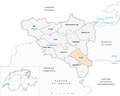
 Karte Gemeinde Wil SG 2013.png 1,476 × 1,186; 440 KB
-
 Karte Gemeinde Zuzwil SG 2013.png 1,476 × 1,186; 439 KB


