Category:Maps of municipalities of the canton of St. Gallen old
Jump to navigation
Jump to search
Media in category "Maps of municipalities of the canton of St. Gallen old"
The following 8 files are in this category, out of 8 total.
-
 Karte Gemeinden des Wahlkreis Rheintal.png 767 × 898; 150 KB
-
 Karte Gemeinden des Wahlkreis Rorschach.png 1,181 × 708; 162 KB
-
 Karte Gemeinden des Wahlkreis Sarganserland.png 944 × 895; 179 KB
-
 Karte Gemeinden des Wahlkreis See-Gaster.png 1,181 × 834; 187 KB
-
 Karte Gemeinden des Wahlkreis St. Gallen.png 1,181 × 794; 194 KB
-
 Karte Gemeinden des Wahlkreis Toggenburg.png 1,003 × 917; 217 KB
-
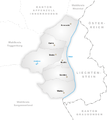 Karte Gemeinden des Wahlkreis Werdenberg.png 767 × 862; 123 KB
-
 Karte Gemeinden des Wahlkreis Wil.png 1,062 × 853; 170 KB


