Category:Maps of municipalities in the canton of Neuchâtel
Jump to navigation
Jump to search
Cantons of Switzerland: Aargau (AG) · Appenzell Ausserrhoden (AR) · Appenzell Innerrhoden (AI) · Basel-Stadt (BS) · Basel-Landschaft (BL) · Bern (BE) · Fribourg (FR) · Geneva (GE) · Glarus (GL) · Jura (JU) · Luzern (LU) · Neuchâtel (NE) · Nidwalden (NW) · Obwalden (OW) · Schaffhausen (SH) · Schwyz (SZ) · Solothurn (SO) · Thurgau (TG) · Ticino (TI) · Uri (UR) · Valais (VS) · Vaud (VD) · Zug (ZG) · Zürich (ZH)
Subcategories
This category has the following 14 subcategories, out of 14 total.
2
L
Media in category "Maps of municipalities in the canton of Neuchâtel"
The following 29 files are in this category, out of 29 total.
-
 Karte Gemeinden des Kanton Neuenburg 2022.png 1,476 × 1,019; 361 KB
-
 Karte Gemeinde Boudry 2022.png 1,476 × 1,019; 362 KB
-
 Karte Gemeinde Brot-Plamboz 2022.png 1,476 × 1,019; 362 KB
-
 Karte Gemeinde Cornaux 2022.png 1,476 × 1,019; 362 KB
-
 Karte Gemeinde Cortaillod 2022.png 1,476 × 1,019; 362 KB
-
 Karte Gemeinde Cressier NE 2022.png 1,476 × 1,019; 362 KB
-
 Karte Gemeinde Enges 2022.png 1,476 × 1,019; 362 KB
-
 Karte Gemeinde Hauterive NE 2022.png 1,476 × 1,019; 362 KB
-
 Karte Gemeinde La Brévine 2022.png 1,476 × 1,019; 362 KB
-
 Karte Gemeinde La Chaux-de-Fonds 2022.png 1,476 × 1,019; 362 KB
-
 Karte Gemeinde La Chaux-du-Milieu 2022.png 1,476 × 1,019; 362 KB
-
 Karte Gemeinde La Côte-aux-Fées 2022.png 1,476 × 1,019; 362 KB
-
 Karte Gemeinde La Grande-Béroche 2022.png 1,476 × 1,019; 362 KB
-
 Karte Gemeinde La Sagne 2022.png 1,476 × 1,019; 362 KB
-
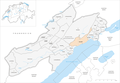
 Karte Gemeinde La Tène 2022.png 1,476 × 1,019; 362 KB
-
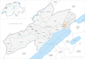
 Karte Gemeinde Laténa 2025.png 1,476 × 1,019; 368 KB
-
 Karte Gemeinde Le Cerneux-Péquignot 2022.png 1,476 × 1,019; 362 KB
-
 Karte Gemeinde Le Landeron 2022.png 1,476 × 1,019; 362 KB
-
 Karte Gemeinde Le Locle 2022.png 1,476 × 1,019; 362 KB
-
 Karte Gemeinde Les Planchettes 2022.png 1,476 × 1,019; 362 KB
-
 Karte Gemeinde Les Ponts-de-Martel 2022.png 1,476 × 1,019; 362 KB
-
 Karte Gemeinde Les Verrières 2022.png 1,476 × 1,019; 362 KB
-
 Karte Gemeinde Lignières 2022.png 1,476 × 1,019; 362 KB
-
 Karte Gemeinde Milvignes 2022.png 1,476 × 1,019; 362 KB
-
 Karte Gemeinde Neuchâtel 2022.png 1,476 × 1,019; 362 KB
-
 Karte Gemeinde Rochefort 2022.png 1,476 × 1,019; 362 KB
-
 Karte Gemeinde Saint-Blaise 2022.png 1,476 × 1,019; 362 KB
-
 Karte Gemeinde Val-de-Ruz 2022.png 1,476 × 1,019; 363 KB
-
 Karte Gemeinde Val-de-Travers 2022.png 1,476 × 1,019; 363 KB


