Category:Maps of the Hungarians
Jump to navigation
Jump to search
Subcategories
This category has the following 3 subcategories, out of 3 total.
Media in category "Maps of the Hungarians"
The following 18 files are in this category, out of 18 total.
-
8.2a-Hungarian ethnic1495.png 2,112 × 1,379; 244 KB
-
8.2b-Hungarian ethnic2001.png 2,112 × 1,383; 256 KB
-
Americans with Hungarian Ancestry by state.svg 959 × 593; 75 KB
-
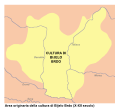
Bijelo Brdo Culture-it.svg 760 × 684; 92 KB
-
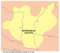
Bijelo brdo culture01.png 1,048 × 937; 47 KB
-
Bijelo brdo culture02.png 1,048 × 937; 47 KB
-
Ethnic Map of Hungary 1910 with Counties.png 6,208 × 4,104; 1.41 MB
-
GyulaGombos.png 1,940 × 1,253; 453 KB
-
Hungarians in eastern Croatia.jpg 1,080 × 596; 120 KB
-
Hungarians in subregions.png 1,601 × 1,054; 108 KB
-
Kingdom of Hungary - Ethnic Map - 1495.jpg 4,771 × 3,337; 11.96 MB
-
Kingdom of Hungary - Ethnic Map - 1784.jpg 4,771 × 3,337; 11.87 MB
-
MaghiariInAfaraUngariei.png 1,409 × 966; 217 KB
-
Percentage of Americans claiming Hungarian Ancestry by state in 2018.png 5,175 × 3,762; 1.29 MB
-
Peuple magyar en 1900.jpg 321 × 165; 26 KB
-
Transylvania ethnic map 1495.png 659 × 614; 646 KB
-
VilágmagyarÓpuszta.JPG 748 × 453; 79 KB
-
Расселение венгров в Европе.png 521 × 414; 26 KB
Categories:
- Hungarians
- Maps of ethnic groups by name
- Maps of ethnic groups in Europe
- Maps of ethnic groups in Hungary
- Maps of ethnic groups in Romania
- Maps of ethnic groups in Transylvania
- Maps of ethnic groups in Slovakia
- Maps of ethnic groups in Ukraine
- Maps of ethnic groups in Croatia
- Maps of ethnic groups in Slovenia


