Category:Maps of the Sorbs
Jump to navigation
Jump to search
Subcategories
This category has the following 4 subcategories, out of 4 total.
M
- Maps of White Serbia (28 F)
Media in category "Maps of the Sorbs"
The following 46 files are in this category, out of 46 total.
-
BOGUSŁAWSKI(1861) Das Siedlungsgebiet der Sorben im 19. Jahrhundert in der Lausitz.jpg 4,872 × 4,148; 8.85 MB
-
Germanische und slavische Volksstaemme zwischen Elbe und Weichsel.jpg 1,973 × 1,665; 1.03 MB
-
1881 Messtischblatt, Heidenschanze Coschütz.jpg 841 × 457; 84 KB
-
Dresden planskizze1 5 6 JH.jpg 2,970 × 2,400; 1,012 KB
-
Ostra planskizze9 550.jpg 2,982 × 2,382; 1.19 MB
-
Brüske Seite 125.jpg 1,863 × 2,548; 494 KB
-
Dervan.png 682 × 674; 35 KB
-
Germany sorbian region.png 188 × 235; 3 KB
-
Lange diercke sachsen freistaat sachsen hauptsiedlungsformen.jpg 1,710 × 998; 540 KB
-
Luzica mapa.png 2,363 × 2,835; 572 KB
-
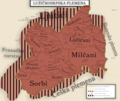
Lužičkosrpska plemena.png 3,006 × 2,538; 1.33 MB
-
Map of Lusatia.JPG 450 × 400; 28 KB
-
Migration of serbs03 01.png 870 × 966; 54 KB
-
Migration of serbs03 02.png 870 × 966; 53 KB
-
Niederwartha.Das Gebiet der Slawen im 8. Jahrhundert.jpg 1,889 × 1,364; 163 KB
-
Nordturinggau 1000.PNG 424 × 290; 91 KB
-
Obersorbisches Kernsiedlungsgebiet.png 2,000 × 1,503; 619 KB
-
Ortsnamenendung-itz.png 2,283 × 2,898; 9.16 MB
-
Sb sulska syc ne 09.10.2012.svg 842 × 1,191; 1.54 MB
-
Schulen 1954-55.PNG 410 × 408; 33 KB
-
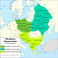
Slavic Tribes in the 7th to 9th century PL.svg 902 × 903; 1.47 MB
-
Slavs west territory Limes Sorabicus.jpg 4,000 × 2,637; 7.69 MB
-
Slawische Siedlungen in Nordostbayern.jpg 1,369 × 1,873; 959 KB
-
Smoler korta01.jpg 1,539 × 2,202; 2.75 MB
-
Sorben Siedlungsgebiet Karte.jpg 2,363 × 2,835; 1.26 MB
-
Sorben.jpeg 3,047 × 3,664; 2.18 MB
-
Sorbisches Siedlungsgebiet-dsb.png 1,398 × 1,958; 443 KB
-
Sorbisches Siedlungsgebiet-hsb.png 1,398 × 1,958; 442 KB
-
Sorbisches Siedlungsgebiet.png 1,398 × 1,958; 439 KB
-
Sorbs in German Empire.png 5,000 × 4,222; 356 KB
-
Treaty of Verdun - Sorbs (Sorben).png 660 × 500; 93 KB
-
Wokrejs gorneblotaluzyca.PNG 300 × 350; 9 KB
-
Ziemiopis - Drezno i okolice w V-VI wieku.png 7,500 × 5,000; 1.86 MB
-
Католичке општине Лужичких Срба.png 4,369 × 6,091; 783 KB
-
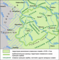
Лужицкие сербы в IX веке.svg 531 × 435; 1.96 MB
-
Лужицкие сербы на карте Германии.svg 2,000 × 2,706; 626 KB
-
Лужицкие-детские-сады-в-Саксонии-2009.png 500 × 618; 134 KB
-
Лужицкие-школы-в-Саксонии-1954-1955.png 500 × 618; 115 KB
-
Лужицкие-школы-в-Саксонии-2009.png 500 × 618; 109 KB
-
Лужичкосрпска католичка област.svg 1,311 × 1,827; 134 KB
-
Племена-лужицких-сербов-pl.png 750 × 766; 417 KB
-
Племена-лужицких-сербов.png 750 × 766; 410 KB
-
Территория лужицких сербов 2003.svg 531 × 435; 685 KB


