Category:Maps of the Baltic Tribes in 1200
Jump to navigation
Jump to search
Media in category "Maps of the Baltic Tribes in 1200"
The following 22 files are in this category, out of 22 total.
-
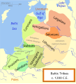
Baltic Tribes c 1200-uk.svg 988 × 1,088; 375 KB
-
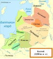
Baltic Tribes c 1200RU.svg 768 × 850; 767 KB
-
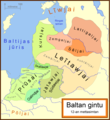
Baltan Gintu.png 2,000 × 2,185; 598 KB
-
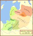
Balten 1200.svg 1,003 × 1,096; 338 KB
-
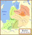
Balti ap 13.gs.svg 1,003 × 1,096; 530 KB
-
Baltic Tribes c 1200 ce.svg 988 × 1,088; 277 KB
-
Baltic Tribes c 1200 en(multilang).svg 988 × 1,088; 358 KB
-
Baltic Tribes c 1200 es.svg 988 × 1,088; 650 KB
-
Baltic Tribes c 1200 pt.svg 988 × 1,088; 278 KB
-
Baltic Tribes c 1200-fr.svg 988 × 1,088; 526 KB
-
Baltic Tribes c 1200-hu.svg 768 × 850; 382 KB
-
Baltic Tribes c 1200.svg 988 × 1,088; 789 KB
-
Baltic Tribes c 1200PL..svg 550 × 599; 186 KB
-
Baltic Tribes ca 1200 AD (et).svg 988 × 1,088; 687 KB
-
Baltic Tribes circa 1200 ad.png 550 × 599; 126 KB
-
Balticstribesinarabic.png 800 × 874; 144 KB
-
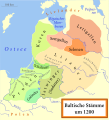
Baltische Stämme um 1200.png 1,980 × 2,180; 473 KB
-
Baltische Stämme um 1200.svg 988 × 1,088; 447 KB
-
Baltiskai gintu.png 2,000 × 2,185; 587 KB
-
Baltų gentys 12-as amžius.svg 1,003 × 1,096; 650 KB
-
Baltų gentys XII amžiuje.svg 1,003 × 1,096; 642 KB
-
Tribu baltiche 1200.png 549 × 600; 92 KB
Categories:
- Maps of the Baltics in the 12th century
- Maps showing 1200
- Maps of ethnic groups in Europe
- Maps of Balts
- Maps of East Prussia
- Prussian Crusade
- Livonian Crusade
- Maps of Yotvingia
- Skalvians
- Maps of the Grand Duchy of Lithuania
- SVG maps of the history of Lithuania
- Samogitia
- Maps of Old Prussians
- Linguistic maps of Baltic languages


