Category:Maps of Vantaa
Jump to navigation
Jump to search
Suomi: Vantaan kaupungin karttoja
Svenska: Kartor över Vanda
Wikimedia category | |||||
| Upload media | |||||
| Instance of | |||||
|---|---|---|---|---|---|
| Category combines topics | |||||
| Vantaa | |||||
city in the region of Uusimaa in Finland | |||||
| Pronunciation audio | |||||
| Instance of |
| ||||
| Part of | |||||
| Location |
| ||||
| Legislative body |
| ||||
| Official language |
| ||||
| Head of government |
| ||||
| Legal form | |||||
| Inception |
| ||||
| Highest point |
| ||||
| Population |
| ||||
| Area |
| ||||
| official website | |||||
 | |||||
Subcategories
This category has the following 3 subcategories, out of 3 total.
A
D
Media in category "Maps of Vantaa"
The following 18 files are in this category, out of 18 total.
-
Capital Region Districts of Finland.svg 1,500 × 1,200; 355 KB
-
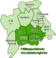
Helsingin seutu - Helsingforsregionen.svg 517 × 531; 28 KB
-
Helsinki Espoo Vantaa Finland street map.svg 5,408 × 4,328; 18.5 MB
-
Helsinki ja Vantaa aluemuutokset.svg 1,050 × 1,300; 786 KB
-
Helsinki region roads.jpg 2,775 × 2,374; 1.38 MB
-
Helsinki region roads2.jpg 1,500 × 1,280; 269 KB
-
Itämetro-Östmetron.kartta-karta.svg 691 × 336; 310 KB
-
Kehärata-Ringbanan.svg 1,010 × 450; 143 KB
-
Location of Vantaa in Finland.png 230 × 400; 6 KB
-
Pääkaupunkiseudun asutusrakenne Vantaa.png 627 × 501; 667 KB
-
Svenskbygder i Vanda.png 1,160 × 858; 213 KB
-
Vantaa dot.png 1,804 × 3,002; 284 KB
-
Vantaa location.png 250 × 425; 99 KB
-
Vantaa uusimaa.png 1,937 × 962; 73 KB
-
Vantaa-Aviapolis.png 1,174 × 863; 51 KB
-
Vantaa.sijainti.suomi.2007.svg 1,850 × 3,220; 269 KB
-
Vantaa.sijainti.suomi.2008.svg 1,850 × 3,220; 269 KB
-
Vantaa.sijainti.suomi.2009.svg 1,850 × 3,220; 233 KB


