Category:Maps of Veracruz
Jump to navigation
Jump to search
Wikimedia category | |||||
| Upload media | |||||
| Instance of | |||||
|---|---|---|---|---|---|
| Category combines topics | |||||
| Veracruz | |||||
federal state of Mexico | |||||
| Instance of | |||||
| Named after |
| ||||
| Location | Mexico | ||||
| Capital | |||||
| Legislative body | |||||
| Inception |
| ||||
| Highest point | |||||
| Population |
| ||||
| Area |
| ||||
| Elevation above sea level |
| ||||
| Different from | |||||
| official website | |||||
 | |||||
Subcategories
This category has the following 11 subcategories, out of 11 total.
Media in category "Maps of Veracruz"
The following 75 files are in this category, out of 75 total.
-
1754 Bellin Map of Veracruz, Mexico - Geographicus - Veracruz-bellin-1754.jpg 1,844 × 2,500; 1.34 MB
-
Abasolo agricultura.jpg 754 × 854; 90 KB
-
Abronia graminea distribution.png 973 × 973; 97 KB
-
Acajete mapa.png 115 × 175; 853 bytes
-
Admiralty Chart No 2854 Harbours in the Gulf of Mexico, Published 1882, Large Corrections 1944.jpg 11,148 × 16,316; 23.63 MB
-
Admiralty Chart No 374 Plans in the Gulf of Mexico, Published 1955, New Edition 1960.jpg 11,282 × 16,559; 23.93 MB
-
Alto Lucero localidades.svg 1,198 × 829; 2.45 MB
-
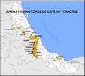
Cafe de Veracruz MAPA.pdf 2,464 × 2,210, 2 pages; 3.68 MB
-
Climas del municipio de Veracruz, Ver.png 5,000 × 4,000; 513 KB
-
Climas-Veracruz, Ver.svg 810 × 689; 198 KB
-
Colonia francesa de Jicaltepec-SR.jpg 1,126 × 757; 249 KB
-
Cortés Ruta Cuba-Tenochtitlan.png 557 × 380; 32 KB
-
Cotaxtla climas.svg 1,198 × 829; 447 KB
-
Cotaxtla hidrologia.svg 1,198 × 829; 678 KB
-
Cotaxtla localidades.svg 1,198 × 829; 455 KB
-
De las Montañas.svg 612 × 684; 171 KB
-
Diputados locales locales de Veracruz, LXV Legislatura.svg 1,089 × 1,079; 1.85 MB
-
Distrito 5 local de Veracruz.svg 1,089 × 1,079; 1.85 MB
-
Distritos electorales locales de Veracruz.svg 1,089 × 1,079; 1.85 MB
-
Distritos locales de Veracruz.svg 1,022 × 1,075; 1.91 MB
-
División Regional de Veracruz.svg 1,244 × 1,313; 30 KB
-
Golden Lane Map.pdf 960 × 1,245; 81 KB
-
HHBCM V1 D140 Yucatan peninsula.jpg 1,842 × 1,246; 414 KB
-
HHBHM V1 D138 Coast of Yucatan.jpg 1,520 × 1,041; 311 KB
-
HHBHM V1 D316 Central and eastern Mexico map.jpg 1,853 × 1,197; 306 KB
-
HHBHM V1 D522 Area surrounding Mexico City.jpg 1,883 × 994; 151 KB
-
HHBHM V2 D057 Vera Cruz to Perote.jpg 1,932 × 1,355; 294 KB
-
HHBHM V2 D118 Pánuco.jpg 1,317 × 1,253; 382 KB
-
HHBHM V2 D575 Central Mexico and the City.jpg 1,300 × 2,199; 434 KB
-
Hidrografía de Tres Valles.svg 990 × 765; 138 KB
-
MAPA DE OZULUAMA.jpg 1,632 × 2,019; 942 KB
-
Mapa de veracruz.jpg 858 × 452; 54 KB
-
Mapa del Municipio de Actopan.gif 1,320 × 1,020; 439 KB
-
Mapa Virreinato Nueva España de Pensacola a Veracruz, de Janos a Sinaloa.jpg 3,793 × 2,755; 1.23 MB
-
Mapa yang.jpg 600 × 450; 19 KB
-
Mapa-huasteco.jpg 2,828 × 1,634; 2.17 MB
-
Mayores localidades de Veracruz, Ver.png 5,000 × 4,000; 539 KB
-
Mexico Veracruz Boca de Rio comunities map.svg 1,572 × 1,781; 2.83 MB
-
MOM D137 Spanish route from the sea to Mexico.jpg 2,206 × 1,211; 427 KB
-
Mp CAP.svg 738 × 468; 266 KB
-
Mp HAL.svg 972 × 918; 278 KB
-
Mp HBJ.svg 936 × 864; 241 KB
-
Mp MON.svg 612 × 684; 326 KB
-
Mp NAU.svg 504 × 378; 200 KB
-
Mp OLM.svg 1,224 × 972; 285 KB
-
Mp PAP.svg 954 × 1,134; 300 KB
-
Mp SOT.svg 576 × 594; 213 KB
-
Mp TOT.svg 648 × 540; 217 KB
-
Mp TUX.svg 446 × 446; 184 KB
-
Panuco climas.svg 1,198 × 829; 278 KB
-
Panuco hidrologia.svg 1,198 × 829; 867 KB
-
Panuco infraestructura.svg 1,198 × 829; 618 KB
-
Panuco localidades.svg 1,198 × 829; 607 KB
-
Plano del Puerto de Veracruz en la costa occidental del Seno Mexicano (5121161938).jpg 2,000 × 1,504; 2.8 MB
-
Puctlancingo Territorio Siglo XVI.jpg 1,961 × 1,738; 659 KB
-
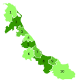
Regiones de Veracruz.svg 1,584 × 1,584; 246 KB
-
Screenshot 20221213 013943 com.android.chrome edit 823463786519131.jpg 1,080 × 1,426; 172 KB
-
Ver-reg1-huasteca alta.png 326 × 342; 18 KB
-
Ver-reg10-olmeca.png 423 × 346; 23 KB
-
Ver-reg2-huasteca baja.png 361 × 338; 15 KB
-
Ver-reg3-totonaca.png 322 × 265; 12 KB
-
Ver-reg4-nautla.png 257 × 188; 9 KB
-
Ver-reg5-capital.PNG 360 × 260; 32 KB
-
Ver-reg6-sotavento.jpg 323 × 320; 14 KB
-
Ver-reg8-papaloapan.png 246 × 271; 12 KB
-
Ver-reg9-los tuxtla.jpg 199 × 185; 7 KB
-
Veracruz Atlahuilco.png 2,403 × 2,503; 954 KB
-
Veracruz Xalapa.png 2,002 × 2,048; 588 KB
-
Vías de comunicación de Tres Valles.svg 990 × 765; 87 KB
-
Zonas metropolitanas de Veracruz.svg 512 × 563; 3.21 MB
-
Furber & Stillman Battle Ground of Cerro Gordo 1846-1848 UTA.jpg 4,773 × 2,982; 4.82 MB


