
Category:Maps of Nayarit
Wikimedia category | |||||
| Upload media | |||||
| Instance of | |||||
|---|---|---|---|---|---|
| Category combines topics | |||||
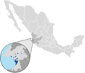
| Nayarit | |||||
state of Mexico     | |||||
| Instance of | |||||
| Location | Mexico | ||||
| Capital | |||||
| Legislative body |
| ||||
| Inception |
| ||||
| Population |
| ||||
| Area |
| ||||
| Elevation above sea level |
| ||||
| official website | |||||
 | |||||
Subcategories
This category has the following 6 subcategories, out of 6 total.
Media in category "Maps of Nayarit"
The following 25 files are in this category, out of 25 total.
-
 Antiguo Jalisco y Guanajuato.png 1,910 × 920; 1.01 MB
-
 Bahia de Banderas localidades.svg 1,198 × 829; 917 KB
-
 Casos de COVID-19 en Nayarit.svg 479 × 583; 248 KB
-
 CerroCruzMapa.png 1,021 × 1,461; 351 KB
-
 Chacalamap.png 353 × 353; 27 KB
-
 Del Nayar localidades.svg 1,198 × 829; 737 KB
-
 Elección de gobernador de Nayarit de 2017.svg 650 × 612; 376 KB
-
 Guerra del Mixtón.PNG 337 × 338; 25 KB
-
 HHBHM V2 D372 Nueva Galicia.jpg 1,349 × 1,223; 290 KB
-
 Islas Marias Nayarit.png 453 × 317; 5 KB
-
 Mapa - Del Nayar (Localidades).png 720 × 1,281; 73 KB
-
 Mapa - División política de Nayarit.png 682 × 683; 143 KB
-
 Mapa de Colonia Loma Hermosa.png 586 × 663; 48 KB
-
 Mapa de Lo De Marcos, Municipio de Bahía de Banderas Nayarit Mexico CP 63729.pdf 1,193 × 1,164; 1,005 KB
-
 Mexico Nayarit location map labels.png 1,553 × 1,874; 411 KB
-
 Mexico Nayarit location map.svg 1,553 × 1,874; 194 KB
-
 Municipalities-Nayarit.svg 418 × 557; 213 KB
-
 Municipios de Nayarit.svg 1,184 × 1,059; 249 KB
-
 Nayarit Ayuntamientos 2008.svg 726 × 967; 213 KB
-
 Nayarit precolombino.gif 553 × 526; 114 KB
-
 Nayarit.png 637 × 600; 47 KB
-
 Political division of Nayarit.jpg 845 × 1,144; 121 KB
-
 ZMP Vallarta.png 717 × 615; 75 KB
-
 ZMPV.PNG 490 × 440; 28 KB
-
 Sierra de San Juan.svg 1,105 × 1,405; 1.64 MB


.png)


