Category:Maps of Oaxaca
Jump to navigation
Jump to search
Wikimedia category | |||||
| Upload media | |||||
| Instance of | |||||
|---|---|---|---|---|---|
| Category combines topics | |||||
| Oaxaca | |||||
state of Mexico | |||||
| Instance of | |||||
| Named after | |||||
| Location | Mexico | ||||
| Located in or next to body of water | |||||
| Capital | |||||
| Legislative body |
| ||||
| Head of government | |||||
| Inception |
| ||||
| Population |
| ||||
| Area |
| ||||
| Elevation above sea level |
| ||||
| official website | |||||
 | |||||
Subcategories
This category has the following 7 subcategories, out of 7 total.
- SVG maps of Oaxaca (232 F)
E
- Election maps of Oaxaca (3 F)
F
L
- Locator maps of Oaxaca (12 F)
M
- Maps of La Mixteca (5 F)
Media in category "Maps of Oaxaca"
The following 105 files are in this category, out of 105 total.
-
131 of 'A Popular History of the Mexican People' (11103245964).jpg 802 × 1,261; 169 KB
-
1999 Oaxaca Earthquake Location.jpg 460 × 489; 58 KB
-
Abronia mixteca.png 636 × 735; 464 KB
-
Abronia oaxacae.png 816 × 1,056; 530 KB
-
Acceso a Nejapa.png 1,024 × 556; 929 KB
-
Admiralty Chart No 1051 Port Angeles to Mangrove Bluff, Published 1887.jpg 16,130 × 11,126; 51.81 MB
-
Chahuites climas.svg 1,198 × 829; 2.31 MB
-
Chahuites hidrologia.svg 1,198 × 829; 2.41 MB
-
Chahuites localidades.svg 1,198 × 829; 2.31 MB
-
Chatino-map-wikipedia.svg 720 × 486; 226 KB
-
Chivaniza.png 796 × 537; 180 KB
-
COVID-19 en Oaxaca por municipio.svg 906 × 625; 1.41 MB
-
Distrito 01 - Silacayoapan.svg 1,082 × 721; 153 KB
-
Distrito 02 - Huajuapan.svg 1,082 × 721; 150 KB
-
Distrito 03 - Coixtlahuaca.svg 1,082 × 721; 153 KB
-
Distrito 04 - Teotitlán.svg 1,082 × 721; 152 KB
-
Distrito 05 - Cuicatlán.svg 1,082 × 721; 151 KB
-
Distrito 06 - Tuxtepec.svg 1,082 × 721; 151 KB
-
Distrito 07 - Choapan.svg 1,082 × 721; 150 KB
-
Distrito 08.svg 1,082 × 721; 153 KB
-
Distrito 09 - Teposcolula.svg 1,082 × 721; 152 KB
-
Distrito 10 - Nochixtlán.svg 1,082 × 721; 152 KB
-
Distrito 11 - Etla.svg 1,082 × 721; 153 KB
-
Distrito 12 - Ixtlán.svg 1,082 × 721; 152 KB
-
Distrito 13 - Villa Alta.svg 1,082 × 721; 152 KB
-
Distrito 14 - Mixe.svg 1,082 × 721; 152 KB
-
Distrito 15 - Putla.svg 1,082 × 721; 151 KB
-
Distrito 16 - Tlaxiaco.svg 1,082 × 721; 152 KB
-
Distrito 17 - Zaachila.svg 1,082 × 721; 153 KB
-
Distrito 18 - Zimatlán.svg 1,082 × 721; 153 KB
-
Distrito 19 - Centro.svg 1,082 × 721; 153 KB
-
Distrito 20 - Tlacolula.svg 1,082 × 721; 153 KB
-
Distrito 21 - Jamiltepec.svg 1,082 × 721; 151 KB
-
Distrito 22 - Juquila.svg 1,082 × 721; 156 KB
-
Distrito 23 - Sola de Vega.svg 1,082 × 721; 150 KB
-
Distrito 24 - Ejutla.svg 1,082 × 721; 152 KB
-
Distrito 25 - Ocotlán.svg 1,082 × 721; 153 KB
-
Distrito 26 - Miahuatlán.svg 1,082 × 721; 150 KB
-
Distrito 27 - Yautepec.svg 1,082 × 721; 153 KB
-
Distrito 28 - Tehuantepec.svg 1,082 × 721; 150 KB
-
Distrito 29 - Juchitán.svg 1,082 × 721; 150 KB
-
Distrito 30 - Pochutla.svg 1,082 × 721; 150 KB
-
Distritos electorales locales de Oaxaca.svg 1,067 × 733; 98 KB
-
División regional, distrital y municipal de Oaxaca.svg 925 × 785; 4.75 MB
-
Eleccion de gobernador de Oaxaca, 2016.svg 1,067 × 733; 98 KB
-
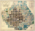
HHBHM V2 D714 Oajaca.jpg 1,327 × 976; 277 KB
-
HHBHM V4 D508 Plan of Oajaca.jpg 1,887 × 2,082; 995 KB
-
His-map-oaxaca.jpg 250 × 208; 24 KB
-
Intensity Oaxaca 2012.jpg 612 × 720; 118 KB
-
IsthmusZapotecLocation.png 794 × 964; 1,016 KB
-
Ixcatlán, Santa María, Mexico WDL458.png 1,024 × 1,551; 2.65 MB
-
Jalapa de Díaz-00004.jpg 1,100 × 850; 318 KB
-
Juchitan de Zaragoza climas.svg 1,198 × 829; 2.56 MB
-
Juchitan de Zaragoza localidades.svg 1,198 × 829; 2.65 MB
-
Location map Mexico Oaxaca.png 960 × 720; 270 KB
-
Location map Oaxaca.png 658 × 566; 90 KB
-
Map of Oaxaca 1.jpg 2,381 × 1,786; 522 KB
-
Map of Oaxaca.svg 602 × 401; 155 KB
-
Mapa de Guelatao.png 633 × 505; 55 KB
-
Mapa de Ixcatlán, Santa María, en el actual estado de Oaxaca.jpg 676 × 1,024; 154 KB
-
Mapa de marginación urbana.jpg 546 × 454; 33 KB
-
Mapa Nejapa.png 1,323 × 945; 324 KB
-
Mapa San Isidro.jpg 1,080 × 1,217; 197 KB
-
Mapa-mixteco.jpg 3,010 × 1,828; 2.57 MB
-
MapChurchBartolo.JPG 6,016 × 4,000; 9.67 MB
-
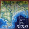
Mazunte Area Map.jpg 1,536 × 1,536; 273 KB
-
Mixteco y idiomas circundantes-es.svg 849 × 521; 232 KB
-
Mixteco y idiomas circundantes.svg 849 × 521; 160 KB
-
Monte Alban and other cities.jpg 522 × 299; 33 KB
-
Municipaliés limitrophes de San Juan Bautista Cuicatlán (Oaxaca).svg 590 × 650; 86 KB
-
MxUCharm.jpg 721 × 525; 62 KB
-
Nacion Chocholteca Map v3.png 2,952 × 1,968; 8.4 MB
-
Ndaxagua localization.jpg 2,340 × 1,654; 1.44 MB
-
Oaxaca ciudades.svg 550 × 370; 239 KB
-
Oaxaca Diputaciones 2007.png 1,051 × 723; 102 KB
-
Oaxaca distritos.png 721 × 450; 114 KB
-
Oaxaca indigenous people.svg 849 × 521; 259 KB
-
Oaxaca map in 1919, from- Plans of Mexican towns 1919-1- (cropped).jpg 944 × 959; 164 KB
-
Oaxaca regiones 50.png 432 × 290; 57 KB
-
Oaxaca regiones mejorado.png 721 × 450; 95 KB
-
Oaxaca regions and districts.svg 602 × 401; 303 KB
-
Oaxaca San Miguel Ejutla.png 1,906 × 1,254; 1.06 MB
-
Oaxaca template.svg 1,082 × 721; 154 KB
-
Oaxaca1848.gif 1,024 × 917; 424 KB
-
Oaxraca fisico regiones.png 707 × 419; 451 KB
-
Ocotlan District municipalities.svg 665 × 516; 40 KB
-
Pinotepa.png 241 × 180; 41 KB
-
Plano de Monte Albán.svg 762 × 762; 428 KB
-
Regiones Oaxaca gris.png 2,000 × 1,333; 138 KB
-
Regiones Oaxaca nombres.png 2,000 × 1,333; 239 KB
-
Regiones Oaxaca.png 2,000 × 1,333; 162 KB
-
Rojas de Cuauhtémoc territorio.svg 512 × 335; 14 MB
-
Rojas de Cuauhtémoc Territorio.svg 512 × 337; 5 KB
-
Rojas de Cuauhtémoc.png 3,782 × 2,475; 199 KB
-
SANTIAGO AYUQUILILLA.png 843 × 653; 1.01 MB
-
Santiago Juxtlahuaca localidades.svg 1,198 × 829; 2.69 MB
-
Sierramixes.png 1,057 × 539; 374 KB
-
Tlacolula localidades.svg 1,198 × 829; 2.65 MB
-
UBICACION AGUA CABALLERO.JPG 641 × 496; 56 KB
-
Villa alta.gif 550 × 420; 27 KB
-
Zapotecan language areas.svg 809 × 561; 166 KB
-
Zapotecan Languages.png 800 × 533; 77 KB
-
Регионы и округа Оахаки.svg 925 × 785; 4.31 MB
