Category:Maps of Chihuahua
Jump to navigation
Jump to search
Subcategories
This category has the following 11 subcategories, out of 11 total.
Media in category "Maps of Chihuahua"
The following 38 files are in this category, out of 38 total.
-
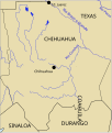
Map of Territorio de Nuevo Mexico.PNG 1,098 × 1,001; 41 KB
-
Santa Fe of New Mexico (location map scheme).svg 500 × 475; 565 KB
-
Map of the Gila Trail.pdf 1,650 × 1,275; 154 KB
-
A map of Casas Grandes & adjacent region.JPG 418 × 513; 49 KB
-
Ancient Cultures.svg 912 × 1,122; 93 KB
-
Ancient Cultures2.svg 912 × 1,122; 33 KB
-
Ascension climas.svg 1,198 × 829; 1.06 MB
-
Ascension hidrologia.svg 1,198 × 829; 1.52 MB
-
Ascension localidades.svg 1,198 × 829; 1,013 KB
-
Chihuahua 1862-1867-en.svg 417 × 565; 78 KB
-
Chihuahua Area Codes Map.png 546 × 592; 685 KB
-
Chihuahua desert.jpg 400 × 324; 78 KB
-
Chihuahua Hidrografia Primitiva.png 464 × 548; 88 KB
-
Chihuahua Hidrografia Primitiva.svg 464 × 548; 83 KB
-
Chihuahua Hidrografia Primitiva5.svg 464 × 548; 88 KB
-
Chihuahua mexico map.jpg 600 × 526; 101 KB
-
Chihuahua Population Density.svg 1,184 × 1,062; 587 KB
-
Chihuahua és környéke fontos forradalmi helyszínekkel.png 1,322 × 1,168; 227 KB
-
Chihuahuan Desert map.svg 1,712 × 1,992; 369 KB
-
Climate Zones of Chihuahua.png 406 × 492; 72 KB
-
Country Club Area.jpg 637 × 458; 66 KB
-
Etnias antiguas de Chihuahua.png 2,148 × 2,324; 793 KB
-
Flag Map of Chihuahua.png 1,254 × 1,537; 173 KB
-
Guadalupe localidades.svg 1,198 × 829; 1.05 MB
-
Hohokam, Ancestral Pueblo, and Mogollon cultures circa 1350 CE.png 712 × 880; 315 KB
-
Madera-Location.png 960 × 720; 443 KB
-
Map of Chihuahua 1824.PNG 1,098 × 1,001; 41 KB
-
Mapa Virreinato Nueva España de Pensacola a Veracruz, de Janos a Sinaloa.jpg 3,793 × 2,755; 1.23 MB
-
Mexico Chihuhuahua Chihuahua city location map.png 756 × 577; 192 KB
-
Municipios de Chihuahua.svg 1,184 × 1,062; 906 KB
-
Oasisamerica Esp.jpg 1,280 × 1,569; 375 KB
-
OasisAmerica-es.svg 912 × 1,122; 80 KB
-
Oasisamerican cultures circa 1350 CE.png 720 × 887; 362 KB
-
Queso Chihuahua con forma del estado.png 4,577 × 6,099; 36.83 MB
-
Queso Chihuahua.jpg 4,499 × 5,599; 2.08 MB
-
Sierra tarahumara.svg 2,176 × 2,453; 805 KB
-
Tarahumara Ubicación.jpg 2,362 × 2,362; 1.41 MB


