Category:SVG maps of Uttar Pradesh
Jump to navigation
Jump to search
States of India: Andhra Pradesh · Arunachal Pradesh · Assam · Bihar · Chhattisgarh · Goa · Gujarat · Haryana · Himachal Pradesh · Jharkhand · Karnataka · Kerala · Madhya Pradesh · Maharashtra · Manipur · Meghalaya · Mizoram · Nagaland · Odisha · Punjab · Rajasthan · Sikkim · Tamil Nadu · Telangana · Tripura · Uttar Pradesh · Uttarakhand · West Bengal
Union territories: Andaman and Nicobar Islands · Chandigarh · Dadra and Nagar Haveli and Daman and Diu · Delhi · Jammu and Kashmir · Ladakh · Lakshadweep · Puducherry
Former states of India: Jammu and Kashmir ·
Former union territories:
Union territories: Andaman and Nicobar Islands · Chandigarh · Dadra and Nagar Haveli and Daman and Diu · Delhi · Jammu and Kashmir · Ladakh · Lakshadweep · Puducherry
Former states of India: Jammu and Kashmir ·
Former union territories:
Subcategories
This category has only the following subcategory.
Media in category "SVG maps of Uttar Pradesh"
The following 58 files are in this category, out of 58 total.
-
2012 Uttar Pradesh Legislative Assembly Election Result Map.svg 1,369 × 1,338; 9.42 MB
-
2017 Uttar Pradesh election result by alliance.svg 512 × 537; 4.86 MB
-
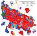
2017 Uttar Pradesh Legislative Assembly Election Result Map.svg 1,369 × 1,338; 9.57 MB
-
2024 Lok Sabha Uttar Pradesh Result Map.svg 775 × 754; 4.81 MB
-
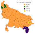
2024 NDA Alliance Lok Sabha Seat Sharing Uttar Pradesh.svg 775 × 754; 6.15 MB
-
2Uttar pradesh map stub with district.svg 758 × 750; 10 KB
-
Awadhi.svg 2,379 × 2,466; 157 KB
-
Bifurcation of Uttar Pradesh - proposals.svg 824 × 436; 740 KB
-
Districts of Uttar Pradesh.svg 909 × 886; 916 KB
-
India Uttar Pradesh COVID-19 map.svg 2,253 × 2,338; 223 KB
-
India Uttar Pradesh districts 2010.svg 2,379 × 2,466; 125 KB
-
India Uttar Pradesh districts 2012.svg 2,379 × 2,466; 128 KB
-
India Uttar Pradesh districts numbered 2012.svg 2,379 × 2,466; 159 KB
-
India Uttar Pradesh districts numbered.svg 2,379 × 2,466; 157 KB
-
India Uttar Pradesh districts.svg 2,379 × 2,466; 122 KB
-
India Uttar Pradesh location map.svg 1,006 × 981; 776 KB
-
India Uttar Pradesh major regions 2012 Hi.svg 641 × 665; 189 KB
-
India Uttar Pradesh major regions 2012.svg 641 × 665; 112 KB
-
India Uttar Pradesh relief map.svg 1,006 × 981; 1.97 MB
-
List of districts of Uttar Pradesh (2012).svg 4,000 × 2,600; 130 KB
-
MNS violence map.svg 1,639 × 1,852; 1.06 MB
-
UP phase wise election schedule 2022.svg 1,369 × 1,338; 6.65 MB
-
Up-subregions2 as.svg 2,400 × 2,515; 242 KB
-
Up-subregions2 ml.svg 2,400 × 2,515; 244 KB
-
Up-subregions2-gu.svg 2,400 × 2,515; 243 KB
-
Up-subregions2-hi.svg 2,400 × 2,515; 244 KB
-
UP-subregions2-kn.svg 2,400 × 2,515; 240 KB
-
Up-subregions2-mr.svg 2,400 × 2,515; 244 KB
-
Up-subregions2-pa.svg 2,400 × 2,515; 240 KB
-
Up-subregions2-te.svg 2,400 × 2,515; 240 KB
-
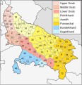
Up-subregions2.svg 2,400 × 2,515; 242 KB
-
Urban Transit System in Uttar Pradesh.svg 8,238 × 10,128; 1.05 MB
-
Uttar Pradesh administrative divisions ml.svg 1,600 × 1,600; 109 KB
-
Uttar Pradesh administrative divisions-bn.svg 1,500 × 1,500; 121 KB
-
Uttar Pradesh administrative divisions-gu.svg 1,500 × 1,500; 122 KB
-
Uttar Pradesh administrative divisions-hi.svg 1,500 × 1,500; 109 KB
-
Uttar Pradesh administrative divisions-kn.svg 1,500 × 1,500; 123 KB
-
Uttar Pradesh administrative divisions-mr.svg 1,500 × 1,500; 104 KB
-
Uttar Pradesh administrative divisions-or.svg 1,500 × 1,500; 121 KB
-
Uttar Pradesh administrative divisions-pa.svg 1,500 × 1,500; 121 KB
-
Uttar Pradesh administrative divisions-te.svg 1,500 × 1,500; 120 KB
-
Uttar Pradesh administrative divisions.svg 1,500 × 1,500; 121 KB
-
Uttar Pradesh constituencies.svg 512 × 498; 389 KB
-
Uttar Pradesh literacy 2011.svg 800 × 750; 614 KB
-
Uttar Pradesh locator map hi.svg 2,400 × 2,515; 137 KB
-
Uttar Pradesh locator map.svg 909 × 886; 838 KB
-
Uttar Pradesh map for WLM-IN.svg 887 × 863; 34 KB
-
Uttar Pradesh Muslim percentage 2011.svg 800 × 750; 618 KB
-
Uttar Pradesh outline shape.svg 300 × 300; 246 KB
-
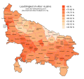
Uttar Pradesh population density 2011.svg 800 × 750; 611 KB
-
Uttar Pradesh rural 2011.svg 800 × 750; 620 KB
-
Uttar Pradesh scheduled castes 2011.svg 800 × 750; 613 KB
-
Uttar Pradesh vector.svg 430 × 433; 130 KB
-
Uttar Pradesh Wahlkreise Lok Sabha.svg 775 × 754; 4.79 MB
-
Uttar Pradesh-Uttarakhand.svg 620 × 680; 185 KB
-
Varanasi district location map blank.svg 1,058 × 912; 284 KB
-
Varanasi district location map.svg 1,058 × 912; 284 KB
-
Wahlkreise zur Vidhan Sabha von Uttar Pradesh.svg 1,369 × 1,338; 9.57 MB
