
Category:Maps of Richmond, Virginia
- 100 most populous cities of the United States
- 1–25
- Austin
- Boston
- Charlotte
- Chicago
- Columbus
- Dallas
- Denver
- El Paso
- Fort Worth
- Houston
- Indianapolis
- Jacksonville
- Los Angeles
- Nashville
- New York City
- Oklahoma City
- Philadelphia
- Phoenix
- Portland
- San Antonio
- San Diego
- San Francisco
- San Jose
- Seattle
- Washington, D.C.
- 26–50
- Arlington
- Atlanta
- Bakersfield
- Colorado Springs
- Detroit
- Fresno
- Kansas City
- Las Vegas
- Long Beach
- Louisville
- Memphis
- Miami
- Minneapolis
- Oakland
- Omaha
- Raleigh
- Sacramento
- Tucson
- Tulsa
- Virginia Beach
- Wichita
- 51–75
- Anaheim
- Anchorage
- Cincinnati
- Cleveland
- Corpus Christi
- Durham
- Greensboro
- Henderson
- Honolulu
- Irvine
- Jersey City
- Lexington
- Lincoln
- Newark
- New Orleans
- Orlando
- Pittsburgh
- Plano
- Saint Paul
- Santa Ana
- St. Louis
- Tampa
- 76–100
- Boise
- Buffalo
- Chesapeake
- Chula Vista
- Fort Wayne
- Laredo
- Lubbock
- Madison
- Norfolk
- Richmond
- Santa Clarita
- Scottsdale
- St. Petersburg
- Spokane
- Toledo
- Winston-Salem
Wikimedia category | |||||
| Upload media | |||||
| Instance of | |||||
|---|---|---|---|---|---|
| Category combines topics | |||||
| Richmond | |||||
capital city of Virginia, United States of America  .jpg)   | |||||
| Instance of | |||||
| Named after | |||||
| Location | Virginia | ||||
| Head of government |
| ||||
| Inception |
| ||||
| Population |
| ||||
| Area |
| ||||
| Elevation above sea level |
| ||||
| Different from | |||||
| official website | |||||
 | |||||
Subcategories
This category has the following 2 subcategories, out of 2 total.
O
Media in category "Maps of Richmond, Virginia"
The following 25 files are in this category, out of 25 total.
-
 Chimborazo Park.svg 800 × 522; 203 KB
-
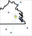
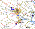
 DistancesToRichmond.png 757 × 448; 10 KB
-
 DistancesToRichmond2 notext3.png 847 × 957; 48 KB
-
 DistancesToRichmond2.png 845 × 955; 42 KB
-
 DistancesToRichmond3.png 813 × 913; 151 KB
-
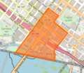
 DowntownRichmondNeighborhoods.jpg 659 × 564; 104 KB
-
 Map of the Central Office District in Richmond, Virginia.png 629 × 549; 503 KB
-
 Map showing Richmond city, Virginia.png 750 × 485; 34 KB
-
 Race and ethnicity 2010- Richmond (5560433168).png 3,009 × 3,009; 3.13 MB
-
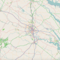 Richmond metro area.png 1,390 × 1,390; 1.41 MB
-
 Richmond Metropolitan Area.png 638 × 293; 33 KB
-
 Richmond Virginia US street map.svg 3,072 × 2,514; 9.46 MB
-
 Richmond-map.jpg 1,654 × 1,165; 313 KB
-
 Richmond-Petersburg TIGER MAP.gif 422 × 359; 18 KB
-
 RichmondFanDistrict.jpg 664 × 561; 114 KB
-
 RichmondFanDistrictBoundaries.jpg 659 × 561; 108 KB
-
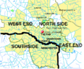 RichmondNSEW.png 684 × 566; 403 KB
-
 Sherwood Park Civic Association.jpg 5,100 × 3,300; 2.31 MB
-
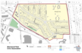 Sherwood Park Civic Association.png 5,100 × 3,300; 3.22 MB
-
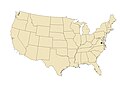
 VAMap-doton-Richmond.PNG 595 × 262; 10 KB
-
 Virginia Senate District 10 (2011).png 3,505 × 1,532; 685 KB
-
 Virginia Senate District 16 (2011).png 3,507 × 1,526; 684 KB
-
 Virginia Senate District 9 (2011).png 3,507 × 1,527; 686 KB
-
 Wikivoyage Richmond Map PNG.png 617 × 540; 64 KB
-
 Wikivoyage Richmond Map.svg 744 × 1,052; 427 KB


.png)


.png)
.png)
.png)

