
Category:Maps of New Orleans
- 100 most populous cities of the United States
- 1–25
- Austin
- Boston
- Charlotte
- Chicago
- Columbus
- Dallas
- Denver
- El Paso
- Fort Worth
- Houston
- Indianapolis
- Jacksonville
- Los Angeles
- Nashville
- New York City
- Oklahoma City
- Philadelphia
- Phoenix
- Portland
- San Antonio
- San Diego
- San Francisco
- San Jose
- Seattle
- Washington, D.C.
- 26–50
- Arlington
- Atlanta
- Bakersfield
- Colorado Springs
- Detroit
- Fresno
- Kansas City
- Las Vegas
- Long Beach
- Louisville
- Memphis
- Miami
- Minneapolis
- Oakland
- Omaha
- Raleigh
- Sacramento
- Tucson
- Tulsa
- Virginia Beach
- Wichita
- 51–75
- Anaheim
- Anchorage
- Cincinnati
- Cleveland
- Corpus Christi
- Durham
- Greensboro
- Henderson
- Honolulu
- Irvine
- Jersey City
- Lexington
- Lincoln
- Newark
- New Orleans
- Orlando
- Pittsburgh
- Plano
- Saint Paul
- Santa Ana
- St. Louis
- Tampa
- 76–100
- Boise
- Buffalo
- Chesapeake
- Chula Vista
- Fort Wayne
- Laredo
- Lubbock
- Madison
- Norfolk
- Richmond
- Santa Clarita
- Scottsdale
- St. Petersburg
- Spokane
- Toledo
- Winston-Salem
Wikimedia category | |||||
| Upload media | |||||
| Instance of | |||||
|---|---|---|---|---|---|
| Category combines topics | |||||
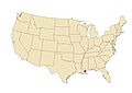
| New Orleans | |||||
largest city of the state of Louisiana, United States    .png)  | |||||
| Instance of | |||||
| Named after | |||||
| Location |
| ||||
| Located in or next to body of water | |||||
| Head of government |
| ||||
| Inception |
| ||||
| Population |
| ||||
| Area |
| ||||
| Elevation above sea level |
| ||||
| Said to be the same as | Orleans Parish | ||||
| official website | |||||
 | |||||
Subcategories
This category has the following 11 subcategories, out of 11 total.
Media in category "Maps of New Orleans"
The following 58 files are in this category, out of 58 total.
-
 Authorized Plan of Protection.jpg 2,436 × 1,542; 2.31 MB
-
 Blank Map of Wards of New Orleans.png 960 × 734; 134 KB
-
 Close-up of New Orleans flood zone map (177181135).jpg 2,048 × 1,538; 591 KB
-
 FEMA - 21562 - Photograph by Robert Kaufmann taken on 01-20-2006 in Louisiana.jpg 3,300 × 2,200; 4.08 MB
-
 Greater New Orleans 1970 Map.jpg 707 × 761; 160 KB
-
 Greater New Orleans Metro Area Louisiana Region Map.png 300 × 275; 40 KB
-
 Home Owners' Loan Corp. (HOLC) Neighborhood Redlining Grade in New Orleans, Louisiana.png 2,999 × 1,687; 3.25 MB
-
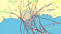 Hurricanes Category 3 or greater within 100 miles of New Orleans.jpg 734 × 415; 72 KB
-
 IHNCconfluence.png 403 × 420; 9 KB
-
 Isle of Orleans.jpg 528 × 612; 158 KB
-
 Jefferson Parish Louisiana Riverfront New Orleans Map 1979.jpg 3,657 × 4,500; 5.08 MB
-
 Jefferson Parish Louisiana Riverfront New Orleans Map 1998.jpg 3,618 × 4,500; 4.58 MB
-
 Lago Pontchartrain.png 889 × 549; 43 KB
-
 Lake Pontchartrain.png 889 × 549; 42 KB
-
 Lower Mississippi River Map.jpg 5,600 × 3,090; 5.81 MB
-
 Loyola Maroon 1975 Mardi Gras Parade Map Crop.png 1,124 × 782; 825 KB
-
 Loyola Maroon 1975 Mardi Gras Parade Map.jpg 600 × 780; 114 KB
-
 Map Eastern New Orleans to Gulfport MS 1982.jpg 6,976 × 3,828; 4.9 MB
-
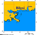 Map of Biloxi and Mississippi coast.png 514 × 482; 13 KB
-
 Map of flood zone in New Orleans (177181347).jpg 2,048 × 1,538; 461 KB
-
 Map of Louisiana and USA highlighting Orleans Parish.png 300 × 275; 46 KB
-
 Map of Mississippi coast.png 514 × 482; 18 KB
-
 New Orleans districts map grouped.png 2,400 × 2,630; 3.94 MB
-
 New Orleans East Bank.png 640 × 745; 315 KB
-
 New orleans east.png 584 × 425; 95 KB
-
 New Orleans elevation relative to Lake Pontchartrain.jpg 1,333 × 933; 1.42 MB
-
 New Orleans Flooding and Gay Neighborhoods.png 1,169 × 850; 294 KB
-
 New Orleans Karte.png 829 × 496; 70 KB
-
 New Orleans levee system 2005.png 542 × 380; 11 KB
-
 New Orleans Levee System.svg 538 × 375; 67 KB
-
 New Orleans Louisiana US street map.svg 5,952 × 5,984; 110.23 MB
-
 New Orleans Neighborhood map blank.png 2,338 × 1,700; 685 KB
-
 New Orleans Section and West Bank 1966 Map.jpg 3,806 × 4,500; 5.81 MB
-
 New Orleans Section and West Bank 1979 Map.jpg 3,633 × 4,500; 5.55 MB
-
 New Orleans Section and West Bank 1998 Map.jpg 3,899 × 4,500; 4.88 MB
-
 New Orleans, Louisiana 1955 Yellow Book.jpg 800 × 651; 181 KB
-
 New Orleans, USA ESA23779715.png 1,400 × 1,050; 1.23 MB
-
 New-orleans-map.jpg 1,654 × 1,165; 312 KB
-
 Orleans Metro sub-basin.jpg 859 × 663; 52 KB
-
 Outfall canals map.jpg 340 × 251; 48 KB
-
 Race and ethnicity 2010- New Orleans (5560463750).png 3,009 × 3,009; 2.15 MB
-
 Race and ethnicity New Orleans (2000).png 3,009 × 3,009; 2.41 MB
-
 Report on Hurricane Betsy USACE New Orleans 1965 Map of Inundated Areas.jpg 2,278 × 2,963; 2 MB
-
 St Roch-Florida map.png 3,008 × 1,709; 1.74 MB
-
 St Roch-Florida map.svg 936 × 974; 1.51 MB
-
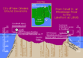
 The Greater New Orleans Hurricane & Storm Damage Risk Reduction System 2014.jpg 2,550 × 1,650; 388 KB
-
-

-
-

-

-

-

-
 United States Congressional Districts in Louisiana (metro highlight), since 2013.tif 1,370 × 802; 1.32 MB
-
 Uptown-carrolton.png 584 × 425; 98 KB
-

-
 Zulu SAPC Mardi Gras 1974 Special 17.jpg 745 × 1,000; 73 KB
-
 Zulu SAPC Mardi Gras 1974 Special Extracted Map.jpg 906 × 626; 159 KB

.jpg)


_Neighborhood_Redlining_Grade_in_New_Orleans,_Louisiana.png)


.jpg)


.png)
.png)


_Echelon_Exercise_at_Naval_Amphibious_Base_Little_Creek.jpg)

