Category:Maps of Austin, Texas
Jump to navigation
Jump to search
- 100 most populous cities of the United States
- 1–25
- Austin
- Boston
- Charlotte
- Chicago
- Columbus
- Dallas
- Denver
- El Paso
- Fort Worth
- Houston
- Indianapolis
- Jacksonville
- Los Angeles
- Nashville
- New York City
- Oklahoma City
- Philadelphia
- Phoenix
- Portland
- San Antonio
- San Diego
- San Francisco
- San Jose
- Seattle
- Washington, D.C.
- 26–50
- Arlington
- Atlanta
- Bakersfield
- Colorado Springs
- Detroit
- Fresno
- Kansas City
- Las Vegas
- Long Beach
- Louisville
- Memphis
- Miami
- Minneapolis
- Oakland
- Omaha
- Raleigh
- Sacramento
- Tucson
- Tulsa
- Virginia Beach
- Wichita
- 51–75
- Anaheim
- Anchorage
- Cincinnati
- Cleveland
- Corpus Christi
- Durham
- Greensboro
- Henderson
- Honolulu
- Irvine
- Jersey City
- Lexington
- Lincoln
- Newark
- New Orleans
- Orlando
- Pittsburgh
- Plano
- Saint Paul
- Santa Ana
- St. Louis
- Tampa
- 76–100
- Boise
- Buffalo
- Chesapeake
- Chula Vista
- Fort Wayne
- Laredo
- Lubbock
- Madison
- Norfolk
- Richmond
- Santa Clarita
- Scottsdale
- St. Petersburg
- Spokane
- Toledo
- Winston-Salem
Wikimedia category | |||||
| Upload media | |||||
| Instance of | |||||
|---|---|---|---|---|---|
| Category combines topics | |||||
| Austin | |||||
city in and county seat of Travis County, Texas, United States, that is also the capital of the State of Texas   .jpg)    | |||||
| Instance of | |||||
| Named after | |||||
| Location | Travis County, Texas | ||||
| Head of government |
| ||||
| Inception |
| ||||
| Population |
| ||||
| Area |
| ||||
| Elevation above sea level |
| ||||
| Different from | |||||
| official website | |||||
 | |||||
Subcategories
This category has the following 3 subcategories, out of 3 total.
Media in category "Maps of Austin, Texas"
The following 34 files are in this category, out of 34 total.
-
 Austin 10-1 District Map (green colors).pdf 1,275 × 1,650; 730 KB
-
 Austin neighborhood areas.png 2,374 × 2,444; 367 KB
-
 Austin printable tourist attractions map.jpg 2,105 × 1,488; 1.54 MB
-
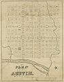 Austin Street Map, 1839.jpg 4,165 × 5,283; 5.03 MB
-
 Austin Texas US street map.svg 5,895 × 5,062; 15.35 MB
-
 Austin TX 1920 map.jpg 690 × 562; 128 KB
-
 AustinTXMap.png 575 × 425; 58 KB
-
 Barton Creek Square Mall Map.svg 1,145 × 901; 2.08 MB
-
 Central Austin Neighborhoods.jpg 1,145 × 901; 644 KB
-
 General Austin Map of Texas.jpg 749 × 1,105; 258 KB
-
 Greater Austin TX 1921 map.jpg 1,477 × 1,309; 709 KB
-
 Home Owners' Loan Corp. (HOLC) Neighborhood Redlining Grade in Austin, Texas.png 2,398 × 1,678; 4.25 MB
-
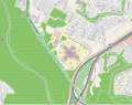
 Location of Waters Park in Austin, TX.jpg 1,560 × 1,199; 401 KB
-
 Map Austin (Texas).jpg 2,207 × 1,799; 1.02 MB
-
 Map of Waller Creek in 1927.jpg 2,455 × 2,236; 830 KB
-
 Map-USA-Texas-Austin01.png 2,401 × 2,291; 418 KB
-
 Map-USA-Texas-Austin01.svg 744 × 1,052; 492 KB
-
 Old map-Austin-1873-sm.jpg 4,309 × 3,202; 5.64 MB
-
 Old map-Austin-1873.jpg 7,328 × 5,443; 10.44 MB
-
 Old map-Austin-1887.jpg 8,000 × 5,497; 14.68 MB
-
 Partial View of Austin, Texas (28097439096).jpg 2,000 × 1,357; 755 KB
-
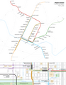 Project Connect Rail System Plan with Downtown Detail.png 2,550 × 3,300; 726 KB
-
 Race and ethnicity 2010- Austin (5560474714).png 3,009 × 3,009; 3.35 MB
-
 Race and ethnicity Austin (2000).png 3,009 × 3,009; 1.25 MB
-
 Texas CVC Map.png 1,467 × 1,080; 2.4 MB
-
 Texas FM 3177 map.svg 1,180 × 698; 80 KB
-
 Texas Loop 1 map.svg 1,180 × 698; 128 KB
-
 Texas Loop 111 map.svg 1,088 × 645; 788 KB
-
 Texas Loop 275 map.svg 1,088 × 645; 676 KB
-
 Texas Loop 343 map.svg 870 × 516; 275 KB
-
 Texas RM 2222 map.svg 1,180 × 698; 107 KB
-
 Texas Spur 69 map.svg 1,180 × 698; 90 KB
-
 Travis County Austin.svg 990 × 765; 647 KB
-
 TXMap-doton-Austin.PNG 300 × 284; 16 KB


_Neighborhood_Redlining_Grade_in_Austin,_Texas.png)

.jpg)


.jpg)

.png)
.png)


