Category:Maps of Portland, Oregon
Appearance
- 100 most populous cities of the United States
- 1–25
- Austin
- Boston
- Charlotte
- Chicago
- Columbus
- Dallas
- Denver
- El Paso
- Fort Worth
- Houston
- Indianapolis
- Jacksonville
- Los Angeles
- Nashville
- New York City
- Oklahoma City
- Philadelphia
- Phoenix
- Portland
- San Antonio
- San Diego
- San Francisco
- San Jose
- Seattle
- Washington, D.C.
- 26–50
- Arlington
- Atlanta
- Bakersfield
- Colorado Springs
- Detroit
- Fresno
- Kansas City
- Las Vegas
- Long Beach
- Louisville
- Memphis
- Miami
- Minneapolis
- Oakland
- Omaha
- Raleigh
- Sacramento
- Tucson
- Tulsa
- Virginia Beach
- Wichita
- 51–75
- Anaheim
- Anchorage
- Cincinnati
- Cleveland
- Corpus Christi
- Durham
- Greensboro
- Henderson
- Honolulu
- Irvine
- Jersey City
- Lexington
- Lincoln
- Newark
- New Orleans
- Orlando
- Pittsburgh
- Plano
- Saint Paul
- Santa Ana
- St. Louis
- Tampa
- 76–100
- Boise
- Buffalo
- Chesapeake
- Chula Vista
- Fort Wayne
- Laredo
- Lubbock
- Madison
- Norfolk
- Richmond
- Santa Clarita
- Scottsdale
- St. Petersburg
- Spokane
- Toledo
- Winston-Salem
Wikimedia category | |||||
| Upload media | |||||
| Instance of | |||||
|---|---|---|---|---|---|
| Category combines topics | |||||
| Portland | |||||
city and county seat of Multnomah County, Oregon, United States | |||||
| Pronunciation audio | |||||
| Instance of |
| ||||
| Part of | |||||
| Named after | |||||
| Location |
| ||||
| Located in or next to body of water | |||||
| Head of government |
| ||||
| Population |
| ||||
| Area |
| ||||
| Elevation above sea level |
| ||||
| Different from | |||||
| official website | |||||
 | |||||
Subcategories
This category has the following 7 subcategories, out of 7 total.
Media in category "Maps of Portland, Oregon"
The following 62 files are in this category, out of 62 total.
-
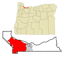
.Portland-Vancouver-Salem CSA.png 1,513 × 983; 112 KB
-
1889 map of the Columbia River.jpg 8,861 × 10,074; 8 MB
-
81286 PBOT Sixth-Sextant-logo 1.rev.1573672647.png 700 × 703; 128 KB
-
Balch creek.census.png 575 × 425; 299 KB
-
Beaumont-wilshire (topo).jpg 472 × 510; 242 KB
-
Beaumont-Wilshire(boundary).jpg 1,650 × 2,373; 1.02 MB
-
Code Oregon (18541631392).jpg 2,448 × 2,778; 3.56 MB
-
East Portland Grand Avenue HD boundary map.png 1,194 × 3,187; 997 KB
-
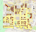
East Portland Grand Avenue HD contributing resources.png 3,187 × 1,194; 1.01 MB
-
Great Fire of 1873 Portland, OR.jpg 1,008 × 769; 312 KB
-
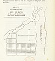
Hall Kelley's town, 1834.png 1,952 × 1,378; 1.71 MB
-
JadeDistrictMap.png 709 × 659; 266 KB
-
Journal of the Association of Engineering Societies (1881) (14764453912).jpg 3,992 × 1,482; 525 KB
-
Kings Hill HD boundary map with titles.png 1,800 × 1,994; 1.32 MB
-
Kings Hill HD boundary map.png 1,800 × 1,627; 1.18 MB
-
Map of Portland, Oregon land claims from Gaston book.png 1,779 × 2,779; 80 KB
-
Map territorial portland.jpg 21,600 × 22,621; 22.86 MB
-
Map web lg.jpg 941 × 659; 82 KB
-
ORMap-doton-Portland.png 300 × 232; 10 KB
-
Paving-map-of-portland-january-1-1894.jpg 3,200 × 4,544; 4.07 MB
-
Pennoyer v Neff Map.png 2,136 × 1,142; 2.21 MB
-
Plat of Portland OR c1850s.png 1,200 × 1,418; 3.21 MB
-
Portland 1901 (fire map).jpg 1,211 × 1,467; 1.12 MB
-
Portland Census Map.pdf 5,404 × 4,800; 3.44 MB
-
Portland downtown map.png 1,374 × 1,445; 1.27 MB
-
Portland GPS Logs - 2008-2012 - Flickr - aaronparecki.png 3,000 × 2,400; 1.81 MB
-
Portland map from Motoring Magazine 1915.png 2,277 × 1,232; 662 KB
-
Portland Multnomah.png 1,100 × 550; 44 KB
-
Portland New Chinatown-Japantown HD boundary map.png 1,334 × 2,081; 710 KB
-
Portland Oregon and Vancouver Washington US street map.svg 3,346 × 3,396; 22.23 MB
-
Portland Oregon ewstreets.png 317 × 720; 9 KB
-
Portland ParkBlocks diff.svg 150 × 215; 2 KB
-
Portland precincts blank.svg 2,480 × 2,126; 102 KB
-
Portland printable tourist attractions map.jpg 2,105 × 1,488; 1.49 MB
-
Portland Thirteenth Avenue HD boundary map.png 1,644 × 2,364; 825 KB
-
Portland travel time contour map (1964) - Flickr - Eric Fischer.jpg 2,430 × 2,778; 1.33 MB
-
Portland Trimet Map.png 3,440 × 1,874; 770 KB
-
Portland Yamhill HD boundary map.png 2,300 × 1,676; 901 KB
-
Portland's location relative to global trading routes in the late 19th century.png 1,503 × 1,503; 3.34 MB
-
Portland, Oregon 1890 Perspective Birds-eye-view Map.jpg 13,760 × 9,520; 35.12 MB
-
Portland, Oregon 1955 Yellow Book.jpg 800 × 1,136; 321 KB
-
Portland-Motoring Magazine-1915-070.jpg 2,272 × 1,207; 763 KB
-
Portland.png 491 × 416; 22 KB
-
Race and ethnicity Portland (1990).png 3,009 × 3,009; 3.32 MB
-
Race and ethnicity Portland (2000).png 3,009 × 3,009; 1.39 MB
-
Race and ethnicity Portland (2010).png 3,009 × 3,009; 3.79 MB
-
Savannah Portland NewYork City Blocks FG.jpg 324 × 591; 73 KB
-
Savannah Portland NewYork City Blocks.svg 325 × 575; 3 KB
-
South Portland HD boundary map.png 1,956 × 1,980; 1.83 MB
-
St. Johns and Sauvie Island.png 916 × 2,244; 1.02 MB
-
The Commercial and financial chronicle (1910) (14741522986).jpg 2,538 × 4,188; 1.91 MB
-
WV map Portland.png 798 × 636; 218 KB
-
WV map Portland.svg 744 × 1,052; 461 KB


