Category:OpenStreetMap maps of Papua New Guinea
Jump to navigation
Jump to search
Media in category "OpenStreetMap maps of Papua New Guinea"
The following 12 files are in this category, out of 12 total.
-
Bougainville2022OSM.png 2,721 × 3,074; 4.2 MB
-
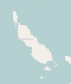
Location map Bourgainville Island.png 572 × 676; 17 KB
-
Location map New Britain and Ireland.png 734 × 641; 31 KB
-
Location map Papua New Guinea Gulf Province.png 788 × 552; 58 KB
-
Location map Sandaun Province.png 529 × 687; 28 KB
-
Map of Henry Reid Bay.jpg 1,235 × 811; 84 KB
-
NewBritain2022OSM.png 7,395 × 3,500; 16.12 MB
-
NewIreland2022OSM.png 5,255 × 3,914; 7.15 MB
-
OSM 2023 PNGuinea Bougainville.png 2,552 × 3,176; 3.48 MB
-
PapuaNewGuineaOMC.PNG 1,358 × 922; 114 KB
-
Sepik River watershed.jpg 1,482 × 851; 242 KB
-
TorresStraitIslands2022OSM.png 2,630 × 3,665; 4.22 MB


