Category:Maps of New South Wales
Jump to navigation
Jump to search
States of Australia: New South Wales · Queensland · South Australia · Tasmania · Victoria · Western Australia
Internal territories of Australia: Australian Capital Territory · Jervis Bay Territory · Northern Territory
External territories of Australia: Ashmore and Cartier Islands · Australian Antarctic Territory · Christmas Island · Cocos (Keeling) Islands · Coral Sea Islands · Heard Island and McDonald Islands · Norfolk Island
Wikimedia category | |||||
| Upload media | |||||
| Instance of | |||||
|---|---|---|---|---|---|
| Category combines topics | |||||
| New South Wales | |||||
state of Australia | |||||
| Instance of |
| ||||
| Named after |
| ||||
| Location | AUS | ||||
| Located in or next to body of water | |||||
| Capital | |||||
| Basic form of government |
| ||||
| Legislative body | |||||
| Executive body | |||||
| Highest judicial authority | |||||
| Head of state |
| ||||
| Head of government |
| ||||
| Inception |
| ||||
| Highest point | |||||
| Population |
| ||||
| Area |
| ||||
| Elevation above sea level |
| ||||
| Replaces |
| ||||
| official website | |||||
 | |||||
Maps of w:New South Wales
Subcategories
This category has the following 14 subcategories, out of 14 total.
C
D
L
M
N
O
P
R
T
Media in category "Maps of New South Wales"
The following 158 files are in this category, out of 158 total.
-
Aboriginal Tribes of Riverena.png 318 × 305; 15 KB
-
ACT-Jervis Bay-MJC minimap.png 1,200 × 1,008; 308 KB
-
ACT-Jervis Bay-MJC.png 1,200 × 1,008; 55 KB
-
ACT-Jervis Bay-MJC.svg 1,200 × 1,008; 364 KB
-
ACT-Jervis Bay-Sydney-MJC minimap.png 1,000 × 1,172; 320 KB
-
Admiralty Chart No 1017 Cape Everard to Montagu Island, Published 1963, New Edition 1966.jpg 11,054 × 16,269; 48.97 MB
-
Admiralty Chart No 1020 Tathra to Wollongong, Published 1961.jpg 11,122 × 16,255; 45.22 MB
-
Admiralty Chart No 1021 Port Jackson to Fraser Island, Published 1957.jpg 11,222 × 16,336; 42 MB
-
Admiralty Chart No 1025 Kiama to Norah Head, Published 1957, New Edition 1966.jpg 16,250 × 11,127; 44.72 MB
-
Admiralty Chart No 1027 Norah Head to Crowdy Head, Published 1957.jpg 16,238 × 11,066; 51.5 MB
-
Admiralty Chart No 1028 Crowdy Head to Wooli Head, Published 1955.jpg 11,072 × 16,254; 49.51 MB
-
Admiralty Chart No 1379 Plans in New South Wales, Published 1965.jpg 16,365 × 11,243; 55.56 MB
-
An account of a voyage to New South Wales (1810) (14593956418).jpg 1,304 × 2,832; 388 KB
-
Ashburnham County (NSW) map of 1886.png 604 × 395; 431 KB
-
Australia, NSW COVID-19 cases map 2021-07-24 11.15AM.png 631 × 452; 81 KB
-
Badjari Map.png 510 × 478; 15 KB
-
Barranbinya Lands.png 300 × 191; 5 KB
-
Beecroft in NSW.jpg 1,885 × 1,670; 344 KB
-
Blaxland's route across the mountains in 1813.jpg 287 × 427; 81 KB
-
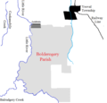
Bolderogery Parish Sketch Map.png 636 × 612; 26 KB
-
Bulli Map.jpg 2,288 × 1,712; 909 KB
-
Burrawang Map.jpg 1,611 × 1,073; 440 KB
-
Burrawang Map.xcf 1,611 × 1,073; 5.06 MB
-
Campbells Creek Map.png 835 × 761; 52 KB
-
Clarence County (NSW) map.png 435 × 389; 263 KB
-
ClarenceRiver.png 988 × 912; 22 KB
-
Cobham lake1.png 792 × 612; 747 KB
-
County of Farnell Parishs.png 824 × 295; 32 KB
-
County of Landsborough 1914.png 942 × 440; 26 KB
-
Covid 19 hotspot map for New South Wales (12 April 2020).png 526 × 431; 7 KB
-
Cundletown, New South Wales.png 1,221 × 741; 37 KB
-
Delilah County1.png 757 × 485; 31 KB
-
Denham County 1876 map.png 473 × 417; 245 KB
-
EB1911 - New South Wales.png 2,968 × 2,180; 5.35 MB
-
Electoral divisions of Australia, 2004 (New South Wales).gif 1,022 × 597; 24 KB
-
EvelynCounty1.png 471 × 520; 38 KB
-
Flag-map of New South Wales.svg 512 × 441; 18 KB
-
Fowlers Gap, New South Wales.png 875 × 684; 12 KB
-
Great Darling Anabranch Map.jpg 300 × 421; 19 KB
-
Great North Walk.jpg 5,632 × 9,573; 4.54 MB
-
Harvey Parish (Peak Hill) NSW.png 503 × 391; 9 KB
-
HumeHwy-StripMap.png 399 × 2,000; 124 KB
-
HUndred of Bingelley.png 479 × 511; 11 KB
-
Hundred of Heathcote.png 404 × 682; 13 KB
-
Hundred of Richmond2.png 500 × 500; 9 KB
-
Hunter River 1901 SLNSW FL10521075.jpg 8,682 × 5,577; 8.38 MB
-
Johns River parish Macquaire County.png 1,237 × 659; 46 KB
-
Killara County (NSW) 1941.png 649 × 476; 21 KB
-
Kulltilla Map.png 511 × 479; 24 KB
-
LangParish 11.png 1,241 × 754; 26 KB
-
LiverpoolNSWmap.jpg 851 × 639; 239 KB
-
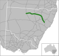
Location Kamilaroi Hwy.svg 421 × 399; 352 KB
-
Map of Broughams Gate.png 1,246 × 769; 15 KB
-
Map of Burns, New South Wales.png 1,251 × 539; 24 KB
-
Map of Campbells Creek, Fowlers Gap New South Wales.png 835 × 761; 52 KB
-
Map of Clyde County in New South Wales 1876.png 347 × 224; 98 KB
-
Map of Cowper county in 1876.png 558 × 437; 5 KB
-
Map of Gloucester County NSW (Australia).png 629 × 442; 375 KB
-
Map of Karrenggapa Traditional Lands.png 514 × 492; 32 KB
-
Map of lang ParishNSW.png 1,238 × 749; 25 KB
-
Map of Lismore Parish near Wanaaring, New South Wales.png 832 × 484; 13 KB
-
Map of Little Topar, New South Wales.png 1,259 × 777; 26 KB
-
Map of location of Windolay in NSW Australia.png 581 × 410; 6 KB
-
Map of Monteagle County (NSW) Australia.png 561 × 405; 408 KB
-
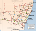
Map of NSW Highways.png 1,200 × 1,020; 1.05 MB
-
Map of Sandon County (NSW) Australia.png 471 × 434; 357 KB
-
Map of Thackaringa.png 476 × 226; 11 KB
-
Map of the Colo River.png 1,280 × 671; 28 KB
-
Map of the traditional lands of the Gundangurra people.png 314 × 310; 5 KB
-
Map of the Unincorperated area of Far Western New South Wales.png 1,091 × 753; 30 KB
-
Map of the Willandra Lakes Region, showing the World Heritage Area boundaries, 2008.jpg 1,283 × 2,459; 471 KB
-
Map of Tilpa New South Wales.png 688 × 574; 18 KB
-
Map of Wanaaring and Tibubuirra, far western New South Wales.png 941 × 575; 13 KB
-
Map of Wanaaring, New South Wales.png 767 × 609; 4 KB
-
Map of where planets (signs) are located - panoramio.jpg 4,288 × 2,848; 6.65 MB
-
Map of Yandagulla Parish, near Louth, New South Wales.png 468 × 493; 15 KB
-
Map of Yarraba Parish.png 577 × 434; 8 KB
-
Map showing Parishes of Yanda County.png 483 × 438; 249 KB
-
Map showing the location of Cockle Creek South of Newcastle, NSW.png 959 × 391; 21 KB
-
Map showing the location of Gulgo County, New South Wales.png 1,015 × 580; 9 KB
-
Map showing the location of Parry County (NSW).png 1,015 × 580; 3 KB
-
Map showing the location of Tara County, New South Wales.png 437 × 427; 12 KB
-
Map showing the location of Wanaaring, New South Wales.png 767 × 609; 19 KB
-
Map showing the location of Windeyer County (New South Wales).png 1,015 × 580; 16 KB
-
McClay River.png 1,278 × 745; 8 KB
-
Milsons Passage & Milson Island.jpg 500 × 610; 179 KB
-
MoreetoBoggabilla.png 977 × 733; 46 KB
-
Morfotts Creek (Fowlers Gap) NSW map1.png 1,278 × 783; 28 KB
-
Mouramba County map 1886.png 1,280 × 1,024; 47 KB
-
Murchison County (NSW) Map 1886.png 592 × 433; 443 KB
-
MuruwariLands.png 307 × 315; 1 KB
-
Narromine Parish (Oxley County) map.png 844 × 548; 26 KB
-
Narromine Parish (Oxley County) map2.png 844 × 548; 7 KB
-
National Native Title Tribunal Map of the application area (South Coast).pdf 1,754 × 2,481; 4.49 MB
-
New England.jpg 1,811 × 1,976; 309 KB
-
New South Wales cadastral divisions.png 1,400 × 1,144; 469 KB
-
New South Wales Districts Map.svg 2,295 × 1,638; 845 KB
-
New South Wales Köppen.svg 765 × 972; 737 KB
-
New South Wales regions map.png 1,592 × 1,386; 1.26 MB
-
Ngunawal Lands.png 243 × 191; 3 KB
-
NNTT Map of the Yuin South Coast native title claim NSW.png 2,340 × 3,309; 1.94 MB
-
NSW floods by LGA 20101205.png 1,000 × 877; 331 KB
-
NSW LGA map (cropped).png 1,000 × 877; 741 KB
-
NSW LGA.svg 744 × 1,052; 289 KB
-
NSW Map 25 04 2021.png 996 × 698; 97 KB
-
NSW Metropolitan Map 25 04 2021.png 1,150 × 807; 101 KB
-
NSW region map.png 916 × 776; 145 KB
-
NSW Warrumbungles Tourist drives.jpg 4,032 × 3,024; 4.78 MB
-
OTA Zone map.jpg 404 × 336; 73 KB
-
Outback NSW regions map.png 3,917 × 3,266; 1.21 MB
-
Outback NSW regions map.svg 750 × 625; 3.02 MB
-
Packsaddle, New South Wales.png 689 × 565; 3 KB
-
Parro River Map.png 195 × 326; 8 KB
-
Pelaw Main Map.png 1,920 × 1,701; 194 KB
-
Persooniaterminalisrgemap.png 1,024 × 907; 97 KB
-
Police Districts Campbell Town, Camden, Narellan and Picton also Liverpool (14086767594).jpg 1,000 × 1,021; 1,012 KB
-
PooleCounty3.png 396 × 326; 21 KB
-
Ragleigh County (NSW) map.png 505 × 434; 392 KB
-
RCC Operational Area Overview.jpg 3,507 × 4,960; 4.48 MB
-
Riverina 1916.jpg 1,129 × 745; 366 KB
-
Riverina NSW copie.png 799 × 599; 216 KB
-
Road towards the Monaro region, within Murray County.jpeg 1,200 × 1,200; 166 KB
-
Robertson Map.jpg 1,727 × 1,447; 725 KB
-
Rostrum Speakers Rock Middle Harbour MAP.001.jpg 432 × 531; 58 KB
-
Rylstone-street map.png 465 × 703; 86 KB
-
Southeastern New South Wales regions map.png 1,330 × 1,399; 374 KB
-
Southeastern New South Wales regions map.svg 750 × 625; 1.98 MB
-
Speers Point, New South Wales map.svg 341 × 287; 72 KB
-
Stage 1 map.png 760 × 1,015; 709 KB
-
Stephens Creek map.png 1,228 × 641; 22 KB
-
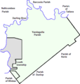
StewartParish-NSwmap12.png 652 × 617; 7 KB
-
Sturt Parish Pool County (NSW).png 512 × 583; 5 KB
-
SVG-Koort Nee-Süüd-Wales.svg 720 × 600; 7 KB
-
Sydney statistical areas.png 2,212 × 1,928; 921 KB
-
Sydneyclimatezone.jpg 2,204 × 3,233; 261 KB
-
Three cities.png 1,012 × 742; 610 KB
-
Tindara Parish, Poole County1.png 579 × 609; 7 KB
-
Tongowoko County1.png 342 × 279; 9 KB
-
Total Full Time Workload Equivalent GPs in New South Wales.png 1,152 × 864; 50 KB
-
Tourism in the 1930s (5691841050).jpg 1,500 × 864; 1.25 MB
-
Traditional lands of Aboriginal tribes in Central NSW.png 312 × 320; 19 KB
-
Tuggerah lake map.jpg 400 × 561; 114 KB
-
Tuggerah Lake map.png 400 × 561; 14 KB
-
UlararaCounty1map.png 761 × 508; 29 KB
-
Wagga Wagga Suburbs and Towns (Development V1).png 1,500 × 1,250; 264 KB
-
Ward Map of Woollahra.gif 1,950 × 2,934; 475 KB
-
Wrrambungles diagram.png 445 × 630; 137 KB
-
Yandaminta Creek.png 304 × 301; 8 KB
-
Yantara Map2.png 562 × 551; 3 KB
