Category:Maps of Christmas Island
Jump to navigation
Jump to search
States of Australia: New South Wales · Queensland · South Australia · Tasmania · Victoria · Western Australia
Internal territories of Australia: Australian Capital Territory · Jervis Bay Territory · Northern Territory
External territories of Australia: Ashmore and Cartier Islands · Australian Antarctic Territory · Christmas Island · Cocos (Keeling) Islands · Coral Sea Islands · Heard Island and McDonald Islands · Norfolk Island
Wikimedia category | |||||
| Upload media | |||||
| Instance of | |||||
|---|---|---|---|---|---|
| Category combines topics | |||||
| Christmas Island | |||||
Australian external territory in the Indian Ocean | |||||
| Audio | |||||
| Instance of | |||||
| Part of | |||||
| Named after | |||||
| Location | AUS | ||||
| Located in or next to body of water | |||||
| Capital | |||||
| Highest judicial authority |
| ||||
| Official language | |||||
| Anthem | |||||
| Currency | |||||
| Inception |
| ||||
| Highest point |
| ||||
| Population |
| ||||
| Area |
| ||||
| Elevation above sea level |
| ||||
| Top-level Internet domain |
| ||||
| Different from | |||||
| official website | |||||
 | |||||
Subcategories
This category has the following 2 subcategories, out of 2 total.
L
T
Pages in category "Maps of Christmas Island"
This category contains only the following page.
Media in category "Maps of Christmas Island"
The following 24 files are in this category, out of 24 total.
-
A monograph of Christmas Island (Indian Ocean) (6376439107).jpg 1,797 × 1,461; 474 KB
-
Admiralty Chart No 3504 Christmas Island, Indian Ocean, Published 1933.jpg 24,364 × 16,652; 89.42 MB
-
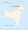
Christmas Island (Australia) map.png 330 × 355; 4 KB
-
Christmas island 76.svg 1,049 × 968; 478 KB
-
Christmas Island Australia 76-fr.png 1,462 × 1,322; 365 KB
-
Christmas Island Australia 76-fr.svg 1,241 × 1,123; 245 KB
-
Christmas Island Australia 76-mk.svg 1,241 × 1,123; 245 KB
-
Christmas Island location map.svg 1,241 × 1,123; 32 KB
-
Christmas Island Map NL.png 2,154 × 1,891; 1.14 MB
-
Christmas Island Map.png 2,154 × 1,891; 742 KB
-
Christmas Island Map.svg 512 × 461; 3 KB
-
Christmas Island Map2.png 1,612 × 1,414; 1,010 KB
-
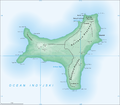
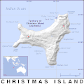
Christmas Island relief location map.svg 1,241 × 1,123; 110 KB
-
Christmas Island-CIA WFB Map.png 330 × 355; 4 KB
-
FirstMap-ChristmasIsland.jpg 460 × 452; 201 KB
-
Kt-map.png 330 × 355; 4 KB
-
Lingiari division map.png 207 × 111; 2 KB
-
Map of Christmas Island 1976.jpg 839 × 766; 692 KB
-
Map of Christmas Island, 1837.jpg 139 × 200; 7 KB
-
PAT - Christmas Island.gif 800 × 800; 46 KB
-
Weihnachtsinsel-en.jpg 330 × 355; 15 KB
-
Weihnachtsinsel.png 330 × 355; 6 KB
-
World Factbook (1990) Christmas Island.jpg 583 × 542; 108 KB

