Category:Rail transport maps of New South Wales
Jump to navigation
Jump to search
Subcategories
This category has the following 2 subcategories, out of 2 total.
M
- Maps of Sydney Metro (15 F)
S
Media in category "Rail transport maps of New South Wales"
The following 34 files are in this category, out of 34 total.
-
Berrima map.jpg 600 × 447; 108 KB
-
Chemin copie.png 800 × 536; 211 KB
-
Chemin de fer NSW.png 800 × 536; 220 KB
-
CountrylinkMap.png 2,151 × 1,441; 289 KB
-
East Hills railway map.jpg 2,576 × 1,040; 1.03 MB
-
Eastern Suburbs & Illawarra Line map.jpg 2,604 × 4,929; 386 KB
-
Eastern Suburbs & Illawarra Line map.png 2,879 × 6,079; 291 KB
-
Eclrailline.png 560 × 341; 33 KB
-
ESI map.png 270 × 319; 56 KB
-
HVL.png 1,600 × 2,133; 492 KB
-
JNL.png 1,600 × 2,133; 207 KB
-
Järnvägsbanor i New South Wales.png 800 × 536; 227 KB
-
Map of One Rail Australia facilities and serviced lines.png 3,327 × 2,144; 869 KB
-
Morpeth railway map.jpg 600 × 434; 90 KB
-
Murulla.jpg 440 × 113; 21 KB
-
New South Wales metropolitan rail area.svg 567 × 567; 86 KB
-
NSWRailMap.png 2,151 × 1,441; 427 KB
-
SBO station.png 1,600 × 2,133; 665 KB
-
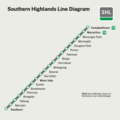
SHL line diagram.png 10,417 × 10,417; 1.67 MB
-
SHL line diagram.svg 2,000 × 2,000; 72 KB
-
Sydney rail 1894.png 3,000 × 2,898; 633 KB
-
UDR.png 1,600 × 2,133; 241 KB
-
WOC.png 1,600 × 2,133; 137 KB


