Category:Maps of Queensland
Jump to navigation
Jump to search
States of Australia: New South Wales · Queensland · South Australia · Tasmania · Victoria · Western Australia
Internal territories of Australia: Australian Capital Territory · Jervis Bay Territory · Northern Territory
External territories of Australia: Ashmore and Cartier Islands · Australian Antarctic Territory · Christmas Island · Cocos (Keeling) Islands · Coral Sea Islands · Heard Island and McDonald Islands · Norfolk Island
Wikimedia category | |||||
| Upload media | |||||
| Instance of | |||||
|---|---|---|---|---|---|
| Category combines topics | |||||
| Queensland | |||||
state of Australia | |||||
| Instance of |
| ||||
| Named after | |||||
| Location | AUS | ||||
| Capital | |||||
| Legislative body | |||||
| Executive body | |||||
| Highest judicial authority | |||||
| Head of state |
| ||||
| Head of government |
| ||||
| Inception |
| ||||
| Highest point | |||||
| Population |
| ||||
| Area |
| ||||
| Elevation above sea level |
| ||||
| Replaces | |||||
| official website | |||||
 | |||||
Maps of w: Queensland
Subcategories
This category has the following 19 subcategories, out of 19 total.
C
- Cadastral maps of Queensland (52 F)
D
E
- Queensland estate maps (88 F)
G
L
- Locator maps of Queensland (79 F)
M
- Maps of K'gari (17 F)
O
P
R
- Maps of Queensland Roads (48 F)
Media in category "Maps of Queensland"
The following 171 files are in this category, out of 171 total.
-
'ndrangheta in Queensland.jpg 467 × 488; 28 KB
-
1862 change to Queensland's western border.jpg 200 × 329; 21 KB
-
1wiresshouses.svg 358 × 306; 9 KB
-
601182 - Mount Isa Mine Early Infrastructure - Map 1 (2016).jpg 707 × 1,000; 89 KB
-
650002 - Marburg State School - boundary map 2 (2015).jpg 707 × 1,000; 107 KB
-
650003 - Murgon State School - boundary map 2 (2015).jpg 707 × 1,000; 120 KB
-
650034 Southport State High School - Map 2 (2016).jpg 1,000 × 707; 112 KB
-
650046 - Bundaberg State High School - map 2 (2017).jpg 707 × 1,000; 119 KB
-
650050 - Toowoomba East State School - map 2 (2017).jpg 707 × 1,000; 120 KB
-
650083 - Laurel Bank Park - Map 1 (2018).jpg 1,000 × 707; 90 KB
-
650083 - Laurel Bank Park - Map 2 (2018).jpg 1,000 × 707; 146 KB
-
A2015 Cape York Peninsula map.svg 583 × 751; 291 KB
-
Admiralty Chart No 1021 Port Jackson to Fraser Island, Published 1957.jpg 11,222 × 16,336; 42 MB
-
Admiralty Chart No 1102 Cleveland Bay, Published 1962.jpg 13,652 × 11,293; 51.9 MB
-
Admiralty Chart No 1670 Approaches to Moreton Bay, Published 1951.jpg 16,223 × 11,123; 48.03 MB
-
Admiralty Chart No 1673 Moreton Bay Approaches to Brisbane, Published 1950.jpg 16,163 × 11,074; 50.79 MB
-
Admiralty Chart No 1937 Adolphus Channel, Published 1953.jpg 11,084 × 16,288; 40.89 MB
-
Admiralty Chart No 2355 Lizard Island to Cape Sidmouth, Published 1959.jpg 16,445 × 11,237; 38.84 MB
-
Admiralty Chart No 2919 Cape Grenville to Cape York, Published 1959.jpg 11,263 × 18,420; 48.93 MB
-
Admiralty Chart No 347 Percy Isles to Whitsunday Passage, Published 1965.jpg 11,256 × 16,436; 55.98 MB
-
Admiralty Chart No 3762 Hay Island to Bow Reef, Published 1911.jpg 11,090 × 16,254; 45.47 MB
-
Admiralty Chart No 3782 Endeavour Strait, Published 1933.jpg 17,970 × 11,034; 35.67 MB
-
Admiralty Chart No 3783 Endeavour Strait, Published 1953.jpg 11,090 × 16,283; 47.02 MB
-
Admiralty Chart No 383 Thursday Island Harbour, Published 1952.jpg 11,256 × 8,265; 28.42 MB
-
Advertising land sale in Glass House Mountains under the title "Pineapple Farms Beerwah", 1903.jpg 13,596 × 21,287; 41.75 MB
-
Australia lei map.png 371 × 352; 39 KB
-
Australia lei map.svg 400 × 400; 256 KB
-
Australia Mines1.png 450 × 450; 84 KB
-
Ayr Masonic Temple, 2021 - Site plan.jpg 566 × 800; 58 KB
-
Badjari Map.png 510 × 478; 15 KB
-
Belmont Tramway map.png 651 × 554; 469 KB
-
Blank Qld region map.PNG 1,202 × 1,426; 50 KB
-
Blue Lake location map.jpg 454 × 600; 60 KB
-
Boundary Map 2 (2016).jpg 706 × 1,000; 114 KB
-
Burke and Wills Plant Camp boundary map, 2015.jpg 1,000 × 706; 109 KB
-
Byfield area map.pdf 1,239 × 1,752, 2 pages; 279 KB
-
Cadastral map 20chain series Queensland, Sheet 2520,1962.jpg 9,074 × 6,800; 7.94 MB
-
Capricorn-coast-map.jpg 500 × 590; 108 KB
-
Caravonica - Cairns - Map.png 1,056 × 1,024; 190 KB
-
Catchments along the Great Barrier Reef.jpg 522 × 668; 59 KB
-
Clapham Junction portions 185 186 199 200.jpg 636 × 1,000; 315 KB
-
Cook's Landing Place, Town od 1770 map 1 (2020).jpg 707 × 1,000; 119 KB
-
Coolgarra Mine Map Provisional.jpg 6,190 × 9,921; 18.69 MB
-
County of Wellesley parishes.svg 1,144 × 949; 130 KB
-
Covid 19 hotspot map for Queensland (12 April 2020).png 800 × 1,054; 80 KB
-
Dallarnil township; Charles White, Auctioneer ; J. Hamilton Adair, Surveyor, 1913.jpg 4,781 × 6,000; 6.55 MB
-
Detroit de torres.png 386 × 298; 4 KB
-
Djagaraga-Gudang territory in Cape York, Queensland, Australia.png 2,572 × 2,168; 103 KB
-
Electoral district of Rockhampton.tif 7,164 × 4,727; 96.9 MB
-
Electoral district of Toowoomba North (Queensland, Australia).png 1,120 × 1,033; 749 KB
-
Electoral district of Toowoomba South (Queensland, Australia).png 1,074 × 842; 713 KB
-
Fantome Island - aerial 1 (2012).jpg 1,000 × 699; 146 KB
-
Fantome Island - aerial 2 (2012).jpg 778 × 544; 104 KB
-
Fantome Island - location map for aerials (2012).jpg 1,000 × 706; 43 KB
-
Fitzroy River Cathcment7.png 979 × 737; 9 KB
-
Flag-map of Queensland.svg 512 × 634; 26 KB
-
G-link route diagram.png 4,020 × 5,313; 1.02 MB
-
G-link route diagram.svg 744 × 1,052; 56 KB
-
Gold Coast Suburbs Map.gif 1,600 × 2,283; 575 KB
-
Golden Gate Mining and Town Complex - boundary map (2015).jpg 707 × 1,000; 105 KB
-
Great Palm Island highlighted.PNG 790 × 650; 1,023 KB
-
Heritage boundaries, Mareeba Uniting Church, 2021.png 566 × 800; 193 KB
-
Heritage register boundary map, The Fort, Oxley, 2020.png 566 × 800; 182 KB
-
Khim climate.png 420 × 323; 137 KB
-
Koolatha County Qld in 1900.png 561 × 376; 14 KB
-
Kuranda Fig Tree Avenue, Species Map, 2018.jpg 1,000 × 678; 113 KB
-
Lake Galilee Map.jpg 827 × 1,170; 748 KB
-
Ludwig Leichhardt Map, Moreton Bay to Port Essington,1844-1845.jpg 1,322 × 827; 133 KB
-
Mackay area tourist drives.jpg 4,032 × 3,024; 4.46 MB
-
Map and aerial photo inset showing the area of the Mount Morgan mine site.png 1,379 × 907; 2.97 MB
-
Map of Area Occupied by Wangerriburra People, Queensland.png 1,417 × 2,079; 159 KB
-
Map of Joseph Brady Park, Barellan Point, 2021.jpg 1,080 × 1,920; 484 KB
-
Map of Marodian Goldfield, 1914.jpg 774 × 567; 80 KB
-
Map of Napranum Aboriginal Shire (shown in yellow), 2017.jpg 1,191 × 1,098; 102 KB
-
Map of Peake's Dairy Farm at St Johns Wood, Ashgrove.jpg 2,384 × 1,758; 457 KB
-
Map of Queensland's major mineral, coal and petroleum operations and resources, 2019.pdf 2,479 × 3,506; 3.39 MB
-
Map of the Gold Coast from Coomera Island to Nobby Beach, 1887.jpg 7,421 × 9,201; 11.42 MB
-
Map of the town of Edungalba, 1875.jpg 8,048 × 6,018; 9.31 MB
-
Map of the Wet Tropics of Queensland - UNESCO World Heritage List.jpg 5,316 × 9,934; 47.83 MB
-
Map remnants of "Mr Kennedy's sketches from camp VIII to camp LXXXII", 1848.jpg 984 × 1,400; 178 KB
-
Map showing the location of Bowen Basin in relation to Australia.jpg 450 × 338; 189 KB
-
Mapwettropicsnrmregion.jpg 3,221 × 4,712; 481 KB
-
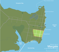
Margate-queensland-suburb-map.png 999 × 882; 201 KB
-
Mount Cuthbert Township and Smelter - boundary map (2014).jpg 707 × 1,000; 103 KB
-
QLDL-MountIsa.png 1,200 × 1,400; 155 KB
-
MRT Range Map G-M.pdf 2,700 × 3,600; 664 KB
-
Mulgowie railway line, 1942.jpg 729 × 996; 122 KB
-
Municipalities Queensland 1858-1877.png 252 × 334; 8 KB
-
New Thuringowa city suburb map.JPG 570 × 665; 34 KB
-
Newellton 20 Chains To An Inch Mine Map Provisional, 1965.jpg 9,921 × 6,346; 10.64 MB
-
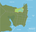
Newport-queensland-suburb-map.png 999 × 882; 205 KB
-
North Down Map - panoramio.jpg 3,216 × 4,288; 3.26 MB
-
North Queensland with 22 Degree(s) Line 2.svg 744 × 1,052; 2.41 MB
-
Pacific Culture Areas-de incl. Queensland and Peru.png 1,271 × 778; 306 KB
-
Pacific Culture Areas-de incl. Queensland.png 1,731 × 1,125; 671 KB
-
Palm Island Queensland locator map.png 790 × 650; 1 MB
-
Palm Islands context map blank.png 805 × 670; 1,004 KB
-
Palm Islands context map en.png 805 × 670; 1.18 MB
-
Palm Islands Queensland map blank.png 614 × 576; 567 KB
-
Palm Islands Queensland map en.png 563 × 595; 660 KB
-
Parishes in the County of Torres, Queensland.png 797 × 1,097; 724 KB
-
Parishes in the Torres Strait, Australia.png 1,867 × 1,291; 2.86 MB
-
Plan of Hewittville, situated at Emu Park (Sheet 1).jpg 4,089 × 6,000; 3.62 MB
-
Plan of Hewittville, situated at Emu Park (sheet 2).jpg 4,099 × 6,000; 4.16 MB
-
Plan of the town of Bowen, 1861.jpg 1,400 × 781; 146 KB
-
Prenzlau State School - boundary map 2 (2015).jpg 707 × 1,000; 82 KB
-
PrinceCharlotteBay.png 7,560 × 7,560; 70.59 MB
-
Qld dividedsmall.png 851 × 1,090; 141 KB
-
QLD electorates 2017 redistribution.png 1,112 × 1,116; 31 KB
-
Qld region map 2.PNG 1,302 × 1,423; 88 KB
-
QLD-locate-base.png 1,200 × 1,400; 154 KB
-
QLD-map-mcr.png 1,200 × 1,400; 276 KB
-
QLD-mapl-mountisa.png 1,200 × 1,400; 194 KB
-
Qld-regions-map.gif 600 × 695; 63 KB
-
Queensland 25 04 2021.png 832 × 794; 78 KB
-
Queensland and British New Guinea prepared for Educational purposes.jpg 3,820 × 6,000; 5.71 MB
-
Queensland boundaries as proclaimed in 1859.jpg 200 × 322; 19 KB
-
Queensland far north map.PNG 510 × 795; 28 KB
-
Queensland Köppen.svg 765 × 1,368; 932 KB
-
Queensland LGA types.png 529 × 535; 68 KB
-
Queensland oil spill map small.PNG 239 × 293; 11 KB
-
Queensland Parish Directory ed 3 1987.pdf 1,239 × 1,754, 184 pages; 40.45 MB
-
Queensland published by Geo. F. Cram.jpg 3,923 × 6,000; 3.55 MB
-
Queensland WV.png 5,906 × 5,906; 1.54 MB
-
Queenslandroads.png 540 × 720; 12 KB
-
Ravensbourne Parish and Locality Map.svg 558 × 945; 29 KB
-
Redcliffe-peninsula-queensland-suburb-map.png 999 × 882; 243 KB
-
Redcliffe.svg 1,208 × 1,071; 66 KB
-
Richmond mine and battery - boundary map (2006).jpg 707 × 1,000; 79 KB
-
Rockhampton (2009) 02.jpg 2,640 × 4,122; 9.84 MB
-
Rothwell-queensland-suburb-map.png 999 × 882; 206 KB
-
Régions du Queensland copie.png 548 × 599; 112 KB
-
Satellite Image southern Moreton Bay Queensland Australia.jpg 339 × 392; 28 KB
-
Savannasaurus-fig2-map.png 1,370 × 1,326; 1.2 MB
-
Scarborough-queensland-suburb-map.png 999 × 882; 204 KB
-
SEQ location map.svg 1,200 × 1,800; 652 KB
-
SEQ-Councils-ScenicRim.png 820 × 1,280; 301 KB
-
Site plan with significant elements, The Fort, Oxley, 2020.png 566 × 800; 252 KB
-
Site plan, Mareeba Uniting Church, 2021.jpg 565 × 800; 74 KB
-
Sketch map of gold & mineral fields Wide Bay & Burnett districts, 1914.jpg 5,000 × 6,319; 17.54 MB
-
State map of Queensland.jpg 4,112 × 6,000; 4.66 MB
-
Storm path of Cyclone Mahina, 1899.jpg 2,289 × 1,459; 690 KB
-
Suncoastshires.png 250 × 293; 23 KB
-
SVG-Koort Queensland.svg 1,466 × 1,960; 44 KB
-
The Quarterly journal of the Geological Society of London (12512795885).jpg 2,237 × 2,768; 1.61 MB
-
ThursdayIsland-Map.png 528 × 385; 11 KB
-
Topographic map, 4-mile military series, Ipswich, edition 2, 1942.jpg 5,157 × 6,784; 5.32 MB
-
Torres Strait txu-pclmaps-oclc-8322829 n 14.jpg 2,122 × 1,365; 1.89 MB
-
TorresStraitIslandsMap with Bramble Cay.png 929 × 922; 2.46 MB
-
TorresStraitIslandsMap.png 929 × 922; 28 KB
-
Town of Caloundra.jpg 6,000 × 4,385; 7.05 MB
-
Wavell Heights Presbyterian Church, 2022 - Site map.jpg 565 × 800; 80 KB
-
Wenlock Goldfield - boundary map (2006).jpg 707 × 1,000; 86 KB
-
Woody-Point-queensland-suburb-map.png 999 × 882; 201 KB
-
Yarrabee-LocationMap.jpg 1,350 × 1,559; 295 KB


