Category:Maps of Sydney
Jump to navigation
Jump to search
Wikimedia category | |||||
| Upload media | |||||
| Instance of | |||||
|---|---|---|---|---|---|
| Category combines topics | |||||
| Sydney | |||||
capital city of New South Wales, Australia | |||||
| Instance of |
| ||||
| Named after | |||||
| Location | New South Wales, AUS | ||||
| Located in or next to body of water | |||||
| Present in work |
| ||||
| Inception |
| ||||
| Significant event |
| ||||
| Population |
| ||||
| Area |
| ||||
| Elevation above sea level |
| ||||
| Different from | |||||
| Maximum temperature record |
| ||||
| Minimum temperature record |
| ||||
| official website | |||||
 | |||||
Subcategories
This category has the following 10 subcategories, out of 10 total.
D
E
- Election maps of Sydney (13 F)
K
- Maps of Kirribilli (6 F)
L
O
- Old maps of Sydney (56 F)
- OpenStreetMap maps of Sydney (11 F)
P
- Maps of Sydney parishes (65 F)
T
- Travel maps of Sydney (29 F)
Media in category "Maps of Sydney"
The following 161 files are in this category, out of 161 total.
-
1839 - Olympic Cauldron at Sydney Olympic Park - SHR Plan 2343 (5061184b100).jpg 705 × 1,000; 264 KB
-
1999SydHail Map Ctr.PNG 225 × 162; 5 KB
-
1999SydHail Map Nth.PNG 225 × 193; 5 KB
-
67renwick.jpg 440 × 263; 17 KB
-
67renwick.svg 440 × 264; 16 KB
-
Ashfield Cherrie Hynton Estate, 1919, Richardson and Wrench.jpg 799 × 1,050; 612 KB
-
Ashfield Heights Estate Canterbury, 1920, Richardson and Wrench.jpg 697 × 1,050; 592 KB
-
Ashfield South Hillcot Estate, 1912, Richardson and Wrench.jpg 666 × 1,050; 536 KB
-
Ashfield The Hill Top Estate , 1924, Richardson and Wrench.jpg 698 × 1,050; 571 KB
-
Ashfield Vale, c.1910, Hardie and Corman.jpg 753 × 1,050; 631 KB
-
Ashfield Vale, c.1910, Raine and Horne.jpg 614 × 1,050; 445 KB
-
Ashfield Villa Sites, c.1890, W Pritchard.jpg 679 × 1,050; 452 KB
-
Australian Electoral Division of Parramatta, 2016.png 5,650 × 5,500; 301 KB
-
Avalon Beach Central Estate, Avalon Pde, Barrenjoey Rd, 1921-1926.jpg 5,000 × 4,031; 4.33 MB
-
Avalon Beach Estate Plateau Rd, Park Reserve, 1921-1926.jpg 5,000 × 4,672; 5.31 MB
-
Avalon Beach Estates, Central Rd, Plateau Rd, 1921-1926.jpg 5,000 × 4,012; 8.45 MB
-
Avalon Sanctuary Estate, Park Ave, 1921-1926.jpg 5,000 × 3,770; 4.51 MB
-
Balmain Map 1.JPG 729 × 395; 56 KB
-
Bays West Precinct Issues Map.png 1,224 × 960; 1.7 MB
-
Bayside Council LGA Sydney 2016.png 335 × 299; 62 KB
-
Blacktown township, subdivision plan, 1886.jpg 691 × 1,050; 590 KB
-
Botany real estate map, 1907.tif 5,986 × 8,925; 152.88 MB
-
Bradfield plan.png 1,087 × 1,052; 141 KB
-
Canada Bay sydney.png 335 × 299; 61 KB
-
Canterbury Park Race Course, c.1920.jpg 1,400 × 1,060; 972 KB
-
Canterbury South Ashfield, 1929, Richardson and Wrench.jpg 707 × 1,050; 591 KB
-
Castle hill NSW State Electoral District.png 400 × 399; 46 KB
-
Catchment second airport.png 874 × 552; 194 KB
-
Choice Villa Sites, Ashfield, 1876, Watkin and Watkin.jpg 756 × 1,050; 605 KB
-
Chuch Point "Browns Block" Pittwater - Browns Rd, Quarter Session Rd, Bay View Rd, 1920.jpg 3,296 × 5,000; 4.44 MB
-
Church Point Estate Pittwater - Quarter Session Rd, Lane Cove, 1909.jpg 3,198 × 5,000; 2.28 MB
-
City of Sydney 1909-1949.png 1,706 × 1,447; 996 KB
-
City of Sydney 1949-1968.png 1,879 × 1,893; 1.3 MB
-
City of Sydney 1968-1982.png 1,514 × 1,401; 883 KB
-
City of Sydney 1982-1988.png 1,554 × 1,859; 1.08 MB
-
City of Sydney 1989-2003.png 1,175 × 1,082; 540 KB
-
City of Sydney 2003-2004.png 1,554 × 1,128; 916 KB
-
City of Sydney Essex and Harrington Street Subdivision.jpg 1,400 × 941; 773 KB
-
City of Sydney Observatory Hill auction 1910.jpg 741 × 1,050; 657 KB
-
City of Sydney The Rocks Subdivision 1907.jpg 747 × 1,050; 640 KB
-
City of sydney.png 335 × 299; 61 KB
-
Collaroy subdivision plan 1922 Brooks.jpg 711 × 1,050; 819 KB
-
COS pre 1909.png 2,259 × 2,259; 1.32 MB
-
Cumberland County Parishes.png 1,694 × 2,606; 715 KB
-
Cumberland County Parishes.svg 1,495 × 2,300; 412 KB
-
Division of PARRAMATTA 2016.png 300 × 355; 37 KB
-
Elizabeth Bay - Birtley Estate - Elizabeth Bay Rd, Birtley Pl, 1927.jpg 3,458 × 5,000; 3.46 MB
-
Fernbank Estate Ashfield, 1907.jpg 698 × 1,050; 543 KB
-
Fernhill Station Estate at Fernhill Station near Dulwich Hill, Richardson and Wrench.jpg 3,218 × 5,000; 2.76 MB
-
FIELD OF MARS - John Sands 1886 map.png 603 × 639; 451 KB
-
Florenza Estate, Upper Bankstown, 1929.jpg 5,000 × 3,749; 8.64 MB
-
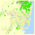
Free vector map of Sydney city Australia Level 12.svg 2,412 × 2,310; 6.33 MB
-
Glebe Island map 1844 SLNSW FL3774208.jpg 6,000 × 4,864; 5.06 MB
-
Goodlet Estate Ashfield , 1921, Richardson and Wrench.jpg 915 × 1,050; 746 KB
-
Goodlet Estate Canterbury Ashfield South , 1920, Richardson and Wrench.jpg 596 × 1,050; 506 KB
-
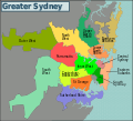
Greater Sydney Discuss.svg 1,276 × 1,162; 388 KB
-
Greater Sydney map.svg 1,279 × 1,176; 412 KB
-
Greater Sydney.png 2,547 × 2,320; 721 KB
-
Harryshistoricallocations.jpg 700 × 848; 39 KB
-
HornsbyNSWmap.jpg 851 × 639; 159 KB
-
Hundred of Dundas.png 1,118 × 1,663; 40 KB
-
Hundred of Evans.png 311 × 439; 34 KB
-
Hundred of Harding, (Sydney Australia).png 529 × 755; 16 KB
-
Hundred of Peckenham.png 474 × 558; 5 KB
-
Hurlstone Park sketch plan, Ernest C V Broughton.jpg 3,906 × 5,000; 3.05 MB
-
Hurlstone Park sketch plan.jpg 5,000 × 4,054; 1.99 MB
-
Inglis' Bazaar & Saleyards, Pyrmont Bridge Rd, 1923.jpg 3,144 × 5,000; 4.39 MB
-
Jeffrey's Estate 5th subdivision Fernhill, Hurlstone Park, 1910.jpg 5,000 × 3,276; 3.06 MB
-
Jeffrey's Estate 6th subdivision Hurlstone Park, Richardson and Wrench, 1912.jpg 3,412 × 5,000; 3.48 MB
-
Jeffreys Estate 2nd subdivision Fernhill, Hurlstone Park, 1903.jpg 3,735 × 5,000; 4.03 MB
-
Karte Sydneybecken.png 989 × 1,500; 2.51 MB
-
KirribilliJeffreyStreet.svg 800 × 727; 49 KB
-
Klimadiagramm-Sydney-Australien-metrisch-deutsch.png 800 × 557; 31 KB
-
Kmc.jpg 480 × 611; 63 KB
-
Linthorpe Estate Newtown 1905 Subdivision plan.jpg 5,000 × 3,125; 3.08 MB
-
Macleay Estate - Elizabeth Bay - Elizabeth Bay, Macley St, Ithaca Rd, Onslow Lane.jpg 4,618 × 5,000; 4.41 MB
-
Map NorthWilloughby WilloughbyEast.jpg 568 × 434; 91 KB
-
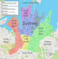
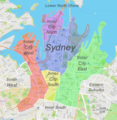
Map of Central Sydney CBD and Inner City Suburbs with Description.png 3,899 × 3,985; 16.59 MB
-
Map of Central Sydney CBD and Inner City Suburbs.png 3,891 × 3,981; 16.95 MB
-
Map of Circular Quay area (2688369208).jpg 1,800 × 1,350; 882 KB
-
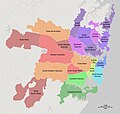
Map of Greater Sydney Regions and Suburbs with Description, Terrain and Colour.png 7,448 × 5,336; 20.16 MB
-
Map of Greater Sydney Regions and Suburbs with Description.jpg 7,049 × 6,673; 2.52 MB
-
Map of Greater Sydney Regions and Suburbs with Heading & Description.jpg 4,345 × 3,005; 1.34 MB
-
Map of Greater Sydney Regions and Suburbs With Heading.jpg 7,191 × 4,953; 3.1 MB
-
Map of Greater Sydney Regions and Suburbs.jpg 6,449 × 5,977; 1.67 MB
-
Map of Port Jackson.jpg 793 × 1,015; 75 KB
-
Map of Sydney central bus district.PNG 800 × 1,307; 104 KB
-
Map Willoughby Chatswood.jpg 568 × 434; 121 KB
-
Map Willoughby Northbridge.jpg 568 × 434; 121 KB
-
Maroubra Subdivision Plan 1918.jpg 772 × 1,050; 777 KB
-
Mosman location map-it.svg 1,181 × 881; 75 KB
-
National Rugby League team locations.PNG 1,754 × 597; 73 KB
-
NSWRL 1908.png 1,200 × 1,176; 152 KB
-
NSWRL 1909.png 1,200 × 1,176; 152 KB
-
NSWRL 1910-1919.png 1,200 × 1,176; 151 KB
-
NSWRL 1920.png 1,200 × 1,176; 151 KB
-
NSWRL 1921-1929.png 1,200 × 1,176; 152 KB
-
NSWRL 1930-1934.png 1,200 × 1,176; 151 KB
-
NSWRL 1935-1937.png 1,200 × 1,176; 152 KB
-
NSWRL 1938-1946.png 1,200 × 1,176; 151 KB
-
Parramatta developed map.png 1,360 × 1,060; 775 KB
-
Party divisions NSW Sydney.png 300 × 355; 29 KB
-
Penrith carte.png 335 × 299; 65 KB
-
Plan of Botanic Gardens, Sydney NSW (29302134055).jpg 2,000 × 2,187; 1.16 MB
-
Plan of part of the North Shore (13768252505).jpg 2,000 × 1,601; 1.82 MB
-
Pope's Estate, Ashfield, 1903, Richardson and Wrench.jpg 689 × 1,050; 513 KB
-
Screen shot.png 837 × 1,237; 1,022 KB
-
Silver Hill Estate Fern Hill, G E Gill, 1902.jpg 5,000 × 3,694; 2.61 MB
-
SLNSW 851814 Banks Papers Series 36a.jpg 802 × 1,050; 444 KB
-
Southern Cross Estate - Tango Ave, Dee Why Rd, Carew St, 1915.jpg 3,254 × 5,000; 9.12 MB
-
SSFL corridor.PNG 1,043 × 717; 726 KB
-
St Philip Glebe Estate Subdivision c. 1878.jpg 3,825 × 5,000; 3.4 MB
-
St Regulus Estate Ashfield, 1907.jpg 790 × 1,050; 605 KB
-
STS068-258-80 Sydney annotated.jpg 639 × 634; 68 KB
-
STS068-258-80 Sydney.jpg 639 × 634; 291 KB
-
Subdivision Annandale, Reserve St, 1880.jpg 810 × 1,050; 606 KB
-
Subdivision Plan Arncliffe, 1910.jpg 666 × 1,050; 629 KB
-
Suttonville, Ashbury, c.1900, W Pritchard.jpg 670 × 1,050; 512 KB
-
Syd HHY.png 1,025 × 636; 102 KB
-
Sydney 1788 Map sr.svg 794 × 612; 52 KB
-
Sydney AST2001oct12 lrg.jpg 2,840 × 2,155; 2.09 MB
-
Sydney Australia street map.svg 4,404 × 4,301; 27.67 MB
-
Sydney councils.png 1,036 × 898; 77 KB
-
SYDNEY divisions by party 2016.png 900 × 1,065; 252 KB
-
SYDNEY divisions overview 2016.png 900 × 1,065; 263 KB
-
Sydney in au.PNG 229 × 139; 6 KB
-
Sydney locator map.png 820 × 561; 24 KB
-
Sydney locator-MJC.png 563 × 476; 11 KB
-
Sydney map-MJC.png 1,200 × 1,152; 70 KB
-
Sydney Metro West geotechnical survey locations 2018-05-22.png 1,500 × 700; 1.35 MB
-
Sydney Metroads.svg 983 × 973; 164 KB
-
Sydney olympic park map.PNG 590 × 705; 51 KB
-
Sydney soccer clubs map.svg 800 × 860; 94 KB
-
Sydney statistical areas.png 2,212 × 1,928; 921 KB
-
Sydney vegetation pre-1750.jpg 1,016 × 873; 377 KB
-
Sydneykarte02.jpg 310 × 320; 33 KB
-
The Chaser APEC prank map fixed.png 1,000 × 1,568; 495 KB
-
The City of Sydney.jpg 4,100 × 2,944; 7.84 MB
-
The Razor Gang areas of Sydney (6075086408).jpg 2,130 × 2,357; 5.62 MB
-
Top Gear Australia test track.svg 1,249 × 683; 47 KB
-
Turanville Estate, Fern Hill, Hurlstone Park, 1906, Raine and Horne.jpg 3,066 × 5,000; 3.19 MB
-
Village of Ashfield, 1879, Richardson and Wrench.jpg 1,400 × 1,118; 1.26 MB
-
Water Frontages- Elizabeth Bay - Rockley House & Grounds - Elizabeth Bay Rd, 1927.jpg 3,366 × 5,000; 3.91 MB
-
Wattle Hill Estate Ashbury, 1915, Location Map, Richardson and Wrench.jpg 795 × 1,050; 565 KB
-
Western Harbour Tunnel and Beaches Link.jpg 1,024 × 1,532; 179 KB
