Category:Maps of Spain in the 18th century
Jump to navigation
Jump to search
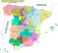
English: This category is about the subject of  Spain 1701-1800 CE: History maps showing all or a substantial part of the territory of Spain as it was in the 18th century.
Contemporary old maps belong into: Category:18th-century maps of Spain and its subcategories. Maps that show history of the entire Iberian Peninsula, belong into: Category:Maps of the Iberian Peninsula in the 18th century.
Contemporary old maps belong into: Category:18th-century maps of Spain and its subcategories. Maps that show history of the entire Iberian Peninsula, belong into: Category:Maps of the Iberian Peninsula in the 18th century.
Media in category "Maps of Spain in the 18th century"
The following 11 files are in this category, out of 11 total.
-
423 of 'England under Stuart Rule, etc' (11246609713).jpg 1,904 × 1,267; 606 KB
-
Battle of Cadiz 1702.PNG 682 × 447; 46 KB
-
Ciudades con voto en las Cortes de Madrid de 1789.svg 2,043 × 1,753; 1.04 MB
-
Densidades de población en España (1787).png 779 × 529; 163 KB
-
Densidades de población en España (1787).svg 568 × 387; 1.49 MB
-
Ensenada1759.svg 889 × 755; 749 KB
-
España Finales Del XVIII.svg 1,154 × 1,044; 187 KB
-
Map Spain 1720.png 482 × 390; 47 KB
-
Señoríos del Reino de Córdoba.svg 588 × 783; 544 KB
-
Señoríos del Reino de Jaén.svg 913 × 520; 671 KB
-
Señoríos del Reino de Sevilla.svg 1,144 × 1,041; 1.88 MB


