Category:Maps of earthquakes in Chile
Jump to navigation
Jump to search
Subcategories
This category has the following 2 subcategories, out of 2 total.
*
2
- 2010 Chile earthquake maps (40 F)
Media in category "Maps of earthquakes in Chile"
The following 56 files are in this category, out of 56 total.
-
1985 Chilean earthquake.png 456 × 528; 300 KB
-
2018-11-01 Iquique, Chile M6.2 earthquake intensity map (USGS).jpg 612 × 684; 109 KB
-
2019-01-20 Coquimbo, Chile M6.7 earthquake intensity map (USGS).jpg 612 × 684; 79 KB
-
2019-06-14 Coquimbo, Chile M6.4 earthquake intensity map (USGS).jpg 612 × 684; 77 KB
-
2019-11-04 Illapel, Chile M6 earthquake intensity map (USGS).jpg 612 × 684; 99 KB
-
2019-11-04 Illapel, Chile M6.1 earthquake intensity map (USGS).jpg 612 × 684; 98 KB
-
2019-12-03 Arica, Chile M6 earthquake intensity map (USGS).jpg 612 × 684; 110 KB
-
2020-09-01 Atacama, Chile M6.3 earthquake intensity map (USGS).jpg 612 × 684; 104 KB
-
2020-09-01 Vallenar, Chile M6.3 earthquake intensity map (USGS).jpg 612 × 684; 105 KB
-
2020-09-01 Vallenar, Chile M6.5 earthquake intensity map (USGS).jpg 612 × 684; 91 KB
-
2020-09-01 Vallenar, Chile M6.8 earthquake intensity map (USGS).jpg 612 × 684; 91 KB
-
2020-09-06 Ovalle, Chile M6.3 earthquake intensity map (USGS).jpg 612 × 684; 109 KB
-
2020-09-06 Ovalle, Chile M6.4 earthquake intensity map (USGS).jpg 612 × 684; 109 KB
-
2020-09-11 Tocopilla, Chile M6.2 earthquake intensity map (USGS).jpg 612 × 684; 111 KB
-
2020-09-11 Tocopilla, Chile M6.3 earthquake intensity map (USGS).jpg 612 × 684; 108 KB
-
2020-11-03 Aisen, Chile M6 earthquake shakemap (USGS).jpg 800 × 1,001; 130 KB
-
2020-11-22 Constitución, Chile M6.1 earthquake intensity map (USGS).jpg 612 × 684; 111 KB
-
2020-12-06 Iquique, Chile M6.1 earthquake intensity map (USGS).jpg 612 × 684; 125 KB
-
2020-12-14 Calama, Chile M6 earthquake intensity map (USGS).jpg 612 × 684; 120 KB
-
2020-12-27 Corral, Chile M6.7 earthquake intensity map (USGS).jpg 612 × 684; 111 KB
-
2020-12-27 Corral, Chile M6.8 earthquake intensity map (USGS).jpg 612 × 684; 109 KB
-
2021-07-04 Vallenar, Chile M6 earthquake intensity map (USGS).jpg 612 × 684; 107 KB
-
2021-09-21 Talcahuano, Chile M6.4 earthquake intensity map (USGS).jpg 612 × 684; 108 KB
-
2021-09-21 Talcahuano, Chile M6.4 earthquake shakemap (USGS).jpg 786 × 999; 233 KB
-
2021-12-03 Hanga Roa, Chile M6.1 earthquake intensity map (USGS).jpg 612 × 684; 71 KB
-
2021-12-03 Hanga Roa, Chile M6.1 earthquake shakemap (USGS).jpg 828 × 999; 143 KB
-
2022-07-15 Aisen, Chile M6.4 earthquake intensity map (USGS).jpg 612 × 684; 66 KB
-
2022-07-15 Aisen, Chile M6.4 earthquake shakemap (USGS).jpg 785 × 1,004; 80 KB
-
2022-07-27 Calama, Chile M6.2 earthquake intensity map (USGS).jpg 612 × 684; 123 KB
-
2022-07-27 Calama, Chile M6.2 earthquake shakemap (USGS).jpg 787 × 1,001; 149 KB
-
2022-07-28 Tocopilla, Chile M6.1 earthquake intensity map (USGS).jpg 612 × 684; 104 KB
-
2022-07-28 Tocopilla, Chile M6.1 earthquake shakemap (USGS).jpg 787 × 1,000; 113 KB
-
2022-09-23 Ancud, Chile M6.1 earthquake intensity map (USGS).jpg 612 × 684; 107 KB
-
2022-09-23 Ancud, Chile M6.1 earthquake shakemap (USGS).jpg 787 × 1,004; 97 KB
-
2022-11-13 Bio-Bio, Chile M6.2 earthquake intensity map (USGS).jpg 612 × 684; 106 KB
-
2022-11-13 Bio-Bio, Chile M6.2 earthquake shakemap (USGS).jpg 787 × 1,002; 127 KB
-
2022-11-13 Lebu, Chile M6.2 earthquake intensity map (USGS).jpg 612 × 684; 111 KB
-
2022-11-13 Lebu, Chile M6.2 earthquake shakemap (USGS).jpg 787 × 1,002; 128 KB
-
2023-03-30 Constitución, Chile M6.3 earthquake intensity map (USGS).jpg 612 × 684; 108 KB
-
2023-03-30 Constitución, Chile M6.3 earthquake shakemap (USGS).jpg 787 × 1,001; 114 KB
-
April 21 2007 Aisen Earthquake.png 425 × 499; 26 KB
-
Chile ridge seismicity distribution.png 1,443 × 720; 1.56 MB
-
Chile, 4.7, May 19 2010.jpg 612 × 684; 137 KB
-
ChileQuake4.21.07.jpg 520 × 602; 65 KB
-
Chileridgeearthquakemagnitude (2).png 788 × 719; 667 KB
-
Location of April 21 2007 Chile earthquake.png 142 × 141; 17 KB
-
Map of Chile showing location of the earthquake of 16 September 2015 (21321614248).jpg 1,280 × 1,843; 404 KB
-
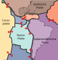
Plates tect2 de.svg 1,235 × 1,265; 383 KB
-
Terremoto-1960-05-21.jpg 566 × 621; 204 KB
-
The location of the epicentre of the 1 April 2014 Chilean earthquake (13681624034).jpg 2,500 × 4,000; 1.05 MB


