Category:Maps of Paraguay
Jump to navigation
Jump to search
Wikimedia category | |||||
| Upload media | |||||
| Instance of | |||||
|---|---|---|---|---|---|
| Category combines topics | |||||
 | |||||
Subcategories
This category has the following 31 subcategories, out of 31 total.
*
B
- Blank maps of Paraguay (8 F)
C
D
E
- Election maps of Paraguay (15 F)
F
G
H
- HDI maps of Paraguay (4 F)
L
M
O
P
- Poverty maps of Paraguay (6 F)
R
- Road maps of Paraguay (19 F)
S
T
- Transport maps of Paraguay (11 F)
W
Pages in category "Maps of Paraguay"
The following 2 pages are in this category, out of 2 total.
Media in category "Maps of Paraguay"
The following 64 files are in this category, out of 64 total.
-
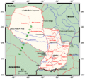
Paraguaymap.gif 1,008 × 938; 39 KB
-
Accesos viales de Ciudad del Este.png 1,334 × 1,350; 224 KB
-
Barrios de CDE.png 1,000 × 982; 280 KB
-
Barrios de Ciudad del Este.png 1,000 × 982; 285 KB
-
Barrios de Lámbare.png 1,000 × 1,000; 175 KB
-
Brazilsoutheast.jpg 1,426 × 1,784; 240 KB
-
Capilla Duarte.jpg 1,624 × 1,137; 466 KB
-
CDE Vías.png 1,000 × 1,000; 203 KB
-
Central departmento, paraguay .png 400 × 472; 38 KB
-
Concepción (Paraguay).png 1,000 × 864; 117 KB
-
Departamento de Concepción (Paraguay).png 1,000 × 1,002; 175 KB
-
Diplomatic missions in Paraguay.PNG 1,425 × 625; 65 KB
-
ECDM 20131223 SAmerica.pdf 1,625 × 1,125; 625 KB
-
ECDM 20140227 CentralSouthAmerica Events.pdf 1,625 × 1,125; 504 KB
-
ECDM 20140325 World FlashEvents.pdf 1,625 × 1,125; 566 KB
-
ECDM 20140611 Paraguay Floods.pdf 1,625 × 1,125; 532 KB
-
ECDM 20140612 SAmerica Floods.pdf 1,625 × 1,125; 434 KB
-
ECDM 20140616 SAmerica Floods.pdf 1,625 × 1,125; 434 KB
-
ECDM 20140710 World Events.pdf 1,625 × 1,125; 527 KB
-
ECDM 20140731 World Events.pdf 1,625 × 1,125; 366 KB
-
ECDM 20151204 World SevereWeather.pdf 1,625 × 1,125; 575 KB
-
ECDM 20160105 World SevereWeather.pdf 1,625 × 1,125; 870 KB
-
ECDM 20160112 SouthAmerica SW.pdf 1,625 × 1,125; 481 KB
-
ECDM 20160202 World SevereWeather.pdf 1,625 × 1,125; 567 KB
-
ECDM 20180205 Bolivia Argentina Paraguay Flood.pdf 1,625 × 1,125; 828 KB
-
ECDM 20190521 Paraguay floods.pdf 1,625 × 1,125; 695 KB
-
ECDM 20190617 Paraguay floods.pdf 1,625 × 1,125; 586 KB
-
ECDM 20200918 SAmerica Wildfires.pdf 1,625 × 1,125; 593 KB
-
ECDM 20240422 South America.pdf 2,479 × 1,754; 965 KB
-
ECHO Paraguay Editable A4 Landscape.pdf 1,754 × 1,239; 354 KB
-
ECHO Paraguay Editable A4 Landscape.png 1,123 × 794; 351 KB
-
Ecorregiones PY.jpg 2,481 × 3,509; 1.02 MB
-
EPP insurgency departments.png 310 × 330; 13 KB
-
Eternal brothers, eternos-hermanos (1).png 344 × 736; 139 KB
-
FLII Paraguay.png 948 × 882; 758 KB
-
Forest Cover of Paraguan Administrative Divisions.png 6,600 × 6,639; 1.32 MB
-
Koppen-Geiger Map PRY present.svg 1,340 × 850; 585 KB
-
Kuruguakua o Curuguacua.png 469 × 469; 193 KB
-
Map of the departments of Paraguay (without labels).jpg 1,254 × 1,370; 136 KB
-
Mapa boq.jpg 1,219 × 1,355; 828 KB
-
Mapa da Tríplice Fronteira (Argentina, Brasil e Paraguai).png 2,176 × 2,172; 273 KB
-
Mapa de Mbocayaty.jpg 970 × 712; 215 KB
-
Mapa de San Lorenzo.jpg 2,516 × 2,316; 1.89 MB
-
Mapa Tobatí.jpg 1,433 × 740; 362 KB
-
MapaAyoreosAislados.jpg 500 × 379; 37 KB
-
Museum exhibits 171020.jpg 5,312 × 2,988; 5.93 MB
-
Paraguay - DPLA - 8f7874b650252dee09381a2e2a18e5e4.jpg 5,952 × 6,576; 3 MB
-
Paraguay - DPLA - ca680d4e165aaa0f7a0458e2899b767a.jpg 2,400 × 3,126; 6.71 MB
-
Paraguay - DPLA - d1ebde93a0166b02f59ab8045452805d.jpg 2,560 × 3,278; 5.01 MB
-
Paraguay - DPLA - e8b07ee2a44b1e30000a442ccaddc6c4.jpg 2,556 × 3,276; 5.67 MB
-
Paraguay Base Map.png 1,117 × 697; 333 KB
-
Paraguay Central Railway map 1926.jpg 978 × 719; 181 KB
-
Paraguay DNI Solar-resource-map lang-ES GlobalSolarAtlas World-Bank-Esmap-Solargis.png 1,842 × 2,527; 1.32 MB
-
Paraguay GHI Solar-resource-map GlobalSolarAtlas World-Bank-Esmap-Solargis.png 1,842 × 2,527; 1.31 MB
-
Paraguay GHI Solar-resource-map lang-ES GlobalSolarAtlas World-Bank-Esmap-Solargis.png 1,842 × 2,527; 1.3 MB
-
Paraguay rutas.jpg 415 × 484; 47 KB
-
PAT - Paraguay.gif 860 × 950; 152 KB
-
Population density of Paraguay departments.png 3,555 × 3,732; 493 KB
-
Pueblos nativos del Paraguay.png 818 × 830; 54 KB
-
Recursos Hídricos.jpg 3,507 × 2,480; 475 KB
-
Tierra Yaperú.png 580 × 440; 13 KB
-
Yhacanguazu.jpg 1,945 × 1,275; 579 KB


