Category:Road maps of Chile
Jump to navigation
Jump to search
Media in category "Road maps of Chile"
The following 35 files are in this category, out of 35 total.
-
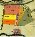
Camino del Peral y del Puente Antiguo.jpg 519 × 534; 96 KB
-
Camino Real del Puente Antiguo.jpg 717 × 382; 159 KB
-
Camino Real del Puente Nuevo.jpg 516 × 537; 93 KB
-
Carreteras Duplas de Chile 2024.jpg 1,185 × 1,782; 540 KB
-
Localizacion Monte Albernas.jpg 520 × 534; 96 KB
-
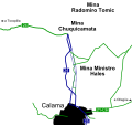
Map Ruta A-31b.svg 961 × 181; 187 KB
-
Map Ruta A-93.svg 961 × 181; 213 KB
-
Map Ruta A-93b.svg 961 × 181; 216 KB
-
Mapa autopista Rutas del Desierto (Chile).svg 880 × 1,110; 495 KB
-
Mapa autopista Valles del Desierto (Chile).svg 1,220 × 1,770; 900 KB
-
Mapa autopistas de Antofagasta (Chile).svg 1,353 × 2,100; 696 KB
-
Mapa cambio de traza ruta 24 (Chile).svg 605 × 568; 91 KB
-
Mapa cambio de traza ruta 25 (Chile).svg 430 × 639; 86 KB
-
Mapa loc Ruta 1 CH.svg 512 × 768; 1.12 MB
-
Mapa ruta 1 (Chile).svg 1,450 × 2,922; 1.16 MB
-
Mapa ruta 11-CH (Chile).svg 1,000 × 700; 398 KB
-
Mapa ruta 12 (Chile).svg 1,000 × 700; 343 KB
-
Mapa ruta 15-CH (Chile).svg 880 × 1,110; 529 KB
-
Mapa ruta 16 (Chile).svg 880 × 1,110; 485 KB
-
Mapa ruta 21-CH (Chile).svg 1,353 × 2,100; 727 KB
-
Mapa ruta 23-CH (Chile).svg 1,353 × 2,100; 738 KB
-
Mapa ruta 24 (Chile).svg 1,353 × 2,100; 701 KB
-
Mapa ruta 25 (Chile).svg 1,353 × 2,100; 686 KB
-
Mapa ruta 26 (Chile).svg 1,353 × 2,100; 686 KB
-
Mapa ruta 27-CH (Chile).svg 1,450 × 2,100; 718 KB
-
Mapa ruta 28 (Chile).svg 1,353 × 2,100; 690 KB
-
Mapa ruta 31-CH (Chile).svg 1,220 × 1,770; 916 KB
-
Mapa ruta 5 Panamericana Arica-La Serena (Chile).svg 371 × 646; 341 KB
-
Mapa ruta A-27 (Chile).svg 1,000 × 700; 349 KB
-
Mapa ruta A-31 (Chile).svg 1,000 × 700; 389 KB
-
Mapa ruta A-35 (Chile).svg 1,000 × 700; 355 KB
-
Mapa ruta A-40 (Chile).svg 880 × 1,110; 486 KB
-
Mapa ruta A-93 (Chile).svg 1,000 × 700; 382 KB
-
Mapa ruta B-55 (Chile).svg 1,353 × 2,100; 714 KB
-
Puentes Antiguos del Maipo.jpg 718 × 379; 158 KB


