Category:Maps of 10th-century Europe
Jump to navigation
Jump to search
| Preceded by: Maps of 9th-century Europe |
Maps of 10th-century Europe 901 AD-1000 AD |
Succeeded by: Maps of 11th-century Europe |
Subcategories
This category has the following 9 subcategories, out of 9 total.
B
- Maps of 10th-century Bulgaria (25 F)
E
- Maps of 10th-century England (12 F)
F
- Maps of 10th-century France (24 F)
G
- Maps of 10th-century Germany (4 F)
- Maps of 10th-century Greece (4 F)
I
- Maps of 10th-century Italy (21 F)
Media in category "Maps of 10th-century Europe"
The following 30 files are in this category, out of 30 total.
-
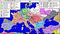
 1000 CE, Europe.svg 512 × 438; 1.76 MB
-
 72 of '(Histoire de la Belgique.)' (11107819555).jpg 2,560 × 1,541; 750 KB
-
 Europe en 900.pdf 1,752 × 1,239; 496 KB
-
 Modern history; Europe (1904) (14742728726).jpg 3,008 × 2,028; 1.47 MB
-
 Modern history; Europe (1904) (14762549261).jpg 3,008 × 2,024; 1.43 MB
-
 925 CE, Europe.svg 512 × 438; 1.7 MB
-
 Historical atlas of modern Europe 1903 (135895458).jpg 7,089 × 9,162; 57.47 MB
-
 Europe en 950.pdf 1,752 × 1,239; 484 KB
-
 Historical atlas of modern Europe 1903 (135895362).jpg 9,140 × 6,884; 56.55 MB
-

-
 Bulgarien BV044875033.jpg 4,500 × 4,321; 5.52 MB
-
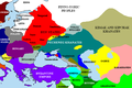
 C. 900 Peoples of Europe.jpg 1,769 × 1,142; 1.32 MB
-
 Europa BV042518560.jpg 1,954 × 1,337; 297 KB
-
 Europe 900.jpg 881 × 583; 1.22 MB
-
 Europe 912 en.jpg 1,206 × 1,238; 529 KB
-
 Europe About A.D. 1000.jpg 1,557 × 1,139; 461 KB
-
 Europe in the 10th century (Atlas of European history, 1909).PNG 1,232 × 842; 1.27 MB
-
 Khazarfall1.png 670 × 448; 32 KB
-
 Kingdom of abkhazia.svg 994 × 768; 2.02 MB
-
 Lotharingia-959 with current borders.svg 512 × 751; 416 KB
-
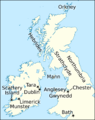 Maccus mac Arailt (map).png 801 × 1,011; 257 KB
-

-
 Putz84.jpg 800 × 710; 104 KB
-
 Rus-10c-ethn.png 2,241 × 2,731; 257 KB
-
 Samuels Macedonian Kingdom.jpg 1,375 × 1,264; 1.83 MB
-
 Souabe et Haute-Bourgogne.png 2,500 × 2,107; 1.12 MB
-
 The Bavarian-Frankish attack against Hungary and the Battle of Pressburg.jpg 2,606 × 1,484; 2.21 MB
-
 The Hungarian-East Frankish war of 907.jpg 2,606 × 1,484; 2.22 MB
-
 Ulrich von Zell Wirkungsorte.jpg 1,168 × 930; 701 KB
-
 The Collegiate Atlas 1876 (73059951).jpg 6,736 × 5,239; 5.22 MB

%27_(11107819555).jpg)
_(14742728726).jpg)
_(14762549261).jpg)

.jpg)
.jpg)
.jpg)


.PNG)


.png)
_(14591228967).jpg)


.jpg)