Category:Maps of 10th-century Italy
Jump to navigation
Jump to search
| Preceded by: Maps of 9th-century Italy |
Maps of 10th-century Italy 901 AD-1000 AD |
Succeeded by: Maps of 11th-century Italy |
Media in category "Maps of 10th-century Italy"
The following 21 files are in this category, out of 21 total.
-
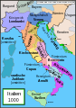
 Italy 1000 AD alt1.svg 564 × 810; 187 KB
-
 Italy 1000 AD-ar.svg 565 × 811; 326 KB
-
 Italy 1000 AD-de.svg 572 × 819; 334 KB
-
 Italy 1000 AD-el.png 418 × 600; 67 KB
-
 Italy 1000 AD-es.svg 565 × 811; 710 KB
-
 Italy 1000 AD-fr.svg 564 × 810; 186 KB
-
 Italy 1000 AD-he.svg 565 × 811; 481 KB
-
 Italy 1000 AD-hu.svg 565 × 811; 361 KB
-
 Italy 1000 AD-it.svg 565 × 811; 400 KB
-
 Italy 1000 AD-ru.svg 565 × 811; 334 KB
-
 Italy 1000 AD-zh.png 565 × 811; 193 KB
-
 Italy 1000 AD.svg 565 × 811; 861 KB
-
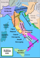
 Italya MS 1000.png 566 × 812; 254 KB
-
 Italya MS 1000.svg 565 × 811; 835 KB
-
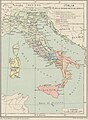
 Cambridge Medieval History V 3 (1922) (14578978918).jpg 4,692 × 6,516; 7.39 MB
-
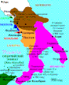
 Duchy of Carinthia-1000 AD.svg 565 × 520; 728 KB
-

-
 Map Italy in the second half of 10th century- Touring Club Italiano CART-TRC-43 02.jpg 3,013 × 4,100; 1.46 MB
-
 Modern history; Europe (1904) (14765415832).jpg 2,028 × 3,008; 2.05 MB
-
 Putz86.jpg 690 × 800; 141 KB
-
 Южная Италия, 980 год.gif 281 × 349; 19 KB


_(14578978918).jpg)

.jpg)

_(14765415832).jpg)

